ISRA FACTSHEETS
ISRA FACTSHEETS
CENTRAL AND SOUTH AMERICAN PACIFIC REGION
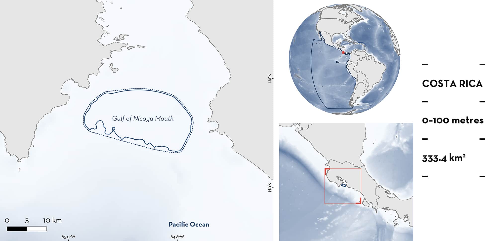
Gulf of Nicoya Mouth
Summary
Gulf of Nicoya Mouth is located at the entrance of the Gulf of Nicoya on the central Pacific coast of Costa Rica. The Gulf of Nicoya is a large tropical estuary with 150 km of coastline. This area has a demersal soft, muddy habitat and is influenced by alluvial input from the numerous rivers, which creates one of the most productive and diverse areas in Costa Rica. Within this area there are: threatened species (e.g., Rasptail Skate Rostroraja velezi); range-restricted species (Southern Banded Guitarfish Zapteryx xyster); and reproductive areas (e.g., Brown Smoothhound Mustelus henlei).
Download factsheet
Gulf of Nicoya Mouth
DESCRIPTION OF HABITAT
Gulf of Nicoya Mouth is located at the entrance to the Gulf of Nicoya along the coast of Puntarenas on the central Pacific coast of Costa Rica. Situated within the Pacific Central-American Coastal Large Marine Ecosystem (LME), the gulf comprises of a large tropical estuary (609.38 km2) with 150 km of coastline of which 112 km is covered with mangroves (approximately 20 km2 in 2018). The area is characterised by well-defined wet (June-November) and dry (December-May) seasons, and is influenced mainly by the Tempisque, Barranca, and Tárcoles rivers, which create one of the most productive and diverse areas in Costa Rica.
This Important Shark and Ray Area is delineated from surface waters (0 m) to a depth of 100 m based on the maximum depth range of the habitat used by Qualifying Species.
CRITERION A
VULNERABILITY
Two Qualifying Species considered threatened with extinction according to the IUCN Red List of Threatened SpeciesTM regularly occur in this area. These are the Vulnerable Rasptail Skate (Pollom et al. 2020) and Southern Banded Guitarfish (Kyne et al. 2020).
CRITERION B
RANGE RESTRICTED
Gulf of Nicoya Mouth holds the regular presence of Southern Banded Guitarfish as a resident range-restricted species. Southern Banded Guitarfish is regularly and predictably caught in trawl fisheries operating in the area (Clarke et al. 2014; Clarke et al. 2016; Clarke et al. 2017; Azofeifa et al. 2021). This species occurs in the Pacific Central-American Coastal LME and only marginally into the Humboldt Current LME.
CRITERION C
SUB-CRITERION C1 – REPRODUCTIVE AREAS
Gulf of Nicoya Mouth is an important reproductive area for three shark and three ray species. Neonates and pregnant females (embryos or egg capsules inside) are regularly caught in trawl fisheries operating within this area which infers the use of the area as a nursery (Clarke et al. 2011; Clarke et al. 2014; Clarke et al. 2016; Azofeifa-Solano et al. 2021; Clarke et al. unpubl. data 2022).
Neonate and gravid female Brown Smoothhound, Rasptail Skate, and Southern Banded Guitarfish were recorded on-board shrimp trawlers through visual appearance or dissections. These species reach maturity at ~37–60 cm total length (TL). Neonates possessed an open umbilical scar, no evidence of calcified claspers, and clasper tip not reaching the distal end of the pelvic fins. Large females were dissected, and pregnancy was determined by the presence of developing egg capsules or embryos. Between March 2010–August 2012, these individuals were more abundant in shallow areas (<50 m), showing that this area provides an advantage for the early life stages of these species (Clarke et al. 2014; Azofeifa-Solano et al. 2021). There is ongoing research which uses a similar methodology, where shrimp trawl fishery catches are analysed visually or through dissection. Preliminary results highlight that catches include neonate and some gravid female Sicklefin Smoothhound, Pacific Angelshark, and Chilean Torpedo. These species reach maturity at ~55–66 cm TL (Pérez-Jiménez & Sosa-Nishizaki 2008), >103 cm TL (Osaer et al. 2015), and ~50 cm TL (Last et al. 2016), respectively. Neonates possessed an open umbilical scar, no evidence of calcified claspers, and clasper tip not reaching the distal end of the pelvic fins. Large females were dissected, and pregnancy was determined by the presence of developing embryos (Clarke et al. unpubl. data 2022).
Download factsheet
SUBMIT A REQUEST
ISRA SPATIAL LAYER REQUEST
To make a request to download the ISRA Layer in either a GIS compatible Shapefile (.shp) or Google Earth compatible Keyhole Markup Language Zipped file (.kmz) please complete the following form. We will review your request and send the download details to you. We will endeavor to send you the requested files as soon as we can. However, please note that this is not an automated process, and before requests are responded to, they undergo internal review and authorization. As such, requests normally take 5–10 working days to process.
Should you have questions about the data or process, please do not hesitate to contact us.


