ISRA FACTSHEETS
ISRA FACTSHEETS
CENTRAL AND SOUTH AMERICAN PACIFIC REGION
Paramount Seamount
Summary
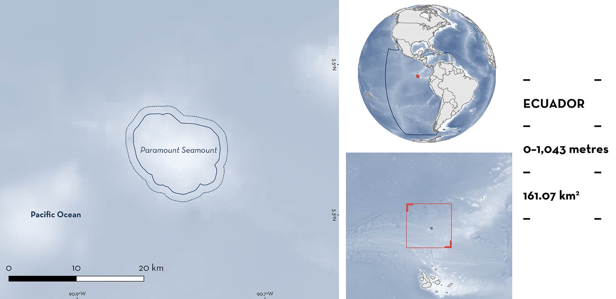
Paramount Seamount is located north of the Galápagos Islands, within the Ecuador Economic Exclusive Zone (EEZ), approximately 230 km northeast of Darwin Island. The area includes the only shallow seamount in the northern region of the oceanic Ecuadorian EEZ with its shallowest point at a depth of approximately 188 m. Within the area there are: threatened species; areas important for movement; and undefined aggregations (Scalloped Hammerhead Sphyrna lewini).
Download factsheet
Paramount Seamount
DESCRIPTION OF HABITAT
Paramount Seamount is located north of the Galápagos Islands and is the only shallow seamount in the northern region of the Ecuador Exclusive Economic Zone that sits outside the Galápagos Marine Reserve. The seamount’s shallowest point is approximately 188 m deep and is located 230 km northeast of Darwin Island (Cambra et al. 2021). It lies on the Cocos Ridge which extends over 1,000 km from the Galápagos Islands to Cocos Island, and on to the Costa Rican Pacific coast, and is one of 14 identified seamounts in the region (Walther 2003; Peñaherrera-Palma et al. 2018). The area is influenced by the convergence of three major oceanic currents: the North Equatorial Current, the South Equatorial Current, and the Equatorial Countercurrent, subjecting the Cocos Ridge to a wide range of surface water temperatures (~18–28°C). This variability is accentuated during periodic ENSO events (Fiedler & Lavín 2017). There is limited benthic habitat information available due to the area’s remoteness.
This Important Shark and Ray Area is delineated from surface waters (0 m) to 1,043 m based on the known depth range of the Qualifying Species.
CRITERION A
VULNERABILITY
The one Qualifying Species is considered threatened with extinction according to the IUCN Red List of Threatened SpeciesTM. The Scalloped Hammerhead is assessed as Critically Endangered (Rigby et al 2019).
CRITERION C
SUB-CRITERION C4 – MOVEMENT
Paramount Seamount is an important movement area for one shark species. Scalloped Hammerheads undertake large-scale movements between Galápagos and Cocos (~690 km) (Nalesso et al. 2014; Ketchum et al. 2014; Hearn et al. 2010, 2017), and Paramount Seamount appears an important connection between these locations. Eight of 35 satellite-tagged individuals in Galápagos undertook a migration between these locations with two individuals tracked back to their origin (summarised in Peñaherrera-Palma et al. 2018). Tracks indicate that tagged animals followed the Cocos Ridge with five of the eight individuals recorded in close proximity to Paramount Seamount. This, coupled with the presence of large persistent aggregations of Scalloped Hammerheads, suggests that the Paramount Seamount is likely an important marker for navigation.
CRITERION C
SUB-CRITERION C5 – UNDEFINED AGGREGATIONS
Paramount Seamount is an important area for the aggregation of one shark species. Two expeditions have been carried out in this area, in 2018 and in 2021, and on both occasions, midwater (10–25 m depth) Baited Remote Underwater Video Surveys (BRUVS) were deployed and found large schools of Scalloped Hammerheads. In 2018, nine seamounts between Galápagos and Cocos were surveyed, and the abundance of Scalloped Hammerheads (MaxN = 132, i.e., the total number of individuals observed in a single frame of video) was second only to West Cocos seamount (MaxN = 170) (Cambra 2018). In the 2021 expedition, Paramount Seamount displayed the greatest abundance of Scalloped Hammerheads (MaxN = 294) after resurveying the same nine seamounts (Hearn et al. 2022). As such, the Paramount Seamount is considered an important aggregation site for this species in the Eastern Tropical Pacific (Cambra et al. 2021). The purpose of this aggregation is unknown but likely linked to a vital life-history function.
Download factsheet
SUBMIT A REQUEST
ISRA SPATIAL LAYER REQUEST
To make a request to download the ISRA Layer in either a GIS compatible Shapefile (.shp) or Google Earth compatible Keyhole Markup Language Zipped file (.kmz) please complete the following form. We will review your request and send the download details to you. We will endeavor to send you the requested files as soon as we can. However, please note that this is not an automated process, and before requests are responded to, they undergo internal review and authorization. As such, requests normally take 5–10 working days to process.
Should you have questions about the data or process, please do not hesitate to contact us.


