ISRA FACTSHEETS
ISRA FACTSHEETS
CENTRAL AND SOUTH AMERICAN PACIFIC REGION
Deep Benthic Midriff Islands
Summary
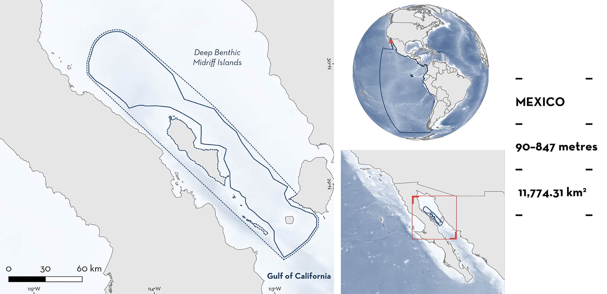
Deep Benthic Midriff Islands is located in the central-northern part of the Gulf of California in Mexico. This area encompasses benthic waters near Tiburón Island and San Lorenzo Island in the southern part to areas north of Angel de la Guarda Island, in the Delfín and Salsipuedes basins. These basins have a maximum depth of ~1,450 m restricting the circulation between the northern and central gulf and serve as a place where very strong tidal currents produce intense mixing. This mixing also produces areas of high temperatures, salinities, and oxygen at great depths compared to other basins in the gulf at similar depths. Within this area there are range-restricted species (e.g., Peppered Catshark Galeus piperatus).
Download factsheet
Deep Benthic Midriff Islands
DESCRIPTION OF HABITAT
Deep Benthic Midriff Islands is located in the central-northern part of the Gulf of California in Mexico off the coast of Sinaloa and Baja California states. Situated within the Gulf of California Large Marine Ecosystem (LME), the area extends from near Tiburón Island and San Lorenzo Island to areas north of Angel de la Guarda Island, in the western coast of the gulf. This region is located in the Delfín and Salsipuedes basins. The first basin goes from 180 m to 720 m depth in the southern part, while the latter reaches a depth of 1,450 m. These basins restrict the circulation between the northern and central gulf and serves as a place where very strong tidal currents produce intense mixing. This mixing also produces areas of high temperatures, salinities, and oxygen at great depths compared to other basins in the gulf at similar depths. Habitats within this area include scarps, rocky areas, and sandy and muddy bottoms (Tovillo-Hernández 1991). This area also partially overlaps with an Ecologically and Biologically Significant Marine Area, the Midriff Islands Region.
This Important Shark and Ray Area is delineated at depths of 90–847 m based on the depth range of Qualifying Species in the area.
CRITERION B
RANGE RESTRICTED
Deep Benthic Midriff Islands area holds the regular presence of three shark and one ray species as range-restricted species. Largenose Catshark, Lollipop Catshark, Peppered Catshark, and California Skate are regularly reported from fisheries operating in this area.
Largenose Catshark is restricted to the Gulf of California LME and was reported in the catch of experimental trawl-nets in the area during 2005 at depths of 90–540 m (López-Martínez et al. 2012). In addition, 143 individuals were caught during experimental trawling in 2007 within the area at 250–460 m (Acevedo-Cervantes et al. 2009).
California Skate and Lollipop Catshark are restricted to the Gulf of California LME and the California Current LME. These species were reported in the catch of experimental trawl-nets within the area during 2004 and 2005 at depths of 90–540 m. California Skate was recorded during September 2004 and February/May 2005. This species was also previously reported between 2003–2004 in the area, as bycatch in the hake fishery (Santana-Morales et al. 2005). In addition, Lollipop Catshark has been reported in the catch of trawlers in the Pacific Hake Merluccius productus fishery in the area from 2014–2017, when 12 individuals were caught at 847 m depth (López-Martínez et al. 2012; Cruz-Acevedo et al. 2019).
Peppered Catshark is restricted to the Gulf of California LME and has been reported in the catch of trawlers fishing for Pacific Hake in the area. In 2015 and during 2018–2020, 448 juveniles and adults (14.0–41.6 cm total length) were caught at depths of 234–462 m (Cruz-Acevedo et al. 2019; Espino-Leal 2022).
Download factsheet
SUBMIT A REQUEST
ISRA SPATIAL LAYER REQUEST
To make a request to download the ISRA Layer in either a GIS compatible Shapefile (.shp) or Google Earth compatible Keyhole Markup Language Zipped file (.kmz) please complete the following form. We will review your request and send the download details to you. We will endeavor to send you the requested files as soon as we can. However, please note that this is not an automated process, and before requests are responded to, they undergo internal review and authorization. As such, requests normally take 5–10 working days to process.
Should you have questions about the data or process, please do not hesitate to contact us.


