ISRA FACTSHEETS
ISRA FACTSHEETS
CENTRAL AND SOUTH AMERICAN PACIFIC REGION
Northern Galápagos Hydrothermal Vents
Summary
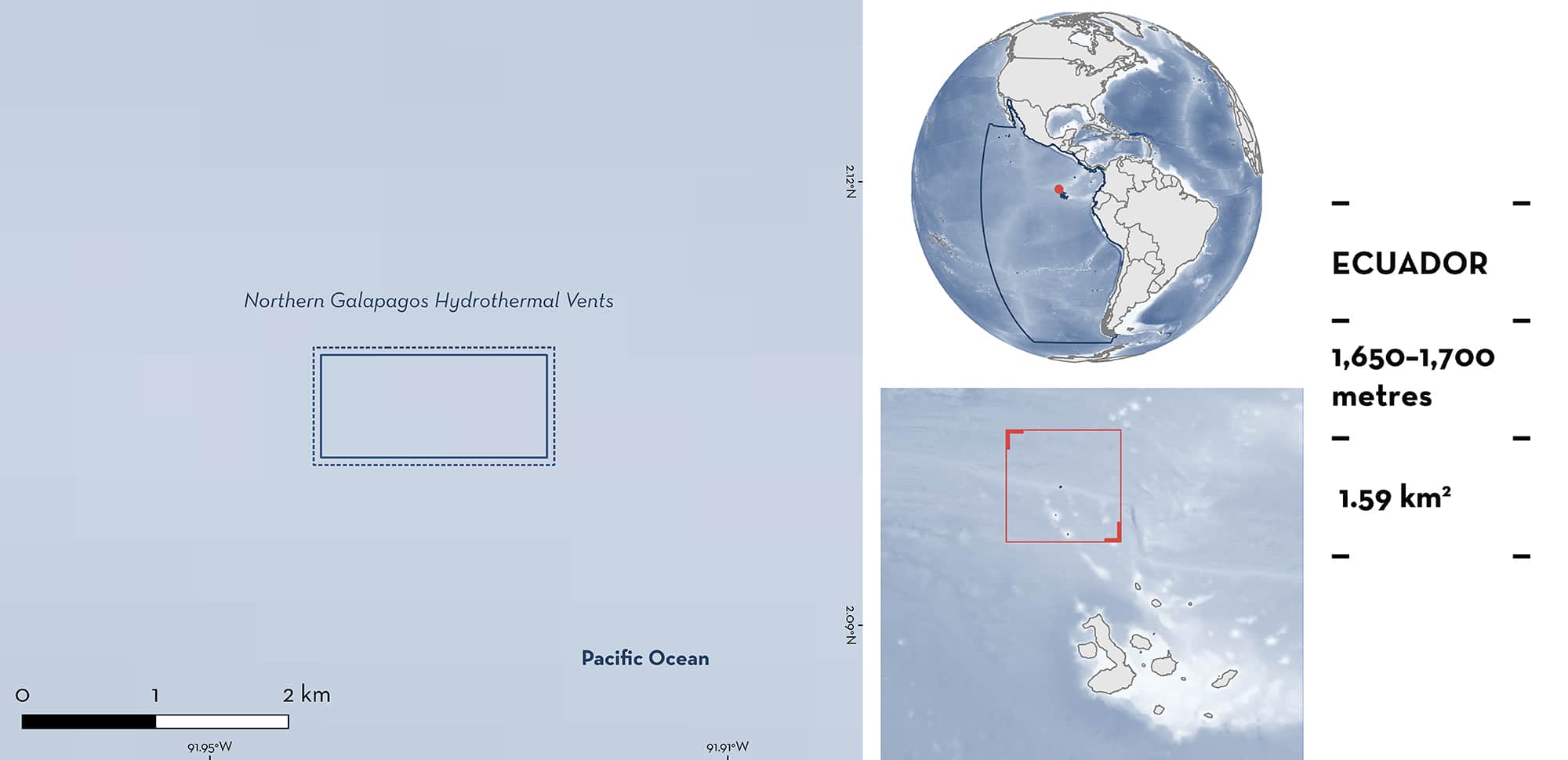
Northern Galápagos Hydrothermal Vents are located at the Iguanas-Pinguinos site on the Galápagos Platform, approximately 45 km north of Darwin Island off the Ecuadorian mainland. The area is within the Galápagos Marine Reserve, a designated UNESCO World Heritage Site and Biosphere Reserve, and overlaps with two Ecologically or Biologically Significant Marine Areas. The area is part of the Galápagos Spreading Centre, a mid-ocean ridge formed by the diverging Cocos and Nazca lithospheric plates and contains deep hydrothermal vents and basaltic ridges. The main habitat encompassed in this area is characterised by active venting and dispersing clouds of ‘black-smoker’ hydrothermal plumes. Within the area there are: reproductive areas and distinctive attributes (Pacific White Skate Bathyraja spinosissima).
Download factsheet
Northern Galápagos Hydrothermal Vents
DESCRIPTION OF HABITAT
Northern Galápagos Hydrothermal Vents is located to the north of the Galápagos Platform in the Eastern Tropical Pacific within the Exclusive Economic Zone of Ecuador. The area is situated in the Galápagos Marine Reserve, a designated UNESCO World Heritage Site and Biosphere Reserve, and overlaps with two Ecologically or Biologically Significant Marine Areas, the Eastern Tropical Pacific Marine Corridor and the Galápagos Archipelago and Western Extension (CBD 2020). The area is located on the Iguanas-Pinguinos site on the Galápagos Spreading Centre, a mid-ocean ridge approximately 45 km north of Darwin Island (Haymon et al. 2007). The ridge is formed by two diverging lithospheric plates: Cocos and Nazca. The area contains active hydrothermal vents at a depth of approximately 1,660 m and is characterised by vigorous, active venting and dispersing clouds of ‘black-smoker’ hydrothermal plumes (Haymon et al. 2008; Salinas-de-León et al. 2018). Currently, 21 active black smoker chimneys have been located within the Iguanas-Pinguinos vent field, which extends for several kilometres along the top of an axial volcanic ridge (Haymon et al. 2007). Mean ambient bottom water temperature has been recorded as 2.76°C, with anomalous temperatures recorded up to 50 m from active vents in some locations (Salinas-de-León et al. 2018).
This Important Shark and Ray Area is delineated to include benthic habitats ranging from 1,650 to 1,700 m representing the depth at which active vents are known from.
CRITERION C
SUB-CRITERION C1 – REPRODUCTIVE AREAS
Northern Galápagos Hydrothermal Vents is an important reproductive area for one ray species. Pacific White Skate egg-cases have been recorded in close proximity to hydrothermal vents where they benefit from elevated water temperatures. Visual examination and genetic barcoding of four egg-cases, sampled at 1,660–1,670 m depth from 157 egg-cases observed in the area, confirm their identity as Pacific White Skate (Salinas-de-León et al. 2018). Given the reported depth range of Pacific White Skate (800–2,906 m), the species likely uses other areas with active vents encompassing a greater area and depth range than that delineated here.
CRITERION D
SUB-CRITERION D1 – DISTINCTIVENESS
Northern Galápagos Hydrothermal Vents is an important area for a distinct behaviour. There are observations of unique ‘incubating’ behaviour of egg-cases by Pacific White Skate at hydrothermal vents. As deep-sea skates possess long egg incubation times, it is hypothesised this behaviour may accelerate embryo development time. Of 157 egg-cases observed, 58% were within 20 m of an active hydrothermal vent. Moreover, temperature measurements recorded while observing egg-cases showed that over 89% of the egg-cases were subject to temperatures above that of the ambient bottom water (Salinas-de-León et al. 2018).
Egg-case nursery sites for other Bathyraja species have been identified across a range of habitats in many ocean basins (Hoff 2016; Lennon et al. 2021). Yet, this area contains the only known example of incubating behaviour. While additional active vents have been recorded on the Iguanas-Pinguinos site, and adjacent Navidad site (~230 km northwest of Iguanas-Pinguinos) (Haymon et al. 2008), the primarily oceanographic nature of the previous completed survey of these vents means the prevalence and extent of this behaviour remains unknown.
Download factsheet
SUBMIT A REQUEST
ISRA SPATIAL LAYER REQUEST
To make a request to download the ISRA Layer in either a GIS compatible Shapefile (.shp) or Google Earth compatible Keyhole Markup Language Zipped file (.kmz) please complete the following form. We will review your request and send the download details to you. We will endeavor to send you the requested files as soon as we can. However, please note that this is not an automated process, and before requests are responded to, they undergo internal review and authorization. As such, requests normally take 5–10 working days to process.
Should you have questions about the data or process, please do not hesitate to contact us.


