ISRA FACTSHEETS
ISRA FACTSHEETS
CENTRAL AND SOUTH AMERICAN PACIFIC REGION
Jaltepeque
Summary
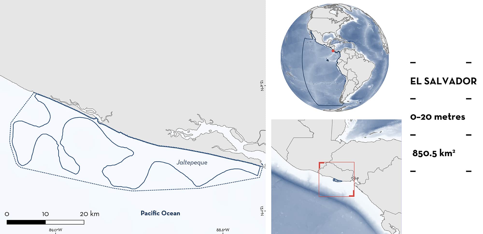
Jaltapeque is located on the Pacific coast of El Salvador, extending approximately 10 km offshore from the Estero de Jaltepeque, and the mouth of the Rio Lempa. The area includes shallow estuarine areas, the marine portion of the Complejo Jaltepeque Ramsar site, and extends out to marine continental shelf habitat to 20 m depth. Habitats include seasonally flooded mangroves, brackish lagoons, sandy beaches, and sentiment-rich benthos. Within this area there are: threatened species and reproductive areas (Scalloped Hammerhead Sphyrna lewini).
Download factsheet
Jaltepeque
DESCRIPTION OF HABITAT
Jaltepeque is located on the Pacific coast of El Salvador to approximately 10 km offshore from the Estero de Jaltepeque, and the mouth of the Rio Lempa. This is the second largest brackish water area and intertidal forested wetland in El Salvador (Ramsar 2021). The site comprises shallow estuarine areas, seasonally flooded mangroves, alluvial forests areas, sandy beaches, and brackish lagoons.
This Important Shark and Ray Area is delineated from surface waters and extends out to marine continental shelf habitat to 20 m depth based on the distribution of neonate catches of the Qualifying Species (Zambrano 2014).
CRITERION A
VULNERABILITY
One Qualifying Species considered threatened with extinction according to the IUCN Red List of Threatened SpeciesTM regularly occurs in the area. This is the Critically Endangered Scalloped Hammerhead (Rigby et al. 2019).
CRITERION C
SUB-CRITERION C1 – REPRODUCTIVE AREAS
Jaltepeque is an important reproductive area for one shark species. High catches of neonate Scalloped Hammerhead up to 10 km off the coast of this area indicate it is important for their young (Canjura 2016). Landings data from San Luis la Herradura and Puerto El Triunfo (located on the northwestern coast and within the Jaltepeque estuary, respectively) recorded 2,934 Scalloped Hammerhead neonates over twelve sampling days during the months of April, May, and June 2010. This was confirmed by the presence of umbilical scars on individuals along with sizes ranging from 42 to 64 cm total length (TL). Concurrent fisher surveys, provide the locations of this high neonate Scalloped Hammerhead catch within the area (Zambrano 2014; Canjura 2016; Oliveros-Ramos et al. 2020). These results mirror those of earlier landing surveys which recorded a catch of 3,592 Scalloped Hammerheads ranging from 44 to 60 cm TL over eight months between April 2009 and January 2010, suggesting regular use of the area (Zambrano 2010). The proximity of these fishing locations to shallow coastal estuarine habitat may indicate strong connectivity to nursery areas (Canjura 2016). High densities of Scalloped Hammerhead neonates are reported to use the shallow water areas adjacent to the mangroves for refuge (Ramsar 2021).
Download factsheet
SUBMIT A REQUEST
ISRA SPATIAL LAYER REQUEST
To make a request to download the ISRA Layer in either a GIS compatible Shapefile (.shp) or Google Earth compatible Keyhole Markup Language Zipped file (.kmz) please complete the following form. We will review your request and send the download details to you. We will endeavor to send you the requested files as soon as we can. However, please note that this is not an automated process, and before requests are responded to, they undergo internal review and authorization. As such, requests normally take 5–10 working days to process.
Should you have questions about the data or process, please do not hesitate to contact us.


