ISRA FACTSHEETS
ISRA FACTSHEETS
CENTRAL AND SOUTH AMERICAN PACIFIC REGION
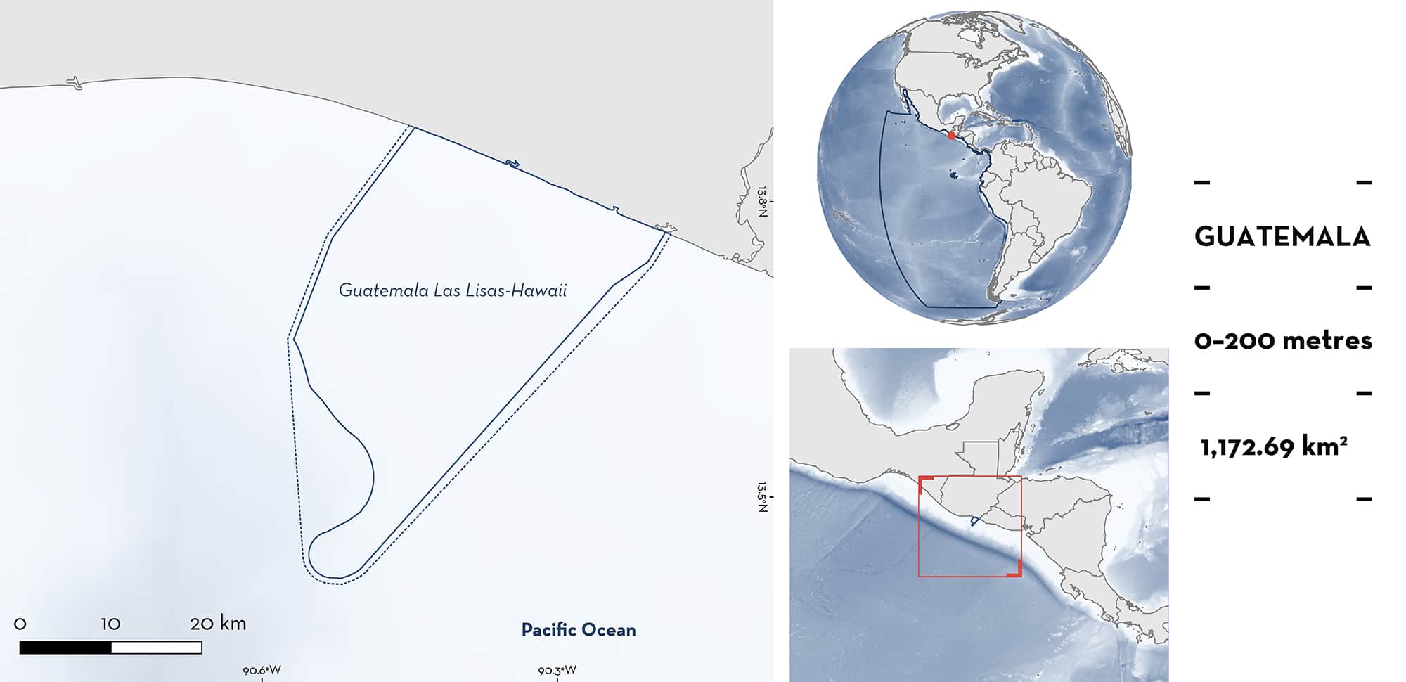
Guatemala Las Lisas-Hawaii
Summary
Guatemala Las Lisas-Hawaii is located in the western part of the Pacific coast of Guatemala near the border with El Salvador. This area includes one protected area and one Key Biodiversity Area. It is characterised by a variety of habitats, including coastal wetlands, mangroves, estuaries, volcanic sand beaches, and river mouths (including El Jiote and El Chapeton). Within this area there are: threatened species (e.g., Silky shark Carcharhinus falciformis); range-restricted species (Vermiculate Numbfish Narcine vermiculatus); reproductive areas (e.g., Scalloped Hammerhead Sphyrna lewini); and feeding areas (Scalloped Hammerhead).
Download factsheet
Guatemala Las Lisas-Hawaii
DESCRIPTION OF HABITAT
Guatemala Las Lisas-Hawaii is located in the Guatemalan Pacific near the border with El Salvador in the Municipality of Chiquimulilla, Department of Santa Rosa. Situated within the Pacific Central-American Coastal Large Marine Ecosystem (LME), the area is characterised by coastal wetlands, mangroves, estuaries, volcanic sand beaches, and river mouths, including El Jiote and El Chapeton (CONAP & PNUD 2017). This area is strongly influenced by two important ocean currents: the California Current and the Equatorial Counter Current. There is year-round riverine discharge of freshwater into the area that increases significantly during the rainy season (May–September) (CONAP & PNUD 2017). Sea surface temperatures range between 24–30°C, with maximum values occurring in April (CONAP & PNUD 2017).
The area includes one protected area, the Multiple Use Area Hawaii (CONAP & PNUD 2017), and one Key Biodiversity Area, Monterrico-Río La Paz (KBA 2022). Due to the high biodiversity recorded in Las Lisas, it has been proposed, and is in the process of being approved by the Guatemalan government, as a protected area (Las Lisas-La Barrona).
This Important Shark and Ray Area is delineated from inshore and surface waters (0 m) to a depth of 200 m based on the depths of capture of Qualifying Species in local artisanal fisheries.
CRITERION A
VULNERABILITY
Three Qualifying Species considered threatened with extinction according to the IUCN Red List of Threatened SpeciesTM regularly occur in the area. Threatened sharks comprise the Vulnerable Silky Shark (Rigby et al. 2021) and the Critically Endangered Scalloped Hammerhead (Rigby et al. 2019); threatened rays comprise the Vulnerable Longtail Stingray (Pollom et al. 2020).
CRITERION B
RANGE RESTRICTED
Guatemala Las Lisas-Hawaii holds the regular presence of Vermiculate Numbfish as a resident range-restricted species. Vermiculate Numbfish is restricted to the Gulf of California LME and the Pacific Central-American Coastal LME. This species was commonly caught in shrimp trawls between 2017–2020 (Castillo & Santana-Morales 2021).
CRITERION C
SUB-CRITERION C1 – REPRODUCTIVE AREAS
Guatemala Las Lisas-Hawaii is an important reproductive area for two shark and one ray species.
Scalloped Hammerhead nursery areas have been identified, particularly during the rainy season (May–September) when turbidity increases and provides protection from predators. This species is commonly caught as bycatch in bottom trammel nets for catfish. Between 1997–1999, 2006–2007, 2014–2015, and 2017–2020, most individuals caught were < 60 cm total length (TL) (size range 40–200 cm TL), which is close to the reported size-at-birth (31–57 cm TL; Rigby et al. 2019). Most individuals sampled had umbilical scars indicating they were neonates or young-of-the-year with juveniles between 70–150 cm TL also recorded in multiple years (Ruiz et al. 2000; Ixquiac et al. 2009; CONAP & PNUD 2017; Ixquiac 2020; Ávalos-Castillo & Santana-Morales 2021).
Based on fishery landings monitoring during 2006–2007, Silky Sharks were one of the most abundant shark species in the area. Neonates represented 23% of landings of this species (n = 163) with sizes of 65–71 cm TL (size-at-birth 65–81 cm TL; Ebert et al. 2021) while young-of-the-year represented 14% of catches (n = 100), with sizes of 72–80 cm TL, with most catches from February to May (Ixquiac et al. 2009).
Longtail Stingray is present year-round in the area (Ávalos-Castillo & Santana-Morales 2021). Preliminary results from a project focused on ray bycatch of benthic trawl fisheries operating within the area includes catches of pregnant females and neonates year-round (Cristopher Ávalos-Castillo et al. unpubl. data 2022).
CRITERION C
SUB-CRITERION C2 – FEEDING AREAS
Scalloped Hammerhead stomach content analysis of neonates and young-of-the-year from 2014–2015 revealed that, from 57% of full stomachs, the main prey for immature sharks were stomatopods (Squillidae) and shrimps (Peneaidae). These prey are very abundant, especially during summer, when neonate and juvenile Scalloped Hammerhead are present in the area (Ixquiac 2020).
Download factsheet
SUBMIT A REQUEST
ISRA SPATIAL LAYER REQUEST
To make a request to download the ISRA Layer in either a GIS compatible Shapefile (.shp) or Google Earth compatible Keyhole Markup Language Zipped file (.kmz) please complete the following form. We will review your request and send the download details to you. We will endeavor to send you the requested files as soon as we can. However, please note that this is not an automated process, and before requests are responded to, they undergo internal review and authorization. As such, requests normally take 5–10 working days to process.
Should you have questions about the data or process, please do not hesitate to contact us.


