ISRA FACTSHEETS
ISRA FACTSHEETS
MEDITERRANEAN AND BLACK SEAS REGION
Western Virsko More
Summary
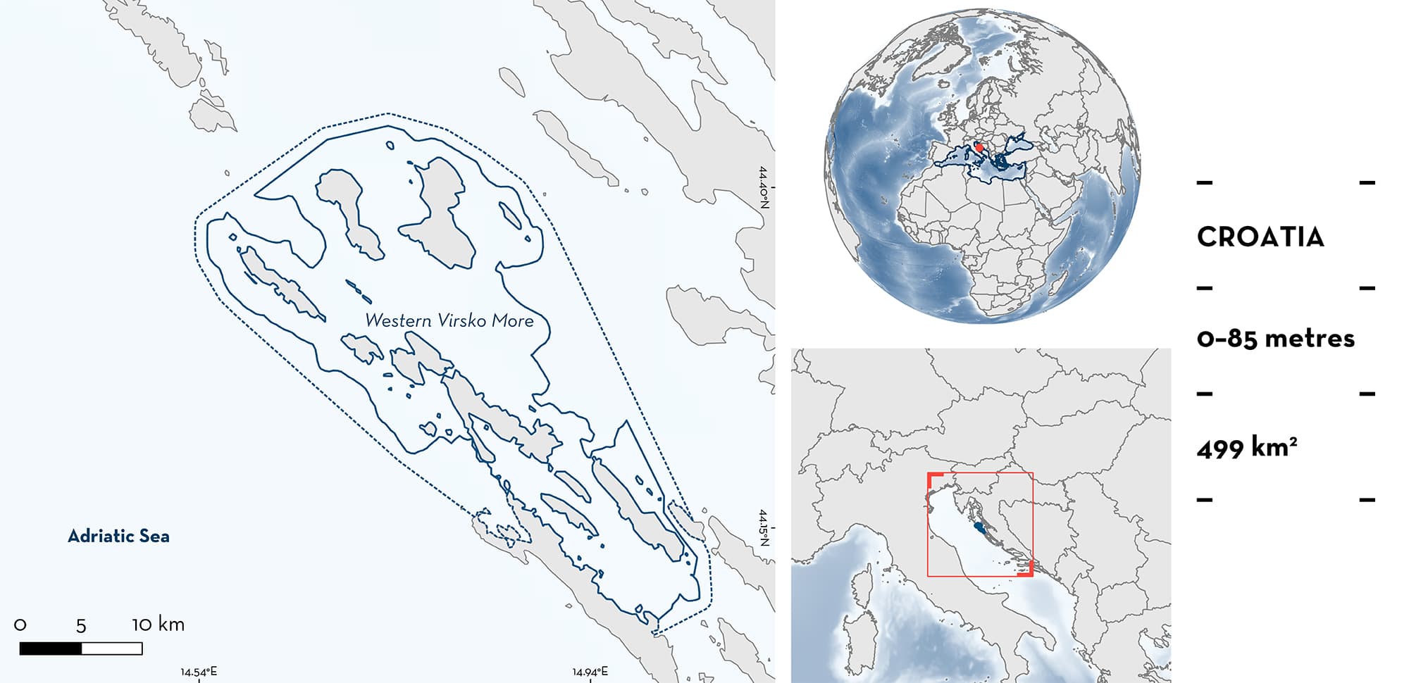
Western Virsko More is a small coastal area in Croatia in the eastern mid-Adriatic Sea. The area includes parts of the coastline of 11 large islands, and 48 smaller islets and rocks, with Olib and Molat Islands being the largest islands in the area. Shallower areas consist of sandy and rocky substrates, while deeper areas (to 85 m depth) comprise muddy-sandy or muddy substrates. Habitats include large shallow bays, channel areas, and open water. The area includes 16 Natura 2000 Special Areas of Conservation (SAC). Within the area there are: threatened species and reproductive areas (Angelshark Squatina squatina).
Download factsheet
Western Virsko More
DESCRIPTION OF HABITAT
Western Virsko More is a small coastal area in Croatia in the eastern mid-Adriatic. The area includes parts of the coastline of 11 large islands, and 48 smaller islets and rocks. Olib and Molat Islands are the largest islands in the area. Water depths range from shallow inshore waters to maximum depths of 85 m. In these deeper areas, the sea bottom is predominantly mud-sand and/or mud formed by heavy sedimentation in the water column. In the shallower areas closer to the islands and in the bays, the sedimentation is lower and therefore the seabed consists mainly of sandy sediments with larger grain sizes. The intertidal zone of this area, with the exception of the beaches of deep bays, consists of rocky bottoms (Dokoza et al. 2021a, 2012b).
The area includes habitats such as large shallow bays, channel areas, and open water. The Maknare part of the area is called seven gates by local inhabitants due to the seven passages between the islands of Molat, Sestrunj, Rivanj, and Tun Veli, as well as three smaller islets in the northern part of the area. Channel areas are characterised by extremely strong currents that change direction twice a day. Rivanj Channel has the most varied seabed morphology. It consists of boulders up to several metres in diameter scattered between large-grained sand dunes reaching several metres high. The deepest point in the channel is 36 m. Due to the strong currents, sedimentation is usually high.
The area’s 16 Natura 2000 Special Areas of Conservation (SAC) include habitat types considered important at the European Union level. These include Neptune Grass (Posidonia oceanica) meadows and biocenosis of: (1) well sorted fine sands; (2) superficial muddy sands in sheltered waters; (3) the coastal detritic bottom; (4) coralligenous habitats; and (5) infralittoral algae.
This Important Shark and Ray Area is benthic and is delineated from inshore waters (0 m) to 85 m based on the bathymetry of the area.
CRITERION A
VULNERABILITY
The one Qualifying Species within the area is considered threatened with extinction according to the IUCN Red List of Threatened SpeciesTM. The Angelshark is assessed as Critically Endangered (Morey et al. 2019).
CRITERION C
SUB-CRITERION C1 – REPRODUCTIVE AREAS
Western Virsko More is an important reproductive area for one species of shark. The area has been known as a site of occurrence and reproduction for Angelsharks since the 19th century (Soldo 2021). The species is now rare in other areas of the Adriatic Sea, but recent catch records and surveys have confirmed that the area is a hotspot for the species in this body of water. From 50 records reported throughout the Croatian Adriatic in the period from 2010–2020, 19 (38%) originate from this area. Furthermore, local fishers report the catch-and-release of Angelsharks from the area (A. Soldo et al. unpubl. data 2023).
Angelshark occurrence data in the area were gathered from the Angel Shark Sightings Map and a Local Ecological Knowledge (LEK) study conducted in Croatia by WWF Adria in 2020 (Pike et al. 2020). Both adult and juvenile Angelshark records were reported. Through the LEK survey, in boreal spring 2020, two fishers reported separate cases of pregnant females aborting pups in gillnets. These were a 15 kg female bearing 20 pups and a 20 kg female bearing 10 pups (Ugarković et al. 2020). Furthermore, reported catches include two neonates in 2020 (25 & 31 cm total length [TL]; size-birth is 24–30 cm TL, Ebert & Dando 2021) (Ugarković et al. 2020).
Marine habitat mapping carried out by the Association Sunce in 2021 identified habitats that correspond with Angelshark breeding and nursery areas. The area is characterised by a mosaic of mostly shallow areas covered with Posidonia meadows, sandy and rocky substrates with infralittoral algae. Such habitats favour the reproduction and development of Angelsharks (Dokoza et al. 2021a, 2021b).
Environmental DNA (eDNA) surveys conducted in 2022 confirmed that the area is a hotspot for Angelsharks in the Adriatic (Vrečko & Markulin 2022). Three replicate samples were collected from eight locations within the area. Laboratory analysis detected traces of Angelshark DNA in samples from three of the eight locations, with a high confirmation probability (all three replicates positive) at one location (Vrečko & Markulin 2022).
Download factsheet
SUBMIT A REQUEST
ISRA SPATIAL LAYER REQUEST
To make a request to download the ISRA Layer in either a GIS compatible Shapefile (.shp) or Google Earth compatible Keyhole Markup Language Zipped file (.kmz) please complete the following form. We will review your request and send the download details to you. We will endeavor to send you the requested files as soon as we can. However, please note that this is not an automated process, and before requests are responded to, they undergo internal review and authorization. As such, requests normally take 5–10 working days to process.
Should you have questions about the data or process, please do not hesitate to contact us.


