ISRA FACTSHEETS
ISRA FACTSHEETS
MEDITERRANEAN AND BLACK SEAS REGION
Ras Akrata – Cap Tenes
Summary
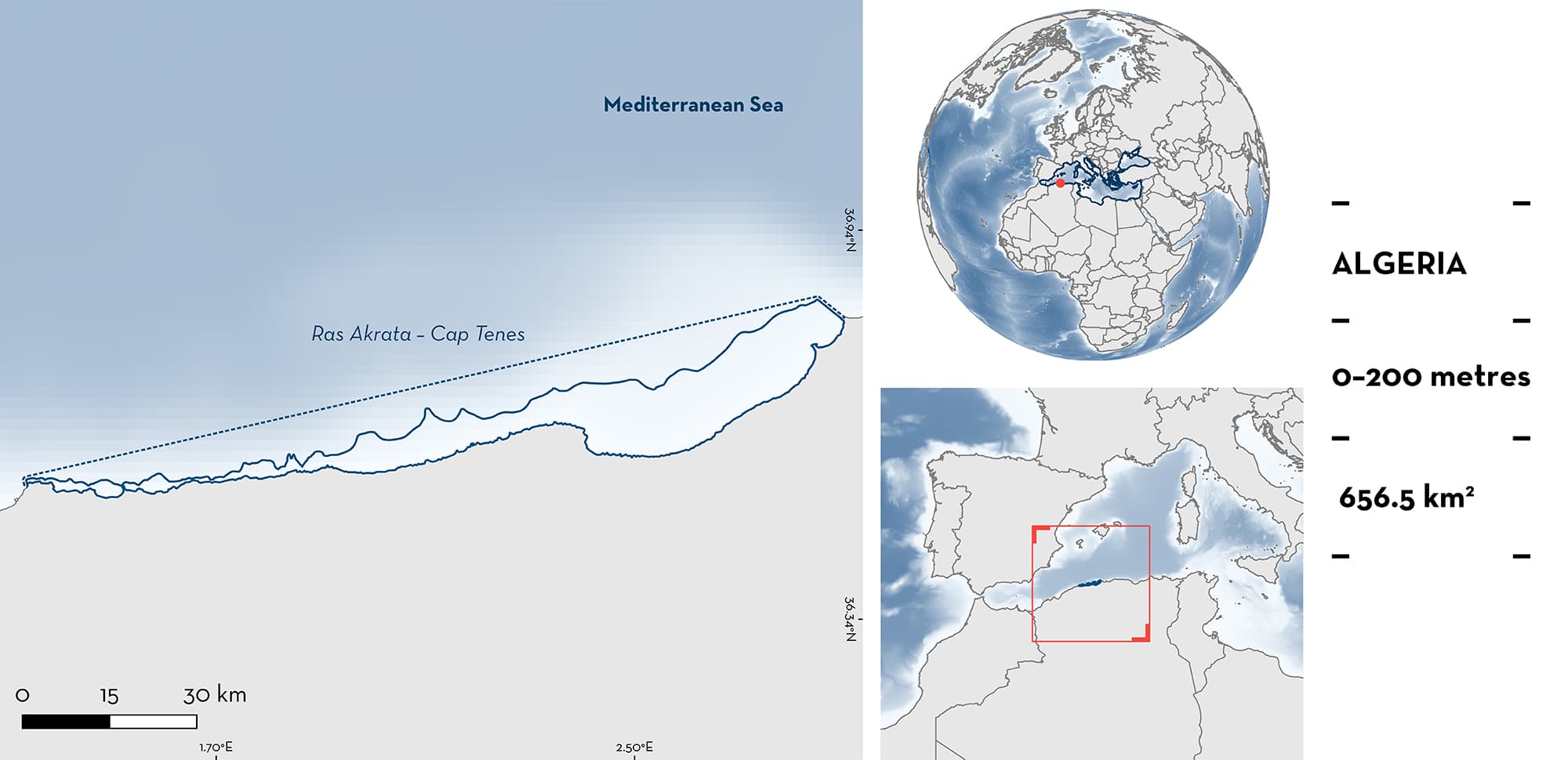
Ras Akrata–Cap Tenes is spread over a 181 km coastal strip along the central basin of the Algerian coast. Located south of the western Mediterranean basin, in the Algerian current of the Modified Atlantic Water, it covers a narrow continental shelf to the south with a steep drop in its central part. This area is characterised by a highly productive ecosystem due to intense upwelling and nutrients supplied by coastal leaching and rivers. In this area there are: threatened species and reproductive areas (Blue Shark Prionace glauca).
Download factsheet
Ras Akrata – Cap Tenes
DESCRIPTION OF HABITAT
Ras Akrata-Cap Tenes is spread over a 181 km coastal strip along the central basin of the Algerian coast. Located south of the western Mediterranean basin, in the Algerian current of the Modified Atlantic Water, it covers a narrow continental shelf to the south (average width = 50 km; Bahbah [2021)) with a steep drop in its central part. The 200 m bathymetric curve is generally considered the limit of the Algerian continental margin and its average width is 24 km (maximum of 55 km in the bay of Bou-Ismail). The continental shelf, being very narrow, reaches a maximum distance of 13 km from shore at the level of Mount Chenoua and a minimum of 3 km between Sidi Fredj and Algiers (Houma 2009). It is characterised by a slope with a clear line of inflection around the 100 m isobath, with rocky outcrops located off Mazafran and Bousmail. On the west side of Mount Chenoua and up to Cap Tenes, the slope gradually increases to its maximum, where the shelf is one of the shortest in the Mediterranean Sea.
Ras Akrata-Cap Tenes can be separated into two distinct zones though the fishing fleet which captures the Qualifying Species operate in both. The first zone corresponds to the eastern sector with the bay of Bou-Ismail, characterised by sandy beaches interspersed with rocky flats. The second zone refers to the western sector (Mont Chenoua – Cap Tenes) characterised by cliffs, rocky coves, and sandy beaches. This area is partly characterised by intense coastal upwelling (Millot 1989) and is recognised as a highly productive ecosystem, with most of its biological production seemingly limited to a very narrow strip of the continental shelf. This high productivity is explained by a significant supply of nutrients due to coastal leaching and rivers present in the location (Oued Damous, Oued Messelmoune, Oued Hachem).
This Important Shark and Ray Area is pelagic and is delineated from inshore and surface waters (0 m) to 200 m based on the bathymetry of the area.
CRITERION A
VULNERABILITY
The one Qualifying Species within this area is considered threatened with extinction according to the IUCN Red List of Threatened Species™. The Blue Shark is assessed as Near Threatened globally (Rigby et al. 2019) but Critically Endangered in the Mediterranean Sea (Sims et al. 2016).
CRITERION C
SUB-CRITERION C1 – REPRODUCTIVE AREAS
Ras Akrata-Cape Tenes is an important reproductive area for one shark species. Along the Algerian coast, Blue Shark has amongst the highest yield of sharks captured from longline fisheries targeting large pelagic species, with 55–75% of animals being juveniles (Mendil unpubl. data 2023).
Blue Shark neonates and young-of-the-year are reported using observational and size frequency data (Bouaziz 2017). Captured young-of-the-year include animals measuring ~80 cm total length (TL). Between 2001–2022, 587 Blue Sharks (68% juveniles) were sampled, measuring 148.2 cm TL on average. Six young-of-the-year were recorded in 2022 (Mendil & Hemida unpubl. data 2023), and 11 were recorded in 2017 (Bouaziz 2017) based on a size-at-birth of 35–50 cm TL. Between 2021–2022, pregnant individuals were also caught in the area.
Download factsheet
SUBMIT A REQUEST
ISRA SPATIAL LAYER REQUEST
To make a request to download the ISRA Layer in either a GIS compatible Shapefile (.shp) or Google Earth compatible Keyhole Markup Language Zipped file (.kmz) please complete the following form. We will review your request and send the download details to you. We will endeavor to send you the requested files as soon as we can. However, please note that this is not an automated process, and before requests are responded to, they undergo internal review and authorization. As such, requests normally take 5–10 working days to process.
Should you have questions about the data or process, please do not hesitate to contact us.


