ISRA FACTSHEETS
ISRA FACTSHEETS
MEDITERRANEAN AND BLACK SEAS REGION
Corsica Canyons
Summary
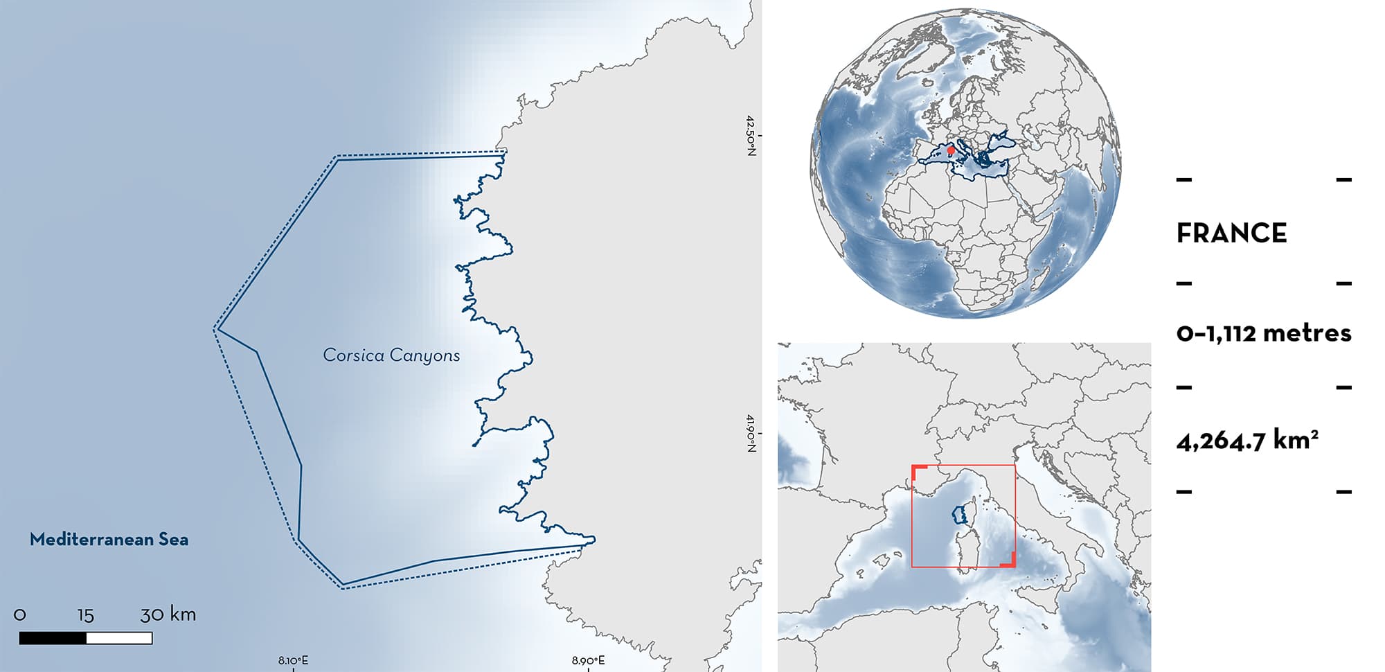
Corsica Canyons is located on the western coast of Corsica in the northwestern Mediterranean Sea. The area is characterised by a very narrow continental shelf and an abrupt continental slope with numerous underwater canyons. It overlaps with the North-western Mediterranean Pelagic Ecosystems Ecologically or Biologically Significant Marine Area, two Key Biodiversity Areas, several Natura 2000 sites, and the Pelagos Marine Mammal Sanctuary. Within this area there are: threatened species, reproductive areas, and undefined aggregations (Spinetail Devil Ray Mobula mobular).
Download factsheet
Corsica Canyons
DESCRIPTION OF HABITAT
Corsica Canyons is located in the northwestern Mediterranean Sea, on the west coast of Corsica Island, France. The area is primarily comprised of pelagic and offshore habitats. It is characterised by a very short continental shelf and an abrupt continental slope with numerous underwater canyons. These canyons generally begin around 100 m deep and rapidly reach more than 1,000 m through complex geological formations.
The major current occurring year-round in the area is the Western Corsican Current which flows south to north and affects surface, intermediate, as well as deep waters (Millot 1999). This current is stronger during the boreal summer (Ifremer 2009; Qiu et al. 2010). Coastal upwelling events are known to occur in the area and are induced by strong northerly winds, blowing parallel to the coast (Ifremer 2009).
The euphotic layer of the area is characterised by a relatively low annual primary production (~130 g C/m2/year) compared to the rest of the Provencal Basin, which is known for localised early-spring algal blooms (Olita et al. 2011). However, interannual variability in winds (e.g., strong northerly wind events) can lead to the extension of the blooming area to Corsica Canyons (Bosc et al. 2004; Olita et al. 2011).
The area overlaps with the North-western Mediterranean Pelagic Ecosystems Ecologically or Biologically Significant Marine Area (CBD 2023), two Key Biodiversity Areas (Golfe de Porto, presqu’île de Scandola et golfe de Galeria; and Iles Sanguinaires; KBA 2023a, 2023b), several Natura 2000 sites, and the Pelagos Marine Mammal Sanctuary.
This Important Shark and Ray Area is pelagic and is delineated from 0 to 1,112 m based on the global depth range of the Qualifying Species and the bathymetry of the area.
CRITERION A
VULNERABILITY
The one Qualifying Species occurring in the area is considered threatened with extinction according to the IUCN Red List of Threatened SpeciesTM. The Spinetail Devil Ray is assessed as Endangered (Marshall et al. 2022).
CRITERION C
SUB-CRITERION C1 – REPRODUCTIVE AREAS
Corsica Canyons is an important reproductive area for one species of ray.
The Spinetail Devil Ray is regularly and predictably observed in the area between June and August each year (Ailerons 2022; Stephan et al. 2023). Observations have been based on the Ailerons citizen science database and records collected during scientific expeditions between 2017–2022 off the west coast of Corsica. Courtship behaviour such as mating trains, pre-copulatory positioning, and biting have been recorded throughout the area and yearly, including in a large school of 50 individuals comprised of males and females. Such courtship behaviours have been described for the species in New Zealand (Duffy & Tindale 2018) and in other mobulid species (Deakos 2012; Sobral 2013; McCallister et al. 2020).
CRITERION C
SUB-CRITERION C5 – UNDEFINED AGGREGATIONS
Corsica Canyons is an important area for undefined aggregations of one species of ray.
Citizen science observations recorded in the Ailerons database yearly from June to August between 2017–2022 highlights sightings (n = 29) of aggregations of Spinetail Devil Rays (4–40 individuals per sighting; Ailerons 2022) from the area. In June 2023, two additional aggregations were spotted in the area with 62 and 40 individuals respectively (Ailerons 2023). The purpose of the aggregation behaviour is currently unknown.
Download factsheet
SUBMIT A REQUEST
ISRA SPATIAL LAYER REQUEST
To make a request to download the ISRA Layer in either a GIS compatible Shapefile (.shp) or Google Earth compatible Keyhole Markup Language Zipped file (.kmz) please complete the following form. We will review your request and send the download details to you. We will endeavor to send you the requested files as soon as we can. However, please note that this is not an automated process, and before requests are responded to, they undergo internal review and authorization. As such, requests normally take 5–10 working days to process.
Should you have questions about the data or process, please do not hesitate to contact us.


