ISRA FACTSHEETS
ISRA FACTSHEETS
MEDITERRANEAN AND BLACK SEAS REGION
North Cyclades
Summary
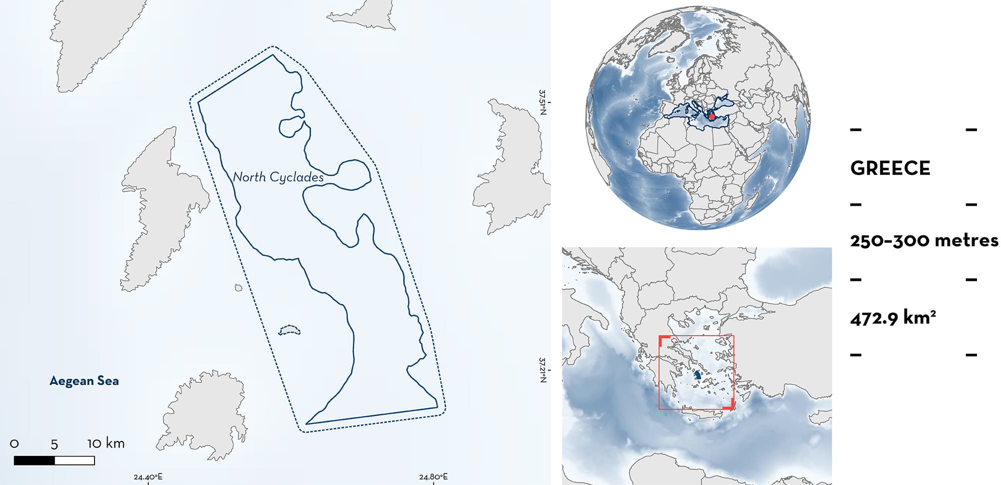
North Cyclades sits within the Cyclades Archipelago, a group of around 220 islands in the Aegean Sea, southeast of mainland Greece. Situated in the northwest part of the archipelago, it consists of a deeper area of the Cyclades plateau, between the islands of Kea, Gyaros, Kithnos, and Ermoupoli. The northern edge of the archipelago is under the influence of the warm Levantine current which splits into the Evvoia current in the northwest and feeds into a permanent gyre in the Myrtoan Sea to the west. The area is characterised by deep calcareous sandy mud to muddy sand habitats. Within this area there are reproductive areas (Longnose Spurdog Squalus blainville).
Download factsheet
North Cyclades
DESCRIPTION OF HABITAT
North Cyclades is located in Greece within the Cyclades Archipelago, a group of over 200 islands located on a plateau (<200 m) in the Central Aegean Sea (Giakoumi & Kokkoris 2013; Sini et al. 2017). Situated in the northwest part of the archipelago, it consists of a deeper area of the Cyclades plateau, between the islands of Kea, Gyaros, Kithnos, and Ermoupoli, which reaches maximum depths of 300 m (Giakoumi & Kokkoris 2013; Sini et al. 2017). The northern edge of the archipelago is under the influence of the warm Levantine current which splits into the Evvoia current in the northwest and feeds into a permanent gyre in the Myrtoon Sea to the west (Nittis & Perivoliotis 2002). The west edge of the archipelago is influenced by less-saline Black Sea waters. Deep habitats in the area are defined by calcareous muddy sands to sandy mud (Peristeraki et al. 2017).
This area overlaps with the Central Aegean Sea Ecologically or Biologically Significant Marine Area (CBD 2023).
This Important Shark and Ray Area is subsurface benthopelagic and is delineated from 250 m to 300 m based on the bathymetry of the area and the depth range of the Qualifying Species in the area.
CRITERION C
SUB-CRITERION C1 – REPRODUCTIVE AREAS
North Cyclades is an important reproductive area for one shark species.
Higher abundance of Longnose Spurdog young-of-the-year and immature specimens have been found in this area compared to surrounding areas (Kousteni et al. 2017; V. Kousteni pers. comms 2023). Of 41 specimens collected in one study in 2005, 2006, and 2009, 24 were female, with an average size of 24 ± 1 cm total length (TL ± SD) (Kousteni et al. 2017), close to its known size-at-birth (18–21 cm TL; Kousteni & Megalofonou 2011). Based on 19 of those female individuals, mean age was estimated to be 1.32 ± 0.67 (yrs ± SD). In contrast, Longnose Spurdog in locations outside the area measured >>40 cm TL (Kousteni et al. 2017). Young-of-the-year individuals were the most frequently encountered age class for both males and females in the study, and the North Cyclades area (Central Aegean Sea) was the only area where they were encountered (Kousteni et al. 2017). This species has been reported in the area in recent years, though information about the size of these more recent records is unavailable (Kousteni 2015; Damalas et al. 2022).
Download factsheet
SUBMIT A REQUEST
ISRA SPATIAL LAYER REQUEST
To make a request to download the ISRA Layer in either a GIS compatible Shapefile (.shp) or Google Earth compatible Keyhole Markup Language Zipped file (.kmz) please complete the following form. We will review your request and send the download details to you. We will endeavor to send you the requested files as soon as we can. However, please note that this is not an automated process, and before requests are responded to, they undergo internal review and authorization. As such, requests normally take 5–10 working days to process.
Should you have questions about the data or process, please do not hesitate to contact us.


