ISRA FACTSHEETS
ISRA FACTSHEETS
MEDITERRANEAN AND BLACK SEAS REGION
Palmahim Brine Pools
Summary
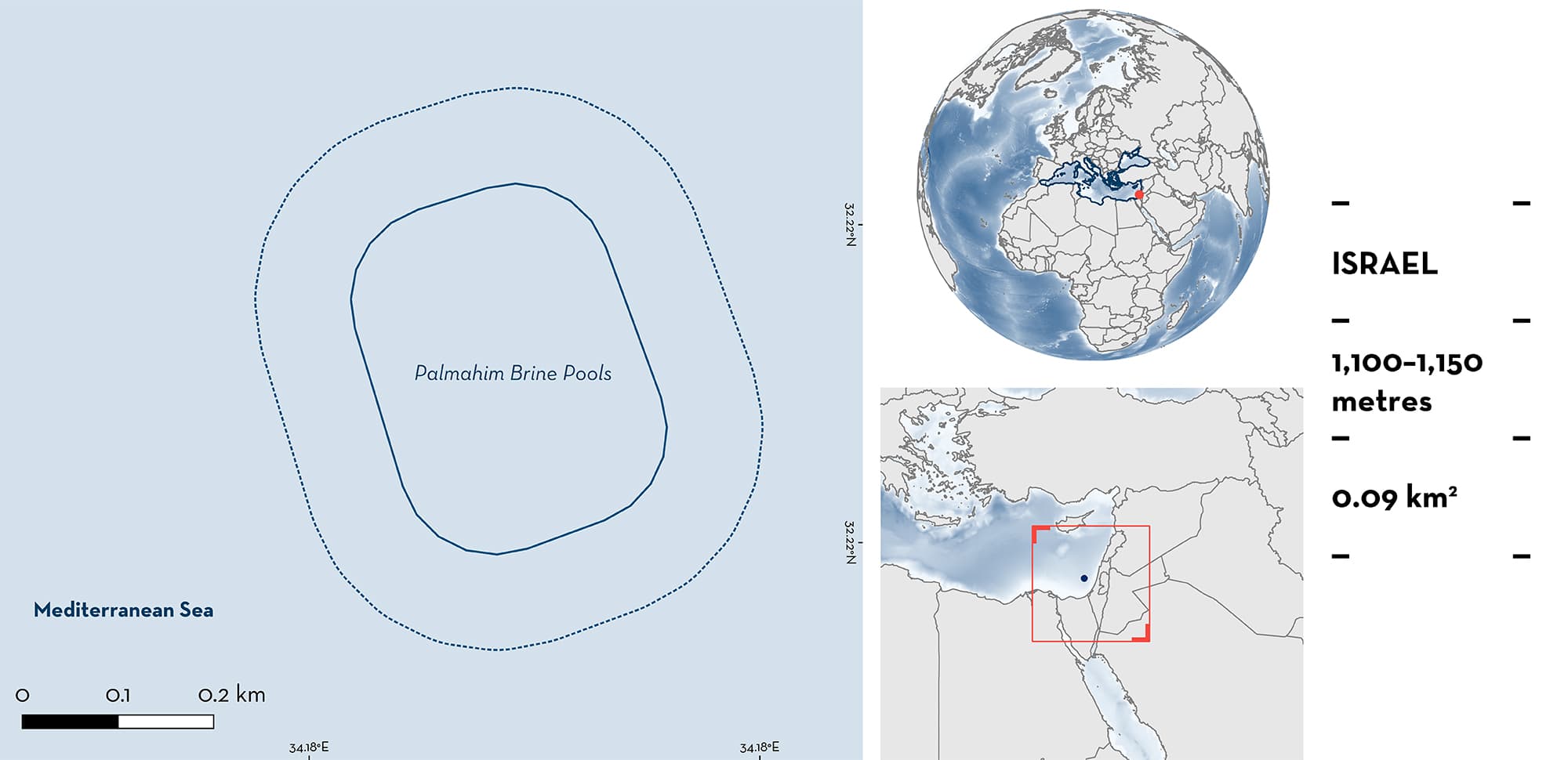
Palmahim Brine Pools is located in the southeastern Mediterranean Sea, 60 km off the coast of Israel. The area is within a marine protected area that covers a large-scale submarine rotational slide rooted in the Messinian evaporites. This area is characterised by a warm and saline brine pool system. Within this area there are: threatened species (Angular Roughshark Oxynotus centrina); reproductive areas (Blackmouth Catshark Galeus melastomus); and feeding areas (Angular Roughshark).
Download factsheet
Palmahim Brine Pools
DESCRIPTION OF HABITAT
Palmahim Brine Pools is located in the ultraoligotrophic southeast Mediterranean Sea, 60 km off the coast of Israel. Gas seepage is prominent at the toe of the Palmahim Disturbance, a large-scale submarine rotational slide rooted in the Messinian evaporites (Lawal et al. 2023). This brine pool system at >1,100 m depth was discovered in 2021. The site comprises several distinct habitats, including warm (~21°C), saline (salinity ~60 PSU), anoxic brines saturated with methane, sulfide, and ammonium at millimolar levels, brine-infused euxinic sediments that are covered with mats of sulfur-oxidising bacteria, reefs of chemosynthetic fauna (mainly Lamellibrachia anaximandri tubeworms, Lucinoma kazani clams, and Idas sp. mussels), and authigenic carbonates.
The area is within the newly declared Palmahim Slide marine protected area.
This Important Shark and Ray Area is benthic and is delineated from 1,100 to 1,150 m based on the bathymetry of the area.
CRITERION A
VULNERABILITY
One Qualifying Species within the area is considered threatened with extinction according to the IUCN Red List of Threatened SpeciesTM. The Angular Roughshark is assessed as Endangered (Finucci et al. 2021).
CRITERION C
SUB-CRITERION C1 – REPRODUCTIVE AREAS
Palmahim Brine Pools is an important reproductive area for one shark species.
The area attracts thousands of Blackmouth Catsharks that breed and lay eggs, mainly among tubeworms or above fields of Lucinoma kazani clams, likely due to the elevated temperatures and ample food present in the area (Y. Makovsky pers. obs. 2023). Two Remotely Operated Vehicle (ROV) surveys were conducted in April and November 2021, and on both occasions the egg deposit field was located (Herut et al. 2022). In an area spanning >200 m2, the seabed is composed of egg cases that stack in layers. The top layer consisted of live egg cases containing yolk sacs and embryos of various stages, and below it there were many layers of old, empty egg cases, confirming the continuous and regular presence of this reproductive process in the area. These results suggest that Blackmouth Catsharks lay eggs year-round in this area.
CRITERION C
SUB-CRITERION C2 – FEEDING AREAS
Palmahim Brine Pools is an important feeding area for one shark species.
During two ROV surveys in April and November 2021, Angular Roughsharks were observed feeding on Blackmouth Catshark eggs and on chemosynthetic clams in this area. Blackmouth Catshark eggs are concentrated in this small area, suggesting that the feeding area is similarly restricted to this site.
Download factsheet
SUBMIT A REQUEST
ISRA SPATIAL LAYER REQUEST
To make a request to download the ISRA Layer in either a GIS compatible Shapefile (.shp) or Google Earth compatible Keyhole Markup Language Zipped file (.kmz) please complete the following form. We will review your request and send the download details to you. We will endeavor to send you the requested files as soon as we can. However, please note that this is not an automated process, and before requests are responded to, they undergo internal review and authorization. As such, requests normally take 5–10 working days to process.
Should you have questions about the data or process, please do not hesitate to contact us.


