ISRA FACTSHEETS
ISRA FACTSHEETS
MEDITERRANEAN AND BLACK SEAS REGION
Northeastern Sardinia
Summary
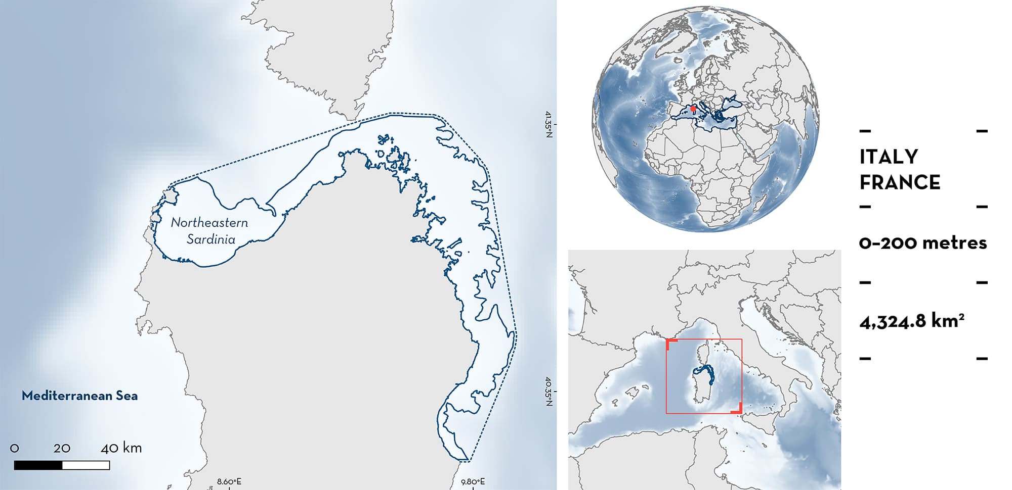
Northeastern Sardinia is a coastal area bordering the coastline of Sardinia (Italy) and the waters of Corsica (France). It includes the Gulf of Asinara, the southern part of the Bonifacio Strait between Sardinia and Corsica, the islands and islets of the Maddalena Archipelago, and extends south to the islands of Tavolara and Molara and the coast down to the Gulf of Orosei. The area is characterised by a continental shelf of variable width (~1–20 km) and includes numerous deepwater canyons. Winter phytoplankton blooms are frequent in the area and characterise seasonal variations in productivity. The area overlaps with the North-western Mediterranean Pelagic Ecosystems Ecological and Biological Significant Marine Area, four Marine Protected Areas, and four Key Biodiversity Areas. Within this area there are: threatened species and feeding areas (Basking Shark Cetorhinus maximus).
Download factsheet
Northeastern Sardinia
DESCRIPTION OF HABITAT
Northeastern Sardinia borders the northern and northwestern coast of Sardinia (Italy) and the waters of Corsica (France). It includes the Strait of Bonifacio which is shared between Italian and French waters. This area is mostly part of the Tyrrhenian Sea, but the western limit sits within the Liguro-Provençal Basin. The continental shelf is narrow in some places and wider in others (~1–20 km wide). The slope is carved by several deepwater canyons, including the Caprera, Mortorio, and Tavolara Canyons in the north, and the Posada, Orosei, and Gonone Canyons in the south (Würtz 2012). In the Tyrrhenian Sea, the Modified Atlantic Water forms the surface water mass layer (0–150 m; mean annual temperature range = 14.8–16°C; Iacono et al. 2021). Phytoplankton blooms, which are influenced by atmospheric and oceanographic conditions, occur mostly at the end of the boreal winter (Siokou-Frangou et al. 2010; Olita et al. 2011).
The area overlaps with the North-western Mediterranean Pelagic Ecosystems Ecological and Biological Significant Marine Area (CBD 2023), four Marine Protected Areas, and four Key Biodiversity Areas (Asinara Island, Piana Island and Stintino Peninsula; Northern Sardinia; Détroit de Bonifaccio et Iles Lavezzi; and Tavolara Archipelago, Cape Ceraso and Cape Figari) (KBA 2023a, 2023b, 2023c, 2023d).
This Important Shark and Ray Area is pelagic and is delineated from surface waters (0 m) to 200m based on the bathymetry of the area.
CRITERION A
VULNERABILITY
The one Qualifying Species occurring in the area is considered threatened with extinction according to the IUCN Red List of Threatened SpeciesTM. The Basking Shark is assessed as Endangered (Rigby et al. 2021).
CRITERION C
SUB-CRITERION C2 – FEEDING AREAS
Northeastern Sardinia is an important feeding area for one shark species.
Basking Sharks are regular, seasonal, and annual visitors of the area. A compilation of data for the period 2005–2012 highlights records from a total of 111 individuals in the area (de Sabata & Clò 2010; de Sabata et al. 2013). Of those, ~75% were directly observed in the water by a network of observers and ~25% were captured by fishers. Individuals ranged 240–800 cm total length (TL) and were mostly observed in spring, particularly in March (de Sabata & Clò 2010; de Sabata et al. 2013). The individuals directly observed in the water were either solitary or in aggregations of up to 11 individuals.
Most sightings occurred in areas near submarine canyon heads (de Sabata & Clò 2010; de Sabata et al. 2013). Upwelling at these canyons transport nutrients to surface waters and enhance productivity (Würtz 2012). Sightings of Basking Sharks correlated to high levels of chlorophyll-a concentrations in the area (de Sabata et al. 2013). In addition, several observations of feeding individuals were made in the area.
Download factsheet
SUBMIT A REQUEST
ISRA SPATIAL LAYER REQUEST
To make a request to download the ISRA Layer in either a GIS compatible Shapefile (.shp) or Google Earth compatible Keyhole Markup Language Zipped file (.kmz) please complete the following form. We will review your request and send the download details to you. We will endeavor to send you the requested files as soon as we can. However, please note that this is not an automated process, and before requests are responded to, they undergo internal review and authorization. As such, requests normally take 5–10 working days to process.
Should you have questions about the data or process, please do not hesitate to contact us.


