ISRA FACTSHEETS
ISRA FACTSHEETS
WESTERN INDIAN OCEAN REGION
Antongil Bay
Summary
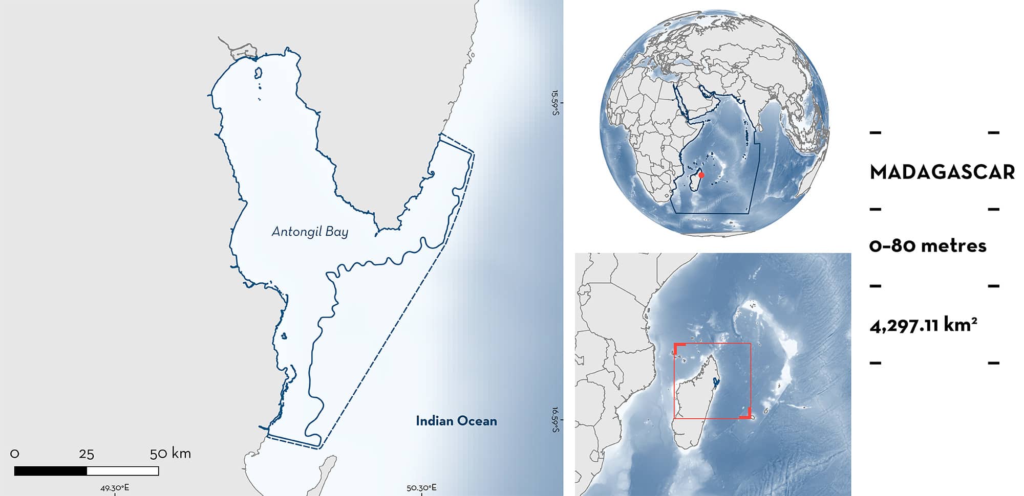
Antongil Bay is a semi-enclosed bay in northeast Madagascar. It is the largest bay in Madagascar, extending ~80 km inland, and encompasses several habitats including mangroves, seagrass beds, coral reefs, soft sediment habitats, and estuaries. The area overlaps with four marine protected areas – Anoromby, Mananara Nord, Masoala, and Nosy Mangabe, several Key Biodiversity Areas, and an additional 26 locally managed marine areas. Within this area there are threatened and range-restricted species (Malagasy Blue-spotted Guitarfish Acroteriobatus andysabini).
Download factsheet
Antongil Bay
DESCRIPTION OF HABITAT
Antongil Bay is a semi-enclosed bay in northeast Madagascar that extends inland ~80 km (Ersts & Rosenbaum 2003), making it the largest bay in Madagascar. It is sheltered from the Indian Ocean by the Masoala Peninsula and comprises shallow productive waters (Doukakis et al. 2007). This area encompasses benthopelagic habitats, with a mean depth of 41.5 m, and a maximum depth of 70 m (Ersts & Rosenbaum 2003). Many habitat types characterise the bay, including mangroves, seagrass beds, coral reefs, and estuaries, with nine major rivers entering the bay (Doukakis et al. 2011). The area is characterised by a long, wet season (December–August) and receives in excess of 2,000 mm of rainfall per year (Doukakis et al. 2007).
Antongil Bay is a managed area, zoned with several area uses, including several small marine protected areas (MPAs) – Anoromby, Mananara Nord, Masoala and Nosy Mangabe MPAs – and an additional 26 locally managed marine areas (LMMAs). There are also several Key Biodiversity Areas (KBAs) that fall inside or overlap with the area, including the Nosy Mangabe Special Reserve KBA, Antongil Bay KBA, and Mananara-North Biosphere Reserve KBA (KBA 2023a, 2023b, 2023c).
This Important Shark and Ray Area is benthic and is delineated from inshore and surface waters (0 m) to 80 m based on the bathymetry of the area and the depth range of the Qualifying Species.
CRITERION A
VULNERABILITY
The one Qualifying Species in the area is considered threatened with extinction according to the IUCN Red List of Threatened SpeciesTM. The Malagasy Blue-spotted Guitarfish is assessed as Endangered (Jabado et al. Submitted).
CRITERION B
RANGE RESTRICTED
This area holds the regular presence of Malagasy Blue-spotted Guitarfish as a resident range-restricted species. This species has been recorded in the bay during baited remote underwater video (BRUV) surveys in October 2017 and again in November 2020 (n = 2). It was also recorded in artisanal fisher landings in the bay between April 2020 and June 2023 (n = 4; Wildlife Conservation Society unpubl. data 2023), suggesting that this species is present in the area throughout the year. The Wildlife Conservation Society has conducted similar surveys at a number of locations around the coastline of Madagascar, and this area is one of only two locations where the regular presence of this species has been recorded (the other is located in the Toliara province on the southwestern side of the island). Given the rarity of sightings and landings data for this species, Antongil Bay is considered an important area for this range-restricted species, which is endemic to Madagascar, and occurs only in the Agulhas Current Large Marine Ecosystem.
Download factsheet
SUBMIT A REQUEST
ISRA SPATIAL LAYER REQUEST
To make a request to download the ISRA Layer in either a GIS compatible Shapefile (.shp) or Google Earth compatible Keyhole Markup Language Zipped file (.kmz) please complete the following form. We will review your request and send the download details to you. We will endeavor to send you the requested files as soon as we can. However, please note that this is not an automated process, and before requests are responded to, they undergo internal review and authorization. As such, requests normally take 5–10 working days to process.
Should you have questions about the data or process, please do not hesitate to contact us.


