ISRA FACTSHEETS
ISRA FACTSHEETS
WESTERN INDIAN OCEAN REGION
Mauritius Northern Islands
Summary
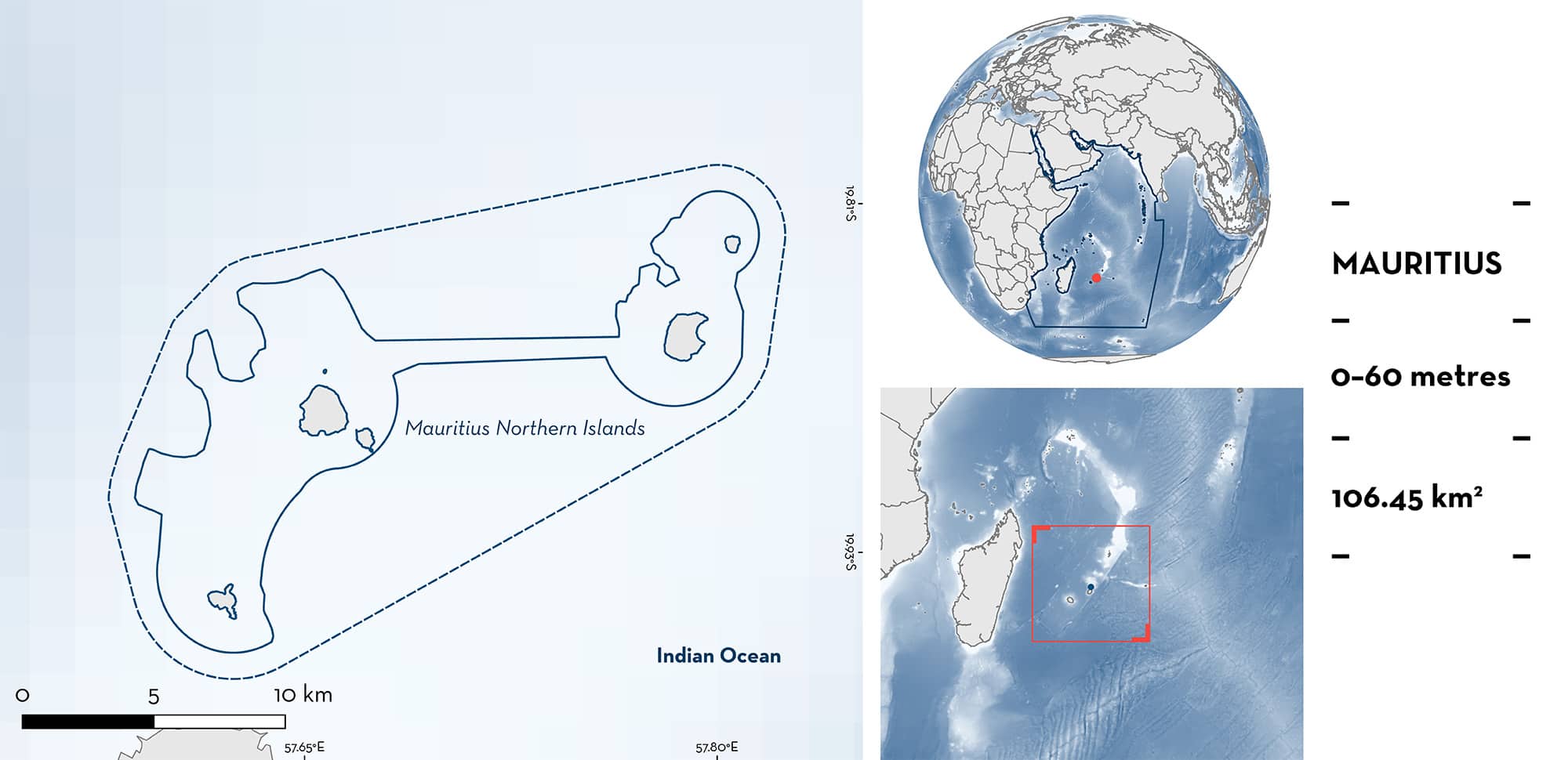
Mauritius Northern Islands is an island complex composed of six islands that lie from 4.5 to 22.5 km north off Mauritius’s main island. This area is under the influence of the monsoon seasons (northwest and southeast) and has renowned pits, famous for the rich oxygen available due to crushing waves against cliffs. It overlaps with three Key Biodiversity Areas. Within this area there are: threatened species (e.g., Grey Reef Shark Carcharhinus amblyrhynchos) and undefined aggregations (e.g., Pink Whipray Pateobatis fai).
Download factsheet
Mauritius Northern Islands
DESCRIPTION OF HABITAT
Mauritius Northern Islands is located in the Republic of Mauritius and is an island complex composed of six islands or islets: Coin de Mire, Flat Island, Gabriel Island, Pigeon Rock, Round Island, and Serpent Island. This region experiences two major seasons namely the southeast monsoon (May to September) characterised by strong persistent southeasterly winds, lower rainfall, and lower temperatures, and the northwest monsoon (December to March) dominated by light northwesterly winds, higher rainfall, and warmer temperatures (Schott & McCreary 2001).
Coin de Mire is the southernmost boundary and lies ~4.5 km north of Cap Malheureux, Mauritius’ main island’s northernmost point. It is an ancient basaltic volcanic cone with areas of bare rock fringing the coast. Flat Island lies 11 km north of Cap Malheureux and is a low-lying island, apart from a bluff. Two small islets, Gabriel Island and Pigeon Rock, lie close to the shore of Flat Island. Fringing coral reefs lie at a maximum of 500 m from land on the eastern side of Flat Island and connect the island with Gabriel Island. Round Island lies ~12 km northeast of Flat Island and Serpent Island lies ~2.5 km northwest of Round Island and is the second largest islet of Mauritius. Shallow waters around the islands and islets have high soft and hard coral cover and diversity, and the slope is then irregular on its descent.
The area overlaps with Flat and Gabriel Islands, Round Island, and Serpent Island Key Biodiversity Areas (KBA 2023a, 2023b and 2023c).
This Important Shark and Ray Area is benthopelagic and is delineated from surface waters (0 m) to 60 m depth based on the bathymetry of the area.
CRITERION A
VULNERABILITY
Two Qualifying Species considered threatened with extinction according to the IUCN Red List of Threatened SpeciesTM regularly occur in the area. These are the Endangered Grey Reef Shark (Simpfendorfer et al. 2020) and the Vulnerable Pink Whipray (Manjaji Matsumoto et al. 2016).
CRITERION C
SUB-CRITERION C5 – UNDEFINED AGGREGATIONS
The area holds undefined aggregations of one shark and one ray species. From February 2019 to May 2023, 25 dives were undertaken in waters of Coin de Mire, 12 dives at Flat Island and/or Gabriel Island, 31 dives at Serpent Island, and five dives at Round Island (Mascarene Archipelago Elasmobranch Observatory [MAEO] unpubl. data 2023; Marine Megafauna Conservation Organisation [MMCO] unpubl. data 2023). All dives lasted a maximum of an hour and were conducted from October to May (i.e., austral summer season).
Aggregations of Grey Reef Sharks were seen once at Coin de Mire (number of individuals = 4), on six occasions at Flat Island/Gabriel Island (number of individuals = 5, 6, 7, 20, 30, 40), 16 times at Serpent Island (average number of individuals = 15.4; min. = 2, max. = 40), and once at Round Island (number of individuals = 20). These aggregations were seen across multiple months and each year of surveys. Pigeon Rock is a recognised dive site called The Shark Pit where sharks can be seen swirling within the pit for the rich oxygen available due to the crushing waves against the cliffs of Pigeon Rock.
Aggregations of Pink Whipray were seen eight times at Coin de Mire (number of individuals = 2, 2, 2, 4, 4, 5, 10, 15; MAEO 2023). These aggregations were seen across multiple months (every month from November to March and in June), from 2021 to 2023 and from 6 to 36 m depth. Individuals were either swimming in mid-water or lying on sandy bottoms, including on pieces of dendritic corals.
Further information is required to understand the nature and function of these aggregations.
Download factsheet
SUBMIT A REQUEST
ISRA SPATIAL LAYER REQUEST
To make a request to download the ISRA Layer in either a GIS compatible Shapefile (.shp) or Google Earth compatible Keyhole Markup Language Zipped file (.kmz) please complete the following form. We will review your request and send the download details to you. We will endeavor to send you the requested files as soon as we can. However, please note that this is not an automated process, and before requests are responded to, they undergo internal review and authorization. As such, requests normally take 5–10 working days to process.
Should you have questions about the data or process, please do not hesitate to contact us.


