ISRA FACTSHEETS
ISRA FACTSHEETS
WESTERN INDIAN OCEAN REGION
Baie Ternay
Summary
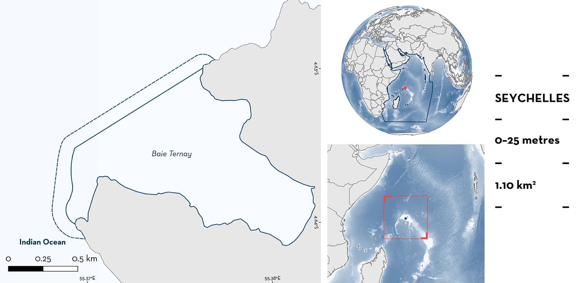
Baie Ternay is located on the northwestern side of Mahé Island, Republic of Seychelles. This area is situated on the wider Mahé plateau, an underwater shelf that comprises the Seychelles Inner Islands. The seabed within this area is composed of seagrass meadows, carbonate and granitic coral reefs, coral rubble fields, and sandy substrates. Baie Ternay overlaps with an Ecologically or Biologically Significant Marine Area, a Key Biodiversity Area, and a marine protected area. Within this area there are: threatened species and undefined aggregations (Spotted Eagle Ray Aetobatus ocellatus).
Download factsheet
Baie Ternay
DESCRIPTION OF HABITAT
Baie Ternay is a shallow bay located on the Mahé plateau, Republic of Seychelles. The prevailing environmental conditions are governed by the monsoon seasons, trade winds, and currents that drive the Seychelles’ oceanography (Novozhilov et al. 1992). From May to September, the winds blow from the southeast. From December to March, they blow from the northwest. The transitional period in April and October/November usually features calm seas and low wind speeds (Novozhilov et al. 1992). Sea surface temperatures are warmer during positive Indian Ocean Dipole and El-Nino events (Burns & Subrahmanyam 2016). During the southeast monsoon, the area is sheltered and features exceptionally calm seas.
The seabed within Baie Ternay is variable and features several habitats including seagrass meadows, carbonate and granitic coral reefs, coral rubble fields, and sandy substrates (Jennings et al. 1996). The coral reef extends from just below the surface (exposed at low tide) to a depth of ~28 m in the centre of the bay. The granitic reef extends below 30 m on the edges of the bay, especially around the northwestern point of the bay and the ‘Lighthouse’ dive site (N Fassbender pers. obs. 2022). The main reef area follows the outline of the bay and is a large U-shape, with a gap in the southeast where a sandy channel extends into the shallow water.
The area overlaps with the Mahé, Alphonse and Amirantes Plateau Ecologically or Biologically Significant Marine Area (EBSA) (CBD 2023), the Cap Ternay / Baie Ternay Marine National Park Key Biodiversity Area (KBA 2023), and the Baie Ternay Marine National Park.
This Important Shark and Ray Area is benthopelagic and is delineated from inshore and surface waters (0 m) to 25 m based on the observations of the Qualifying Species in the area.
CRITERION A
VULNERABILITY
The one Qualifying Species within the area is considered threatened with extinction according to the IUCN Red List of Threatened SpeciesTM. The Spotted Eagle Ray is assessed as Endangered (Finucci et al. Submitted).
CRITERION C
SUB-CRITERION C5 – UNDEFINED AGGREGATIONS
Baie Ternay is an important area for undefined aggregations of one ray species.
Marine megafauna is recorded as part of an ‘incidental sightings’ data collection program by Global Vision International (GVI) Seychelles. GVI conducts monitoring of marine fish, corals, and invertebrates at 24 dive sites around Northwest Mahé, of which five dive sites fall into the Baie Ternay area. An incidental sighting is defined as any encounter with marine megafauna, whereby the diver encountering the animal records the species, number of individuals, estimated size, depth, and time. Incidental sightings are recorded during monitoring dives, training or recreational dives conducted by GVI Seychelles. The monitoring dives alone consist of at least 34 dives per site per year.
Observation records between 2007–2022 from these sites show regular and predictable observations of Spotted Eagle Ray in the area, year-round, with a total of 1,093 individuals observed (Global Vision International – Seychelles unpubl. data 2023). Aggregations of four animals or more were recorded on 247 occasions with a mean group size of 10 individuals (maximum = 45). These individuals had an estimated mean size of 55 cm disc width (DW) (range: 20–150 cm DW). The mean depth of these observations was 8.4 m (range: 5 – 12 m). Further information is required to determine the function of these aggregations.
Download factsheet
SUBMIT A REQUEST
ISRA SPATIAL LAYER REQUEST
To make a request to download the ISRA Layer in either a GIS compatible Shapefile (.shp) or Google Earth compatible Keyhole Markup Language Zipped file (.kmz) please complete the following form. We will review your request and send the download details to you. We will endeavor to send you the requested files as soon as we can. However, please note that this is not an automated process, and before requests are responded to, they undergo internal review and authorization. As such, requests normally take 5–10 working days to process.
Should you have questions about the data or process, please do not hesitate to contact us.


