ISRA FACTSHEETS
ISRA FACTSHEETS
WESTERN INDIAN OCEAN REGION
Southwest Indian Ocean Ridge
Summary
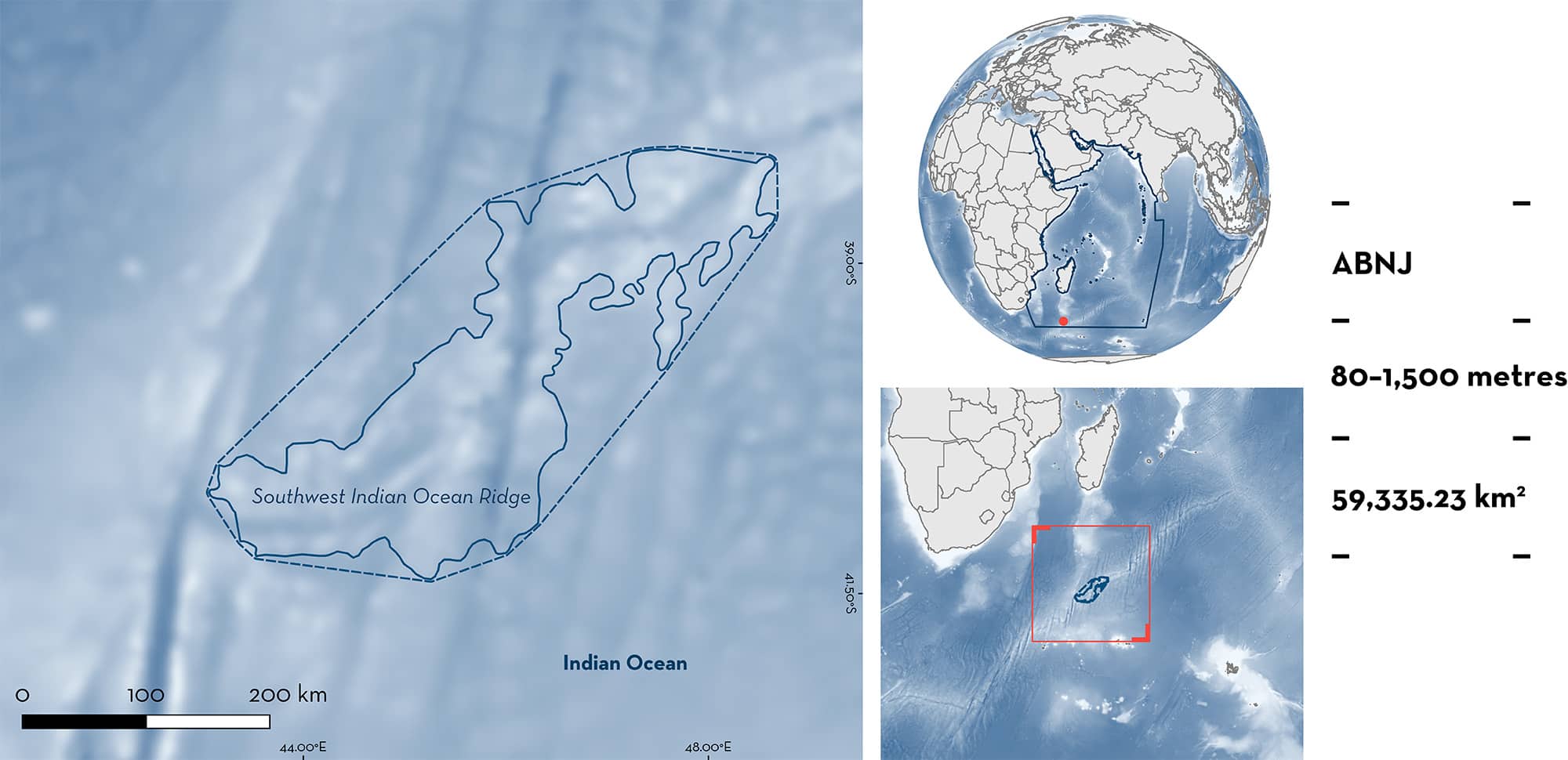
Southwest Indian Ocean Ridge is a deepwater, open ocean area in the southwestern Indian Ocean ~1,500 km south of Madagascar, in areas beyond national jurisdiction (ABNJ). The area is characterised by a large ridge that spans from the southwest to the northeast. Southwest Indian Ocean Ridge overlaps with the Agulhas Front Ecologically or Biologically Significant Marine Area. Within the area there are range-restricted species (Seafarer’s Ghostshark Chimaera willwatchi) and reproductive areas (Southern Lanternshark Etmopterus granulosus).
Download factsheet
Southwest Indian Ocean Ridge
DESCRIPTION OF HABITAT
Southwest Indian Ocean Ridge lies on a long deepwater ridge ~1,500 km south of Madagascar in the southwestern Indian Ocean. The large ridge system is a mid-ocean ridge at the divergent tectonic boundary of the Somali Plate and the Antarctic Plate (Goslin et al. 1980). In the area, the continuous ridge runs from southwest to northeast. The depth of the area ranges from 145–5,800 m with a mean of 2,740 m. The geological features of the area mainly include ridges and spreading ridges, with several seamounts rising higher into the water column.
The area partly overlaps within the Agulhas Front Ecologically or Biologically Significant Marine Area (EBSA; CBD 2023). Parts of the Southwest Indian Ocean Ridge have been designated as Benthic Protected Areas (BPAs; Rogers et al. 2017).
This Important Shark and Ray Area is benthic and extends from 89–1,500 m, based on the bathymetry of the area and the global depth ranges of the Qualifying Species.
CRITERION B
RANGE RESTRICTED
The area holds the regular presence of the Seafarer’s Ghostshark as a resident range-restricted species. This species was recently described from the area and is only known from a small region, with additional specimens collected from Walters Shoals and the northern part of the Madagascar Ridge (Clerkin et al. 2017). The species was frequently caught as bycatch in benthic and mid-water trawls and was collected in 2000, 2001, 2012, and 2014 in the area (Clerkin et al. 2017).
CRITERION C
SUB-CRITERION C1 – REPRODUCTIVE AREAS
Southwest Indian Ocean Ridge is an important reproductive area for one shark species.
Pregnant female Southern Lanternshark have been recorded from locations at depths between 500 and 1,300 m (Clerkin 2017, Nehmans 2019). Some pregnant specimens were also found elsewhere on the Southwest Indian Ocean Ridge, but of 78 individuals examined, most (75%) were concentrated in the area. Southern Lanternsharks comprise most of the deepwater shark bycatch in the broader southwestern Indian Ocean region, but this area was the clear hotspot for pregnant females. Elsewhere globally the species is also frequently caught but pregnant females are rarely observed (e.g., New Zealand; Wetherbee 1996; B Finucci pers. obs. 2023), underlining the importance of this area. The relative abundance of Southern Lanternsharks observed as bycatch in trawl fisheries on the Southwest Indian Ocean Ridge in 2012 and 2014 (n = 112 tows) was 3.96 sharks per tow, with tows of ~60 min (Clerkin 2017).
Download factsheet
SUBMIT A REQUEST
ISRA SPATIAL LAYER REQUEST
To make a request to download the ISRA Layer in either a GIS compatible Shapefile (.shp) or Google Earth compatible Keyhole Markup Language Zipped file (.kmz) please complete the following form. We will review your request and send the download details to you. We will endeavor to send you the requested files as soon as we can. However, please note that this is not an automated process, and before requests are responded to, they undergo internal review and authorization. As such, requests normally take 5–10 working days to process.
Should you have questions about the data or process, please do not hesitate to contact us.


