ISRA FACTSHEETS
ISRA FACTSHEETS
WESTERN INDIAN OCEAN REGION
Maamunagau & Fenfushi
Summary
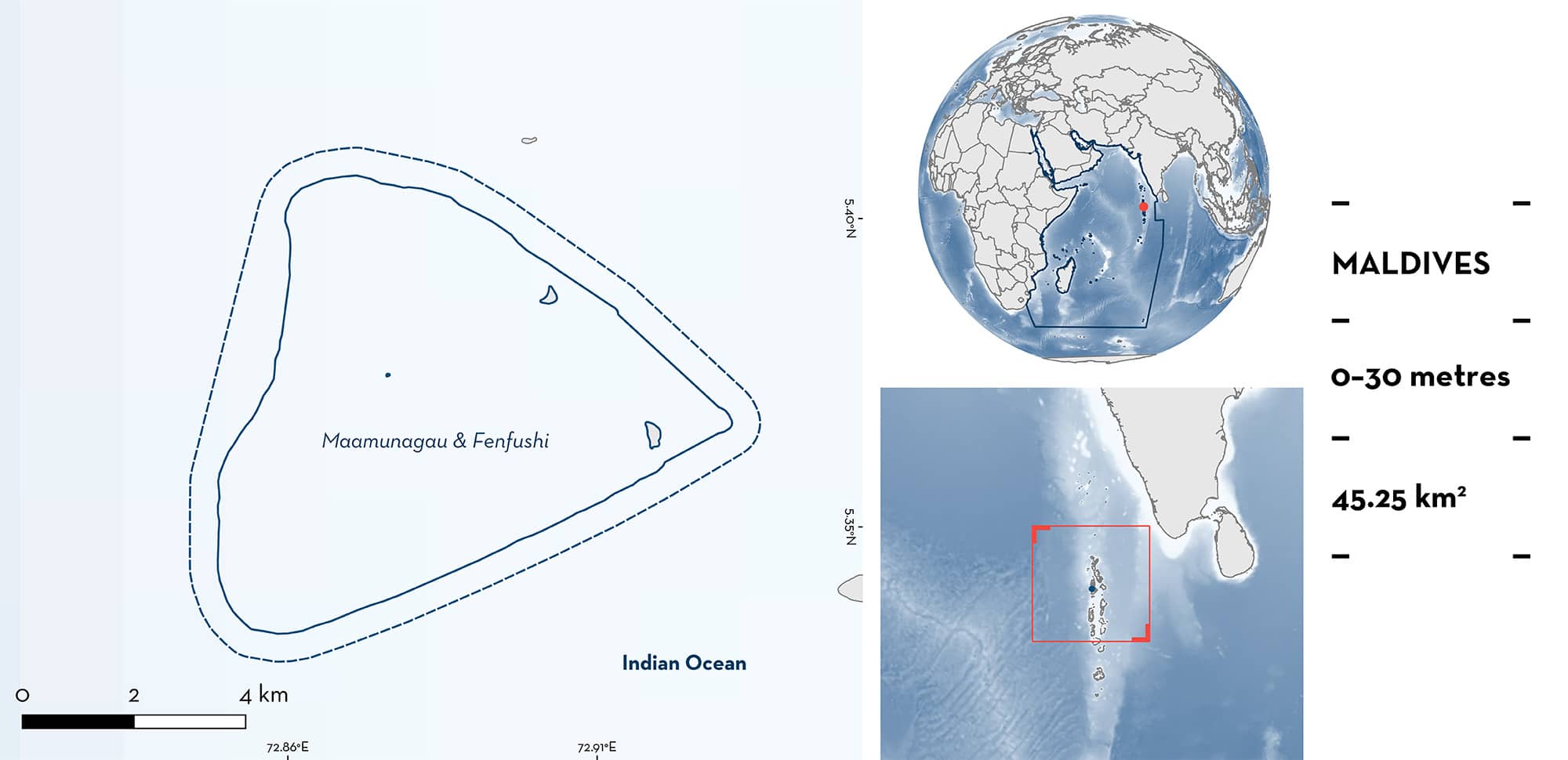
Maamunagau & Fenfushi is located in southwestern Raa Atoll in the Maldives. This area encompasses two enclosed reef areas with internal lagoons extending from a single island. These two lagoons (Maamunagau and Fenfushi) are separated by a channel. The large, sheltered lagoons trap and concentrate zooplankton and are characterised by sandy substrates and randomly located coral bommies. This area overlaps with Villingilee Thila, a Marine Protected Area. Within this area there are: threatened species, reproductive areas and feeding areas (Reef Manta Ray Mobula alfredi).
Download factsheet
Maamunagau & Fenfushi
DESCRIPTION OF HABITAT
Maamunagau & Fenfushi is located in southwestern Raa Atoll in the northern Maldives. This area encompasses two enclosed reef areas with internal lagoons (called Maamunagau and Fenfushi) extending from a single island. Maamunagau is located south of Fenfushi.
Maamunagau & Fenfushi is influenced by the South Asian Monsoon (Gischler et al. 2014), which drives currents and deep water upwellings, bringing nutrient rich water into the euphotic zone on the leeward side of the atoll. This process enables photosynthetic phytoplankton to flourish, generating a bloom of predatory zooplankton that feed on the phytoplankton. The large, sheltered lagoons of Maamunagau & Fenfushi trap and concentrate the zooplankton, as the strong lunar currents flow through the channels (J Haines unpubl. data 2023). Productivity in the region peaks during the northeast monsoon (December to April) (J Haines pers. obs. 2019–2022).
The Maamunagau lagoon and enclosing reef extends ~7.5 km west from the island. The lagoonal area is comprised of sandy substrate, and randomly located coral bommies, reaching depths of ~20 m. Surrounding the entire lagoon lies a fringing reef, reaching maximum depths of ~5 m on top of the reef, and sloping to depths of ~30 m on the outside.
The Fenfushi lagoon and enclosing reef extends ~4.5 km west from the island. The lagoonal area is comprised of sandy substrate, and randomly located coral bommies, reaching depths of ~10 m. Surrounding the entire lagoon lies a fringing reef, reaching maximum depths of ~3 m on top of the reef, and sloping to depths of ~50 m on the outside.
Lying between Maamunagau and Fenfushi reefs is an open channel that reaches depths of ~60 m. Located within this channel, Villingilee Thila (also known as Fenfushi Giri) is a round shallow reef pinnacle reaching depths of ~30 m on the outer rim and depths of ~5 m on top.
The only existing Marine Protected Area of Raa Atoll, Villingilee Thila, falls within this area.
This Important Shark and Ray Area is benthopelagic and is delineated from the inshore and surface waters (0 m) to 30 m based on the bathymetry of the area.
CRITERION A
VULNERABILITY
The one Qualifying Species within the area is considered threatened with extinction according to the IUCN Red List of Threatened SpeciesTM. The Reef Manta Ray is assessed as Vulnerable (Marshall et al. 2022).
CRITERION C
SUB-CRITERION C1 – REPRODUCTIVE AREAS
Maamunagau & Fenfushi is an important reproductive area for one ray species.
Data from 2,349 field surveys conducted between the years 2019–2023 revealed that 7% (n = 32) of identified Reef Manta Rays (n = 464) are young-of-the-year (YOY), based on sizes of 150–180 cm disc width (DW) (Stevens 2016; N Froman unpubl. data 2023). Size-at-birth for this species is 130–150 cm DW (Last et al. 2016). The YOY sightings occur regularly, between December and April, and the individuals remain in the area for repeated years following their birthing year. This location is the main YOY aggregation location in Raa Atoll (75% of the YOY sighting in Raa atoll are reported in this area) (J Haines unpubl. data 2023). Large lagoons are known to offer a sheltered environment, protection from predatory risk, and an abundance of food (Setyawan et al. 2022).
CRITERION C
SUB-CRITERION C2 – FEEDING AREAS
Maamunagau & Fenfushi is an important feeding area for one ray species.
This area holds regular and predictable aggregations of feeding Reef Manta Rays. Based on 1,865 underwater visual census (UVC) surveys conducted by snorkellers between 2019–2023, a total of 3,393 sightings of 429 individuals have been observed using four feeding strategies (straight, surface, chain, and piggyback) (Stevens 2016; J Haines unpubl. data 2019–2022). In all observations, the Reef Manta Rays swam with their cephalic fins unfurled and mouths agape as the zooplankton was funnelled and strained through their gill plates (Stevens 2016). The largest aggregation of feeding Reef Manta Rays comprised 45 individuals, although aggregations of 10–15 individuals are more regular. These feeding aggregations are observed predictably during December to April, as the productivity of the area is strongly influenced by the northeast monsoon (Gischler et al. 2014).
Download factsheet
SUBMIT A REQUEST
ISRA SPATIAL LAYER REQUEST
To make a request to download the ISRA Layer in either a GIS compatible Shapefile (.shp) or Google Earth compatible Keyhole Markup Language Zipped file (.kmz) please complete the following form. We will review your request and send the download details to you. We will endeavor to send you the requested files as soon as we can. However, please note that this is not an automated process, and before requests are responded to, they undergo internal review and authorization. As such, requests normally take 5–10 working days to process.
Should you have questions about the data or process, please do not hesitate to contact us.


