ISRA FACTSHEETS
ISRA FACTSHEETS
ASIA REGION
Botubarani
Summary
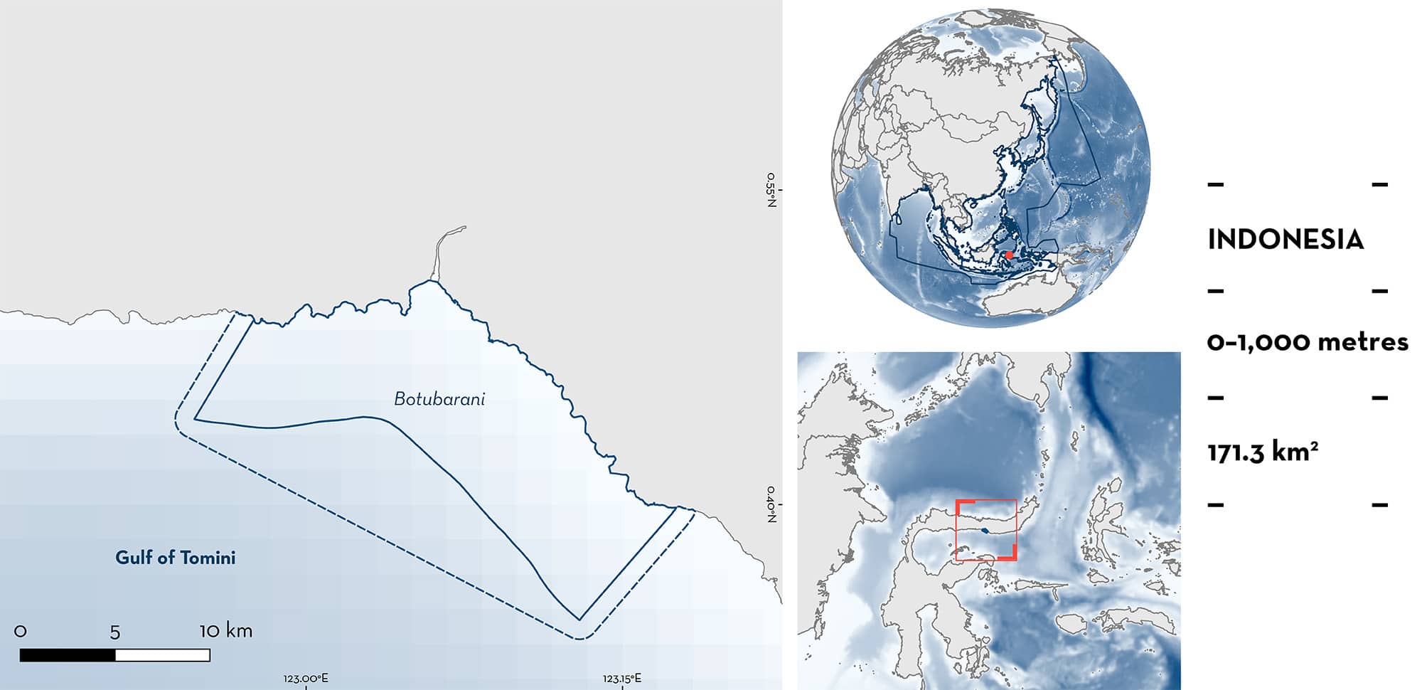
Botubarani is located in the waters from the Gulf of Tomini in Sulawesi, Indonesia. The area is highly influenced by discharge from the Bone Bolango River that, along with eastern monsoon winds, produce high productivity. The area overlaps with the Desa Olele (Bone Bolango) marine protected area. Within the area there are: threatened species and feeding areas (Whale Shark Rhincodon typus).
Download factsheet
Botubarani
DESCRIPTION OF HABITAT
Botubarani is located in the Gorontalo Province of Sulawesi in Indonesia. It sits in the Gulf of Tomini and is a semi-enclosed area that is highly influenced by discharge from the Bone Bolango River (Kadim et al. 2019; Sahamani et al. 2020). The area includes an estuary and a wide continental shelf with coral reefs that steeply drops to depths >500 m.
East monsoon winds and river discharge produces high productivity from May to September which is also the season with higher abundances of nike fishes (Awaous sp.) that move between freshwater and marine habitats (Pasisingi & Abdullah 2018; Kadim et al. 2019).
The area overlaps with the Desa Olele (Bone Bolango) marine protected area (UNEP-WCMC 2024).
This Important Shark and Ray Area is benthopelagic and is delineated from inshore and surface waters (0 m) to 1,000 m based on the bathymetry of the area.
CRITERION A
VULNERABILITY
The one Qualifying Species within the area is considered threatened with extinction according to the IUCN Red List of Threatened Species. The Whale Shark is assessed as Endangered (Pierce & Norman 2016).
CRITERION C
SUB-CRITERION C2 – FEEDING AREAS
Botubarani is an important feeding area for one shark species.
Aggregations of Whale Sharks have been reported regularly in the area since 2016 (Handoko et al. 2017a, 2017b, 2019; Rosalina et al. 2021; Rombe et al. 2022). The occurrence of these aggregations has been linked to tourist activities providing shrimp heads to attract the sharks and due to the presence of a shrimp processing factory disposing waste into the sea (Handoko et al. 2017a). However, local ecological knowledge from fishers revealed that aggregations have occurred in the area for at least the past 70 years (Handoko et al. 2017a; Monitoring Team Botubarani unpubl. data 2024). Aggregations are composed of juveniles and sub-adults between 300–800 cm total length (TL; mean = 500 cm). To date, 59 individuals have been identified with a maximum of 20 individuals reported in a single day (Rombe et al. 2022; Monitoring Team Botubarani unpubl. data 2023). Whale Sharks occur year-round in Botubarani with a peak in presence from May to August which coincides with the occurrence of the largest biomass of nike fish in the area (Pasisingi & Abdullah 2018), on which Whale Sharks commonly feed (Rombe et al. 2022; Monitoring Team Botubarani, unpubl. data 2024). Nike is a local name for a group of small fishes in their post-larval and juvenile stages (Sahami et al. 2020). These fishes move from marine to estuarine and freshwater habitats and are present in the area from 3–9 days each month during the main fishing season (June to August), usually in the last quarter moon phase towards the new moon (Pasisingi & Abdullah 2018; Pasisingi et al. 2020; Sahami et al. 2020).
Download factsheet
SUBMIT A REQUEST
ISRA SPATIAL LAYER REQUEST
To make a request to download the ISRA Layer in either a GIS compatible Shapefile (.shp) or Google Earth compatible Keyhole Markup Language Zipped file (.kmz) please complete the following form. We will review your request and send the download details to you. We will endeavor to send you the requested files as soon as we can. However, please note that this is not an automated process, and before requests are responded to, they undergo internal review and authorization. As such, requests normally take 5–10 working days to process.
Should you have questions about the data or process, please do not hesitate to contact us.


