ISRA FACTSHEETS
ISRA FACTSHEETS
ASIA REGION
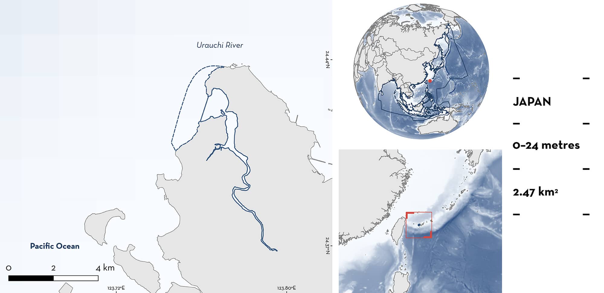
Urauchi River
Summary
Urauchi River is located on Iriomote Island within the Okinawa prefecture of Japan. The area is an ecologically significant fluvial system, characterised by mangrove forests and estuarine waters at the lower reaches of the river, and transitioning to a dense subtropical forest upstream. The area overlaps with the Iriomote-Ishigaki National Park. Within this area there are: threatened species and reproductive areas (Bull Shark Carcharhinus leucas).
Download factsheet
Urauchi River
DESCRIPTION OF HABITAT
Urauchi River is located on Iriomote Island within the Yaeyama district, Okinawa prefecture, Japan. The area is a prominent and ecologically significant fluvial system characterised by its length of 19 km, making it the largest river in the Okinawa prefecture. The river’s lower reaches are marked by extensive mangrove forests at its estuary, dominated by Red Mangrove Rhizophora stylosa and patches of Black Mangrove Bruguiera gymnorrhiza (Nanjo et al. 2011), which transition into dense, subtropical forests upstream, indicative of a diverse array of terrestrial and aquatic habitats.
The area is characterised by various static and dynamic habitat features. The mangrove ecosystems at the estuary play a significant role in the complex estuarine food web (Nanjo et al. 2014). The Urauchi River displays varied salinity gradients, with levels fluctuating throughout the day at the river mouth and progressively decreasing further upstream (Sakurai 2017).
Urauchi River is part of the Iriomote-Ishigaki National Park (Protected Planet 2024) and Yaeyama Island Key Biodiversity Area (KBA 2024).
This Important Shark and Ray Area is benthopelagic and is delineated from inshore and surface waters (0 m) to a depth of 24 m based on the bathymetry of the area.
CRITERION A
VULNERABILITY
The one Qualifying Species within the area is considered threatened with extinction according to the IUCN Red List of Threatened Species. The Bull Shark is assessed as Vulnerable (Rigby et al. 2021).
CRITERION C
SUB-CRITERION C1 – REPRODUCTIVE AREAS
Urauchi River is an important reproductive area for one shark species.
Data from multiple scientific studies were collected in the area between 2014 and 2019 with additional historical records dating back to 1979 that confirm the presence of neonate and young-of-the-year (YOY) Bull Sharks in the area on a regular and predictable basis. Bull Sharks travel upstream in Urauchi River and from May to June it is common for the public and tourists to report neonates in the river (Devloo-Delva et al. 2023; R Matsumoto pers. obs. 2024). Urauchi River harbours most of the Bull Shark records in freshwater on Iriomote Island and has been recognised as the most pristine and undisturbed reproductive habitat for Bull Sharks in Japan (Devloo-Delva et al. 2023).
Between 2014–2019, the upstream presence was confirmed with the capture of 69 neonates, 24 YOY, and 12 juveniles in the boreal spring and summer (March–September) during gillnet surveys (Sakurai 2017; Ziadi-Künzli 2017; Hoydo 2019) and during winter and fall using environmental DNA (Hoydo 2019). Life-cycle stage was established based on size-at-birth and on the examination of growth rings in vertebrae, with neonates measuring 69.5–79 cm total length (TL) and YOY <96.8 cm TL. Sharks >1 year old were 95.2–110.2 cm TL (Ziadi-Künzli 2017). Neonate and YOY sharks were also characterised by visible umbilical scars (Ziadi-Künzli 2017; Hoydo 2019). The pupping season likely spans from March to August (possibly February–September) (Sakurai 2017).
Historical information is available to confirm the longstanding importance of the area for Bull Shark reproduction. Records of neonates and YOY from opportunistic captures in fisheries since 1979 include: September 1979 (male; 75.7 cm TL); August 1993 (female; 74.9 cm TL); and 2003 (female; 86 cm TL) (Matsumoto et al. 2006). Additionally, Bull Shark were reportedly captured by anglers in the river between 2000–2002 (Tachihara et al. 2003).
Download factsheet
SUBMIT A REQUEST
ISRA SPATIAL LAYER REQUEST
To make a request to download the ISRA Layer in either a GIS compatible Shapefile (.shp) or Google Earth compatible Keyhole Markup Language Zipped file (.kmz) please complete the following form. We will review your request and send the download details to you. We will endeavor to send you the requested files as soon as we can. However, please note that this is not an automated process, and before requests are responded to, they undergo internal review and authorization. As such, requests normally take 5–10 working days to process.
Should you have questions about the data or process, please do not hesitate to contact us.


