ISRA FACTSHEETS
ISRA FACTSHEETS
ASIA REGION
Naha and Mukue River
Summary
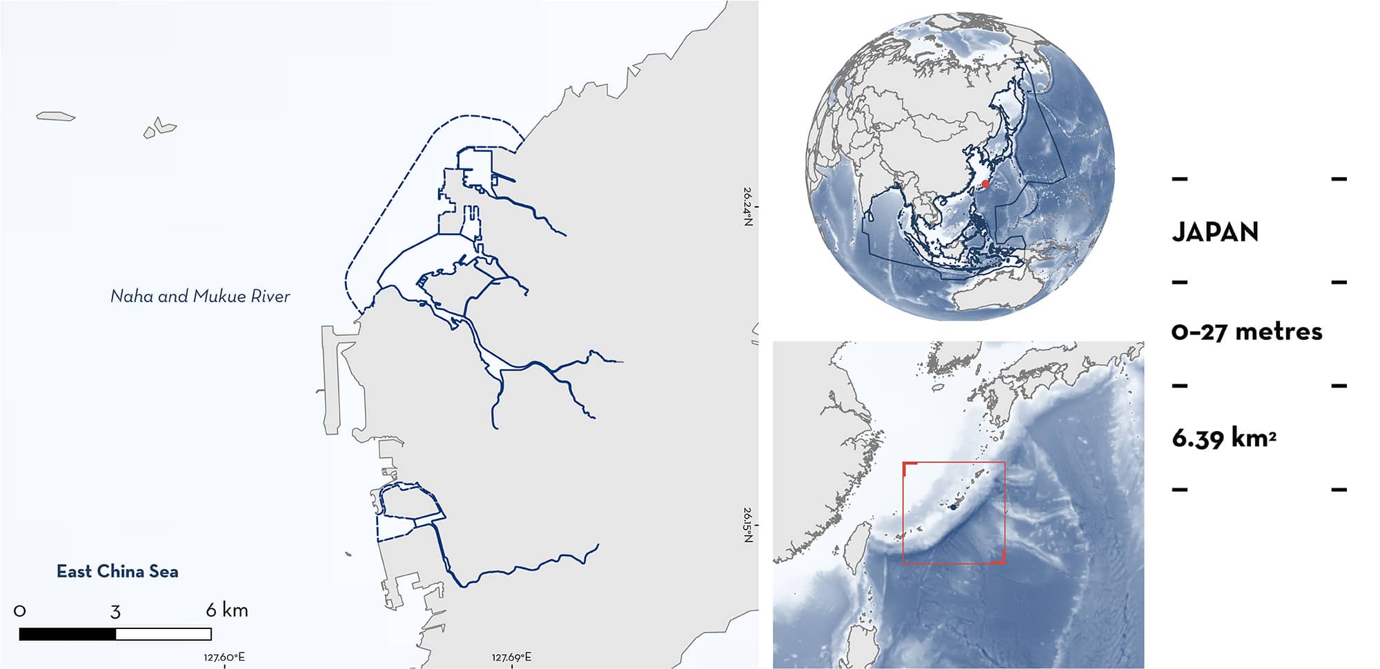
Naha and Mukue River is located in the Naha region of Okinawa Island, Japan. This area includes coastal waters and river systems. This area is characterised by habitats that encompass a variety of small but important ecological niches, from the brackish waters of river estuaries to the coastal mangroves and exposed mudflats during low tide. Within the area, the estuary Manko is part of a National Wildlife Sanctuary and is designated as a Ramsar Site and Key Biodiversity Area. Within this area there are: threatened species and reproductive areas (Bull Shark Carcharhinus leucas).
Download factsheet
Naha and Mukue River
DESCRIPTION OF HABITAT
Naha and Mukue River is located in the region of Naha on Okinawa Island, within the Okinawa prefecture of Japan. Naha and Mukue River is characterised by river systems influenced by tidal fluctuations, ensuring water presence year-round, encompassing the lower reaches of the Kokuba, Asato, and Aja Rivers. However, the upper sections of these rivers and channels may experience dry conditions during periods of low rainfall. The area encompasses the estuary Manko, a tidal flat formed at the confluence of the Kokuba River that flows through Naha City and the Noha River that flows through Tomigusuku City in the southwest of Okinawa Island and represents a unique ecological convergence where terrestrial, riverine, and marine environments intersect. This includes water bodies, mudflats, mangrove forests, and reed beds, all closely juxtaposed in a relatively compact area. The transitional zones, where these distinct environments interface, are characterised by gradual changes in ground elevation, soil properties, and salinity levels, contributing to estuary Manko’s ecological richness (Ramsar 2016). This mudflat is exposed during low tides, but the main water body and channels of the Kokuba River system retain flow even during low tides. The species composition gradually shifts from freshwater to marine as one moves downstream (Ramsar 2016).
The Mukue River is located south of Naha in Itoman city. Although the main river channel has been artificially modified, being both lowered and lined with concrete, it still preserves muddy substrates accompanied by vegetation. This combination of artificial and natural elements in the river’s structure contributes to some degree to its ecological functionality, maintaining a habitat supporting various brackish fish species.
Naha and Mukue River overlaps with the Manko Ramsar Site (Wetland of International Importance; Ramsar 2016), the Manko Tidal Flat Key Biodiversity Area (KBA 2024), and the Lake Manko National Wildlife Protection Area (UNEP-WCMC & IUCN 2024).
This Important Shark and Ray Area is benthopelagic and is delineated from inshore and surface waters (0 m) to 27 m based on the bathymetry of the area.
CRITERION A
VULNERABILITY
One Qualifying Species within the area is considered threatened with extinction according to the IUCN Red List of Threatened Species. The Bull Shark is assessed as Vulnerable (Rigby et al. 2021).
CRITERION C
SUB-CRITERION C1 – REPRODUCTIVE AREAS
Naha and Mukue River is an important reproductive area for one shark species.
Bull Shark neonates and young-of-the-year (YOY) seasonally enter the river and streams in this area. Based on citizen science reports, including regular sightings and documented captures (n = 15) between 1997–2023 (Matsumoto et al. 2006; F Ziadi-Künzli pers. obs. 2023; R Matsumoto pers. obs. 2024), small-sized Bull Sharks enter the river systems of western Okinawa regularly and predictably between the months of May and October each year (R Matsumoto pers. obs. 2024). Small-bodied animals (68–90 cm total length [TL]) are commonly caught by recreational anglers (Anglers 2024; F Ziadi-Künzli pers. obs. 2023), and reports of sightings are common in media outlets (R Matsumoto per. obs. 2024). Based on sizes <100 cm TL of animal sightings and captures (size-at-birth for the species is 56–81 cm TL with an average growth rate of 15–20 cm per year for the first five years; Ebert et al. 2021), most of the encounters correspond to neonates and YOY.
This area concentrates most of the neonate and YOY sightings around Okinawa Island. This could be related to the fact that it is urban with increased opportunities for human sightings, because the embarkment constructions have deepened the riverbeds allowing sharks to use the river more frequently without being affected by tidal fluctuations, or the abundance of invasive prey species like tilapia (R Matsumoto pers. obs. 2024). The habitat for Bull Shark reportedly extends into other river systems in the Naha region. Additional contemporary information is required to understand the regular and predictable use of these other areas.
Download factsheet
SUBMIT A REQUEST
ISRA SPATIAL LAYER REQUEST
To make a request to download the ISRA Layer in either a GIS compatible Shapefile (.shp) or Google Earth compatible Keyhole Markup Language Zipped file (.kmz) please complete the following form. We will review your request and send the download details to you. We will endeavor to send you the requested files as soon as we can. However, please note that this is not an automated process, and before requests are responded to, they undergo internal review and authorization. As such, requests normally take 5–10 working days to process.
Should you have questions about the data or process, please do not hesitate to contact us.


