ISRA FACTSHEETS
ISRA FACTSHEETS
ASIA REGION
Koh Tao
Summary
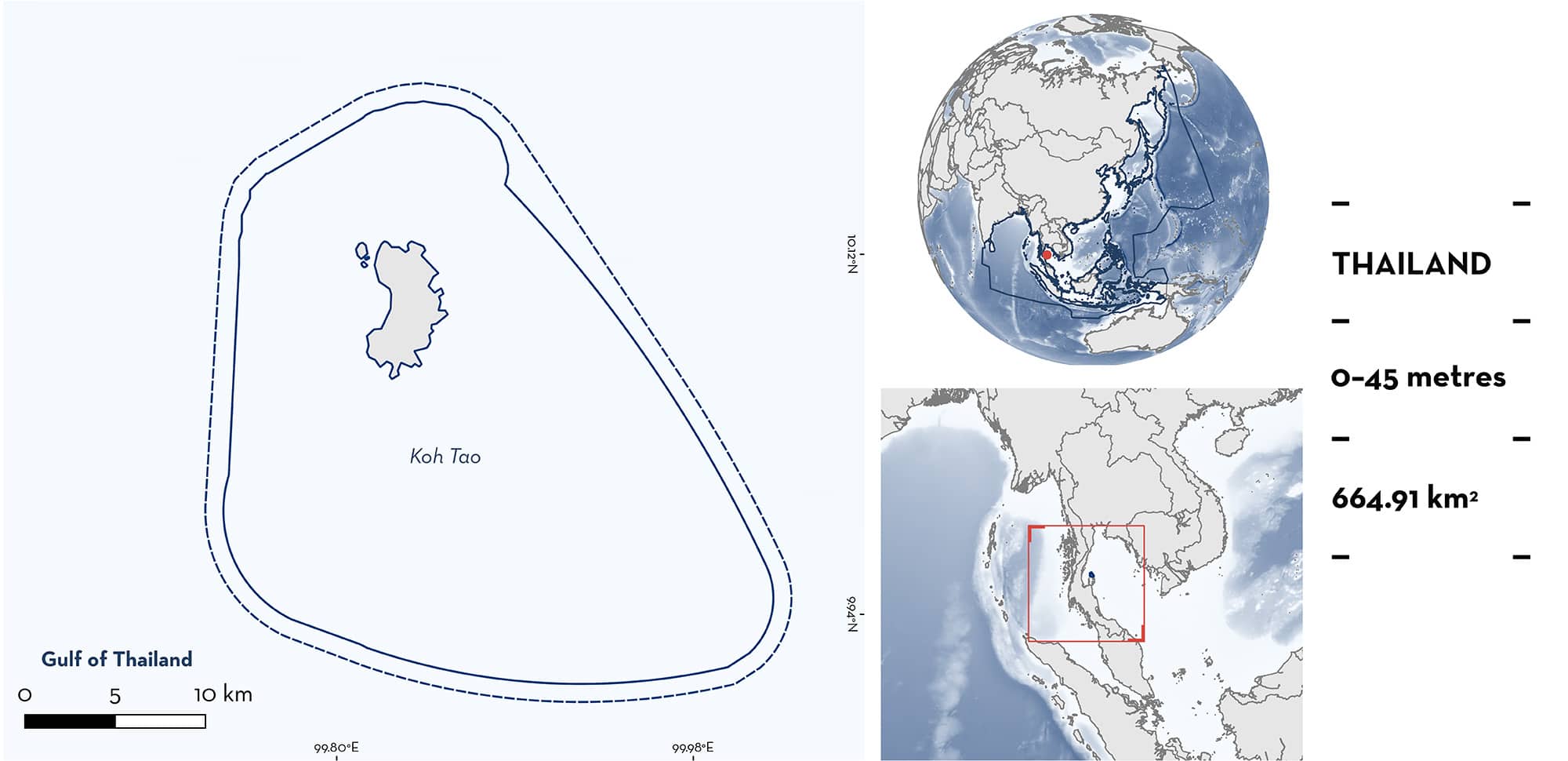
Koh Tao is located in the Chumphon Archipelago of Thailand. Koh Tao Island itself is situated ~100 km offshore of mainland Thailand and is characterised by shallow corals reefs and rocky outcrops as well as a number of offshore pinnacles. The area overlaps with the Suratthani Environmental Protected Area. Within this area there are: threatened species (e.g., Blacktip Reef Shark Carcharhinus melanopterus); reproductive areas (Blacktip Reef Shark); and undefined aggregations (Whale Shark Rhincodon typus).
Download factsheet
Koh Tao
DESCRIPTION OF HABITAT
Koh Tao is located in the Gulf of Thailand, within the Thai exclusive economic zone. The area is part of the Chumphon Archipelago and the island of Koh Tao is situated ~100 km off the mainland of Thailand. The area consists of shallow coral reefs and small offshore pinnacles (Magson et al. 2022).
The area experiences minimal currents but there are strong upwellings during monsoonal transition periods around April–May and October–November, bringing with them increases in plankton levels (Buranapratheprat et al. 2008).
Koh Tao overlaps with the Suratthani Environmental Protected Area.
This Important Shark and Ray Area is benthopelagic and is delineated from inshore and surface waters (0 m) to 45 m based on the bathymetry of the area.
CRITERION A
VULNERABILITY
Two Qualifying Species considered threatened with extinction according to the IUCN Red List of Threatened Species regularly occur in the area. These are the Endangered Whale Shark (Pierce & Norman 2016) and the Vulnerable Blacktip Reef Shark (Simpfendorfer et al. 2020).
CRITERION C
SUB-CRITERION C1 – REPRODUCTIVE AREAS
Koh Tao is an important reproductive area for one shark species.
Neonate Blacktip Reef Sharks (estimated size, 30–60 cm total length [TL]) have been recorded in the area year-round during snorkel surveys since 2013 (K Magson unpubl. data 2024; Thai Sharks and Rays [TSAR] unpubl. data 2024). However, reports from local divers suggest the presence of neonates long before 2006 (TK Waipaka pers. comm. 2024). Size-at-birth for this species is 30–52 cm TL (Ebert et al. 2021). There is an anecdotal report of mating Blacktip Reef Sharks in Shark Bay in the area from June 2022 (TSAR unpubl. data 2024).
Dedicated surveys conducted between February 2012 and 2014 revealed high numbers of female Blacktip Reef Sharks at Shark Bay in Koh Tao seasonally (~13 individuals/minute with ~10 m horizontal visibility; S Arunrugstichai unpubl. data 2024). Of these sightings, ~75% of the individuals showed signs of late-term pregnancy with bulging abdomens. Snorkel surveys were conducted 2–3 times a week, as conditions permitted. Pregnant sharks were repeatedly observed using the shallow area of Shark Bay (<4 m depth) until late March–early April, after which neonates (~45 cm TL) were observed using shallower waters of the area (<1 m depth), with few pregnant females observed. After this period, sightings of adult sharks in the bay gradually returned to background levels (~3 individuals/minute), while the neonates were observed forming schools and gradually migrated to other nearby bays for foraging. Similar observations have been made in 2015 and 2019 (K Magson unpubl. data 2024).
CRITERION C
SUB-CRITERION C5 – UNDEFINED AGGREGATIONS
Koh Tao is an important area for undefined aggregations of one shark species.
Between 1991–2023, a total of 1,409 observations of Whale Sharks were recorded from Chumpon Pinnacle, Koh Tao, and Sail Rock within the area, representing 48% of all Whale Shark sightings throughout Thailand during this period (n = 2,911; Marine Megafauna Foundation [MMF] unpubl. data 2024; Department of Marine and Coastal Resources [DMCR] unpubl. data 2024). Between 2013–2021, 21 out of 126 observations (17%) recorded more than one Whale Shark, with a maximum of three individuals at a time (MCRRDI 2021). Between 2004–2019, a total of 178 individual Whale Sharks were identified using photo-identification (from 249 sightings) within Koh Tao (Magson et al. 2022). Most of these records (89%) were between 2015–2019 due to an increase in sighting reports facilitated by social media and direct marketing. Aggregations have further been observed at Sail Rock (August 2021), Shark Island (February 2017; December 2022), and Chumphon Pinnacle (2023; K Magson pers. obs. 2024) within the area. Sightings were recorded year-round, however there were seasonal peaks between April–May and October–November, corresponding to the monsoon-transition periods which result in stronger upwellings in the area. Upwellings can result in productivity and may explain why Whale Sharks are found in this area.
Whilst the reason for the aggregation is unknown, feeding behaviour has been observed on several occasions, although most individuals have never been resighted. Further information is required on the nature and function of the aggregations.
Download factsheet
SUBMIT A REQUEST
ISRA SPATIAL LAYER REQUEST
To make a request to download the ISRA Layer in either a GIS compatible Shapefile (.shp) or Google Earth compatible Keyhole Markup Language Zipped file (.kmz) please complete the following form. We will review your request and send the download details to you. We will endeavor to send you the requested files as soon as we can. However, please note that this is not an automated process, and before requests are responded to, they undergo internal review and authorization. As such, requests normally take 5–10 working days to process.
Should you have questions about the data or process, please do not hesitate to contact us.


