ISRA FACTSHEETS
ISRA FACTSHEETS
POLAR WATERS REGION
Skagerrak
Summary
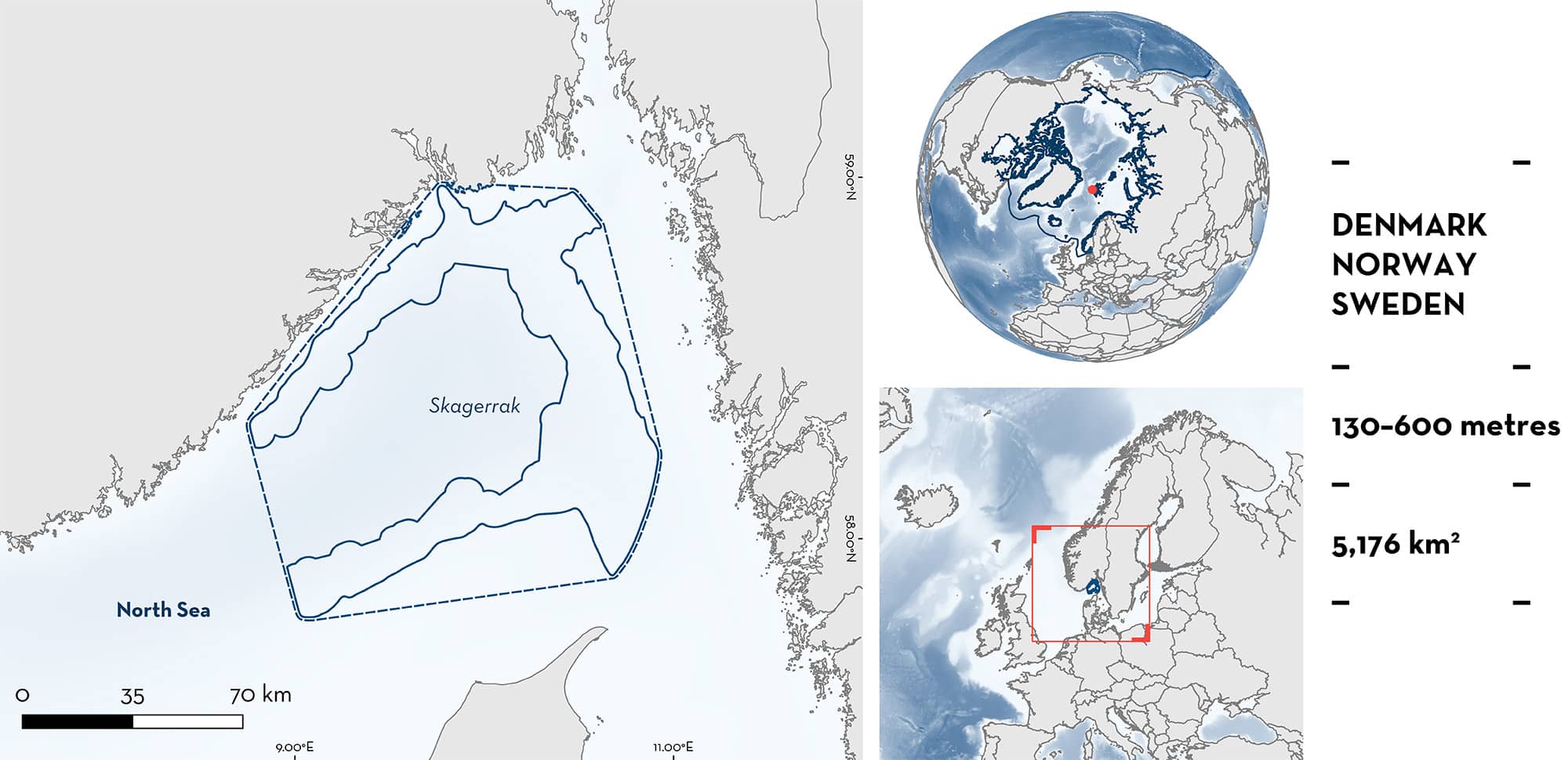
Skagerrak is located south of Norway, and overlaps with the Danish, Norwegian, and Swedish exclusive economic zones. The area is within the Norwegian Trench, an elongated depression influenced by three distinct water masses. It is influenced by large-scale eddies and upwelling driven by multiple water currents. This area overlaps with the Skagerrak-Southwest Norwegian Trench Key Biodiversity Area. Within this area there are: threatened species and reproductive areas (Rabbitfish Chimaera monstrosa).
Download factsheet
Skagerrak
DESCRIPTION OF HABITAT
Skagerrak is located south of Norway, and overlaps with the Danish, Norwegian, and Swedish exclusive economic zones. It lies in the strait that separates the North Sea and the Kattegat Sea, encompassing the region between the Jutland peninsula of Denmark, the east coast of Norway, and the west coast of Sweden. This area is located within the Norwegian trench, an elongated depression which reaches depths of ~700 m, atypical of the average ~100 m depth of the North Sea (Furnes et al. 1986; Rodhe 1989).
There are three distinct water masses in the Norwegian Trench: coastal water (0–300 m), Atlantic water (off shelf, 0–400 m; below coastal water, 300–400 m), and Norwegian deepsea water (off the shelf break, to 700 m) (Nordby et al. 1999). The area is influenced by the northeast flow of the Norwegian Coastal Current, and the southward inflow of the Atlantic Water (Johannessen et al. 1989). There is increased water velocity at the shelf break caused by the Norwegian Atlantic Current (Nordby et al. 1999). Large-scale eddies result from the difference in densities between the Norwegian Coastal Current and the adjacent Atlantic Water (Johannessen et al. 1989).
This area overlaps with the Skagerrak-Southwest Norwegian Trench Key Biodiversity Area (KBA 2024).
This Important Shark and Ray Area is benthic and subsurface and is delineated from 130 m to 600 m based on the depth range of the Qualifying Species in the area.
CRITERION A
VULNERABILITY
One Qualifying Species considered threatened with extinction according to the IUCN Red List of Threatened Species regularly occurs in the area. This is the Vulnerable Rabbitfish (Finucci 2020).
CRITERION C
SUB-CRITERION C1 – REPRODUCTIVE AREAS
Skagerrak is an important reproductive area for one chimaera species.
Between 2018–2022, 3,322 Rabbitfish were captured in trawl fisheries operating in the Norwegian Trench (Jac et al. 2022; Jac et al. unpubl. data. 2024). Of these, 31% (n = 1,029) were neonates/young-of-the-year (YOY) measuring <20 cm total length (TL) (Jac et al. unpubl. data 2024). The species has an estimated size-at-birth of ~15 cm TL (R Jac pers. obs. 2024). Individuals in this size range were observed in every year of the survey: 2018 (n = 72), 2019 (n = 66), 2020 (n = 283), 2021 (n = 231), and 2022 (n = 377). A non-autocorrelated Kernel Density Model was built with the locations of neonates/YOY as input. The utilisation distribution (UD) of 50% was used as the initial boundary, then refined to within the Norwegian Trench and the depth of capture. This identified two important areas: Skagerrak and another area located in Norway.
Within Skagerrak, 480 individuals were neonates/YOY (Jac et al. unpubl. data. 2024). Individuals in this size range were observed in every year of the survey: 2018 (n = 24), 2019 (n = 37), 2020 (n = 141), 2021 (n = 102), and 2022 (n = 176). The surveys in this area were undertaken in January, and therefore additional temporal data are required to confirm seasonality in reproductive behaviour (Jac et al. 2022). This area is particularly important as it has the highest known catch records of Rabbitfish at this life history stage within the overlapping jurisdictions. Further, in Skagerrak, Rabbitfish are caught in waters as shallow as 136 m, shallower than its previously reported minimum depth (200 m) (Finucci 2020; R Jac pers. obs. 2024).
Download factsheet
SUBMIT A REQUEST
ISRA SPATIAL LAYER REQUEST
To make a request to download the ISRA Layer in either a GIS compatible Shapefile (.shp) or Google Earth compatible Keyhole Markup Language Zipped file (.kmz) please complete the following form. We will review your request and send the download details to you. We will endeavor to send you the requested files as soon as we can. However, please note that this is not an automated process, and before requests are responded to, they undergo internal review and authorization. As such, requests normally take 5–10 working days to process.
Should you have questions about the data or process, please do not hesitate to contact us.


