ISRA FACTSHEETS
ISRA FACTSHEETS
POLAR WATERS REGION
Akuliaqattaq
Summary
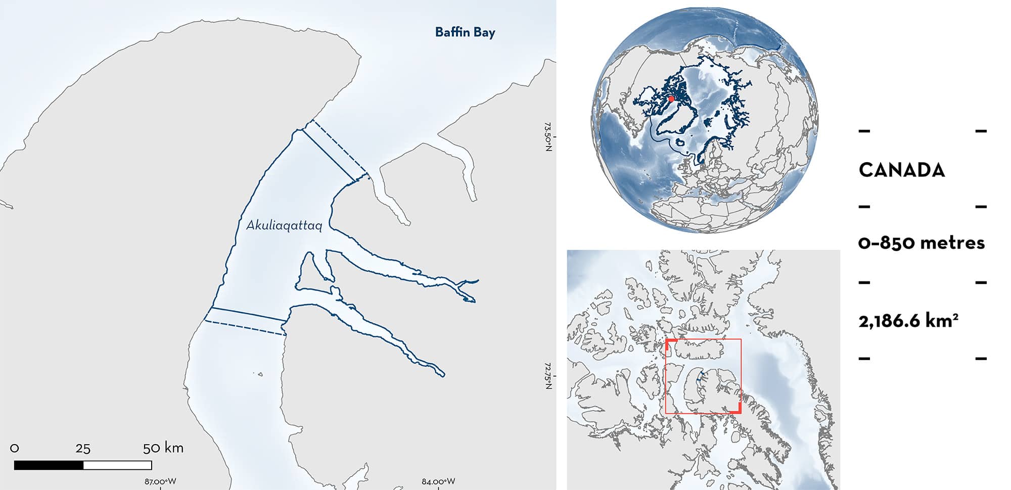
Akuliaqattaq is located in Admiralty Inlet, on the northern coast of Baffin Island, Nunavut, Canada. The area is situated within a fjord, which functions as a semi-closed marine ecosystem, and the substrate is dominated by soft muds. The area overlaps with the Tallurutiup Imanga National Marine Conservation Area. Within the area there are: threatened species and undefined aggregations (Greenland Shark Somniosus microcephalus).
Download factsheet
Akuliaqattaq
DESCRIPTION OF HABITAT
Akuliaqattaq is located in Admiralty Inlet, on the northern coast of Baffin Island in Nunavut, Canada. The area extends south from Lancaster Sound along the western shore of Baffin Island’s Borden Peninsula. Admiralty Inlet itself is ~300 km long and runs north-south with several smaller inlets and bays present within the fjord, including Adams Sound and Strathcona Sound where the traditional hamlet of Ikpiarjuk (Arctic Bay) is situated. The area is located within two fjords, which function as a semi-closed marine ecosystem and the substrate is dominated by soft mud (Devine et al. 2019).
High productivity from glacial runoff elevates key nutrient concentrations in surface waters within fjords. This is particularly important during the critical period after the spring bloom when surface plankton are nutrient limited, but insolation is still abundant (Bhatia et al. 2021). Fast ice is present during the boreal winter season (December to February), but it is a well-known Narwhal Monodon monoceros summering area as the ice clears (Breed et al. 2017). Dissolved oxygen and temperature (-1.8 and 0.6°C) start to drop when the ice-covered period starts, and salinity decreases (31.4–32.9) (O’Neil 2016).
The area overlaps with the Tallurutiup Imanga National Marine Conservation Area (UNEP-WCMC & IUCN 2024).
This Important Shark and Ray Area is benthopelagic and is delineated from inshore and surface waters (0 m) to a depth of 850 m based on the depth range of Qualifying Species in the area.
CRITERION A
VULNERABILITY
One Qualifying Species considered threatened with extinction according to the IUCN Red List of Threatened Species regularly occurs in the area. This is the Vulnerable Greenland Shark (Kulka et al. 2020).
CRITERION C
SUB-CRITERION C5 – UNDEFINED AGGREGATIONS
Akuliaqattaq is an important area for undefined aggregations of one shark species.
Between 2015–2016, a total of 31 baited remote underwater video stations (BRUVS) deployments were conducted from a fishing vessel in Nunavut (Devine et al. 2018). Individuals were identified from the video footage using unique scar and colouration patterns and other physical characteristics. The number of individuals recorded in each deployment ranged from 0 to 18. Within this area, video recordings ranged from 385 to 710 minutes in five deployments. Greenland Sharks were present in all five deployments, and the total number of sharks per set ranged from one to 18 individuals with three sets detecting greater than 14 individuals, representing the highest numbers throughout the survey and significantly greater abundance compared to other regions. Greenland Sharks measured from video footage ranged from 195–325 cm total length (TL). This area also had the fastest first detection times (used as a proxy for high abundance) in comparison to other areas.
Concurrent longline fishing also encountered higher catch rates in this region compared to other inshore areas fished, capturing a total of 42 Greenland Sharks (n = 5 longline sets, fishing depth 351–819 m) (Wheeland & Devine 2015).
In September 2023, an additional five BRUVS deployments were conducted in the area at shallower depths (122–392 m). Greenland Sharks were present in four out of five sets (absent in the shallowest set of 122 m), with 1–7 individuals observed per deployment. A total of 14 Greenland Sharks were observed, confirming Greenland Shark aggregations and use of this area across years (Donovan & Forbes 2023). More information is required to determine the nature and function of this aggregation.
Download factsheet
SUBMIT A REQUEST
ISRA SPATIAL LAYER REQUEST
To make a request to download the ISRA Layer in either a GIS compatible Shapefile (.shp) or Google Earth compatible Keyhole Markup Language Zipped file (.kmz) please complete the following form. We will review your request and send the download details to you. We will endeavor to send you the requested files as soon as we can. However, please note that this is not an automated process, and before requests are responded to, they undergo internal review and authorization. As such, requests normally take 5–10 working days to process.
Should you have questions about the data or process, please do not hesitate to contact us.


