ISRA FACTSHEETS
ISRA FACTSHEETS
NEW ZEALAND & PACIFIC ISLANDS REGION
Mele Bay
Summary
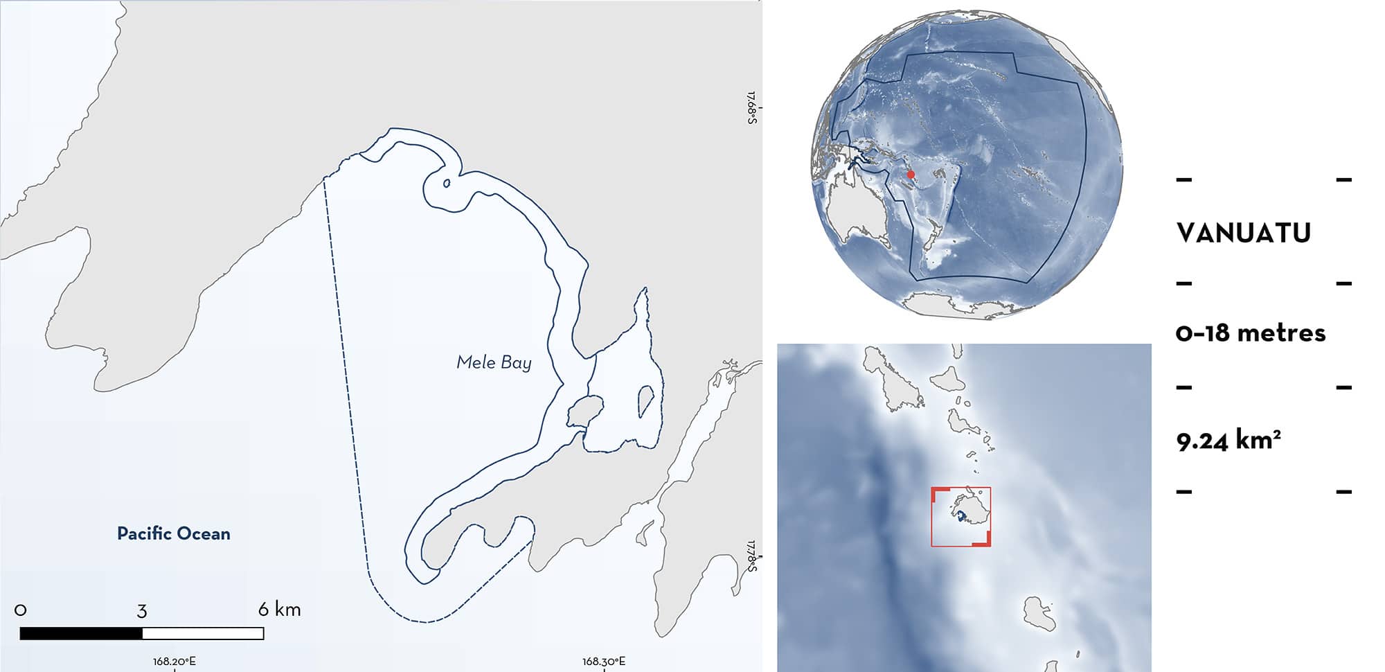
Mele Bay is located on the southwest coast of Etafe Island in the Republic of Vanuatu. This area is within a large embayment that encompasses the coastal, shallow extent of the bay where the coastline is characterised as a sandy beach environment with limited fringing reef. The bay has a narrow, relatively shallow shelf with an average depth of 10 m. Within this area there are: threatened species (e.g., Spotted Eagle Ray Aetobatus ocellatus); range-restricted species (Oceania Fantail Ray Taeniura lessoni); reproductive areas (Whitetip Reef Shark Triaenodon obesus); and undefined aggregations (Spotted Eagle Ray).
Download factsheet
Mele Bay
DESCRIPTION OF HABITAT
Mele Bay is located on the southwest coast of Etafe Island in the Republic of Vanuatu. This area is within a large embayment that encompasses the coastal, shallow extent of the bay where the coastline is characterised as a sandy beach environment with limited fringing reef. Mele Bay has a very narrow shelf between the shoreline and the shelf break. Its geomorphology make it extremely unstable and prone to erosion. Four rivers drain into the bay, Teae River from the northeast, and Tepwuka, La Colle, and Tagabe rivers from the southeast (Smith 1991). The climate in Vanuatu is characterised by high rainfall and high temperatures throughout the year, and experiences severe tropical cyclones during the austral summer months of December to February (Walshe et al. 2017).
This Important Shark and Ray Area is benthic and pelagic and is delineated from inshore and surface waters (0 m) to 18 m based on the bathymetry of the area.
CRITERION A
VULNERABILITY
Two Qualifying Species considered threatened with extinction according to the IUCN Red List of Threatened Species regularly occur in the area. These are the Endangered Spotted Eagle Ray (Finucci et al. 2024) and the Vulnerable Whitetip Reef Shark (Simpfendorfer et al. 2020).
CRITERION B
RANGE RESTRICTED
Mele Bay holds the regular presence of one species of ray as a resident range-restricted species. Recreational divers observe Oceania Fantail Rays year-round in this area (on average one ray is observed in every three dives, and dives are conducted in the area at least once per week; C Shaw pers. obs. 2024). In addition, between 2011–2018, there were six records of Oceania Fantail Rays on reported online from Mele Bay (iNaturalist 2024). These records make up half of the iNaturalist observations of Oceania Fantail Rays throughout Vanuatu waters, and observations on this platform were between the months of April and October. The rays are generally observed resting under rocks or on the substrate. This species range is not within Large Marine Ecosystems but is restricted to Melanesia, including Papua New Guinea, Vanuatu, Solomon Islands, and Fiji (Last et al. 2016; Hylton et al. 2017).
CRITERION C
SUB-CRITERION C1 – REPRODUCTIVE AREAS
Mele Bay is an important reproductive area for one shark species.
Local ecological knowledge confirms that between 2009–2024, Whitetip Reef Sharks have been observed on 25% of dives in the area (dives are conducted at least once a week; C Shaw pers. obs. 2024). Young-of-the-year (YOY) Whitetip Reef Sharks visually estimated to measure <80 cm total length (TL) aggregate in Mele Bay in groups of 1–5 individuals, where they rest under plate corals. Adult sharks are observed in the area in fewer numbers (1–2 individuals per dive). Size-at-birth for this species is estimated to be 52–60 cm TL (Ebert et al. 2021), indicating sharks <80 cm TL would be classed as neonates or YOY. Local divers have also reported seeing pregnant females with visibly extended abdomens in the area (C Shaw pers. obs. 2024). In addition, two ‘small’ Whitetip Reef Sharks were photographed together in Mele Bay by a local photographer (no size estimate provided; Critterspotter 2024). Since 1993, five observations of 1–2 Whitetip Reef Sharks have been logged on iNaturalist between the months of February and August in the area (no size estimates provided; iNaturalist 2024). These comprise the majority (63%) of iNaturalist records of this species in Vanuatu waters, and highlight the importance of this area to this species.
CRITERION C
SUB-CRITERION C5 – UNDEFINED AGGREGATIONS
Mele Bay is an important area for undefined aggregations of one ray species.
Spotted Eagle Rays are regularly observed in the area. Recreational divers visit the area at least once a month and report seeing groups of 10–15 Spotted Eagle Rays every couple of months (C Shaw pers. obs. 2024). There are only three records of Spotted Eagle Rays logged on iNaturalist throughout Vanuatu waters (iNaturalist 2024), highlighting the importance of this area for this species.
Download factsheet
SUBMIT A REQUEST
ISRA SPATIAL LAYER REQUEST
To make a request to download the ISRA Layer in either a GIS compatible Shapefile (.shp) or Google Earth compatible Keyhole Markup Language Zipped file (.kmz) please complete the following form. We will review your request and send the download details to you. We will endeavor to send you the requested files as soon as we can. However, please note that this is not an automated process, and before requests are responded to, they undergo internal review and authorization. As such, requests normally take 5–10 working days to process.
Should you have questions about the data or process, please do not hesitate to contact us.


