ISRA FACTSHEETS
ISRA FACTSHEETS
NEW ZEALAND & PACIFIC ISLANDS REGION
Récifs de l’Astrolabe
Summary
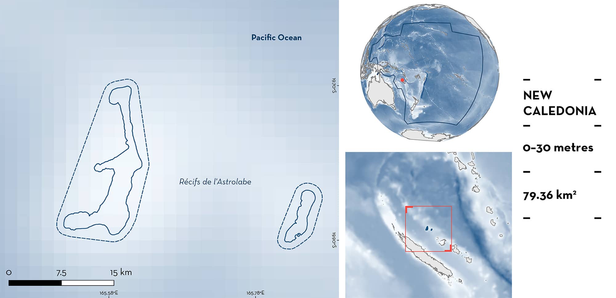
Récifs de l’Astrolabe is located in the northeast side of New Caledonia. The area is composed of two ribbon reefs with a northeast-southwest alignment and separated by a deep channel. It is characterised by live and dead coral substrates with sandy patches. The area overlaps with the Natural Park of the Coral Sea. Within this area there are: threatened species and undefined aggregations (Grey Reef Shark Carcharhinus amblyrhynchos).
Download factsheet
Récifs de l’Astrolabe
DESCRIPTION OF HABITAT
Récifs de l’Astrolabe is located in the northeast side of New Caledonia in the Coral Sea. It sits in the Loyalty Ridge and is found ~90 km north of Ouvéa Island and ~110 km northeast of Grand Terre Island. The area is composed of two ribbon reefs with a northeast-southwest alignment and separated by a 25 km deep channel (Maurizot et al. 2020). Grande Astrolabe is ~20 km long and ~3.5 km wide, while Petit Astrolabe is ~8 km long and <3 km wide (Haeberle 1952). The area has been considered as an incipient atoll with shallow waters of an incipient lagoon on the western side of both reefs (Maurizot et al. 2020). The area is characterised by live and dead coral substrates with sandy patches (Wantiez et al. 2016; Schohn et al. 2017).
The area overlaps with the Natural Park of the Coral Sea (UNEP-WCMC & IUCN 2024).
This Important Shark and Ray Area is benthic and pelagic and is delineated from inshore and surface waters (0 m) to 30 m based on the bathymetry of the area.
CRITERION A
VULNERABILITY
One Qualifying Species considered threatened with extinction according to the IUCN Red List of Threatened Species regularly occurs in the area. This is the Endangered Grey Reef Shark (Simpfendorfer et al. 2020).
CRITERION C
SUB-CRITERION C5 – UNDEFINED AGGREGATIONS
Récifs de l’Astrolabe is an important area for undefined aggregations of one shark species.
Aggregations of Grey Reef Sharks are regularly observed in this area and have been documented by underwater surveys, visual censuses and Baited Remote Underwater Video Station (BRUVS) surveys (Vigliola et al. 2014; Wantiez et al. 2016; Juhel et al. 2017).
Between 2012–2014, underwater surveys (n = 253) were conducted along all New Caledonia reefs. Surveys consisted of fixed-width transects (25 m long by 4 m wide at 10 and 20 m depths), distance-sampling visual census (50 m long by 10 m wide at ~15 m depth), and BRUVS (1 hour at ~20 m depth; Vigliola et al. 2014). Of these surveys, 46 were conducted in Récifs de l’Astrolabe during 2012 and 2013, showing that Grey Reef Sharks aggregate in the area (Vigliola et al. 2014). Carcharhinids were observed in 90% of the visual surveys and in BRUVS, MaxN values (maximum number of individuals of a species observed in a single frame) were the largest recorded in all New Caledonia (MaxN = 6; Vigliola et al. 2014; A Friedlander unpubl. data. 2024). In addition, surveys with BRUVS (2012–2014) and distance-sampling visual census (2012–2014) were conducted at 385 sites for BRUVS and 2,790 sites for visual census (including 15 marine protected area) along New Caledonia with Récifs de l’Astrolabe holding one of the largest abundances for sharks among all sites (Juhel et al. 2017). Aggregations for Grey Reef Sharks in visual censuses (mean = 3.2 individuals, maximum = 12 individuals) and BRUVS (3–14 individuals) were among the largest in all New Caledonia (Juhel et al. 2017). Of 70 surveys with rotating video stations conducted in 2014 in the area (deployed for 12 minutes from the boat and consisting of cameras rotating 60° every 30 seconds), Grey Reef Sharks were observed in 40% of the deployments (Schohn et al. 2017). Further, of 18 fixed-width transect surveys conducted in the area in 2016 (5–10 m depths), Grey Reef Shark were observed in 88.9% of the surveys with aggregations of individuals (n = 4) between 55–180 cm total length observed in 12 of the surveys (Wantiez et al. 2016). More information is needed to understand the nature and function of these aggregations.
Download factsheet
SUBMIT A REQUEST
ISRA SPATIAL LAYER REQUEST
To make a request to download the ISRA Layer in either a GIS compatible Shapefile (.shp) or Google Earth compatible Keyhole Markup Language Zipped file (.kmz) please complete the following form. We will review your request and send the download details to you. We will endeavor to send you the requested files as soon as we can. However, please note that this is not an automated process, and before requests are responded to, they undergo internal review and authorization. As such, requests normally take 5–10 working days to process.
Should you have questions about the data or process, please do not hesitate to contact us.


