ISRA FACTSHEETS
ISRA FACTSHEETS
SOUTH AMERICAN ATLANTIC REGION
Mar del Plata Canyon
Summary
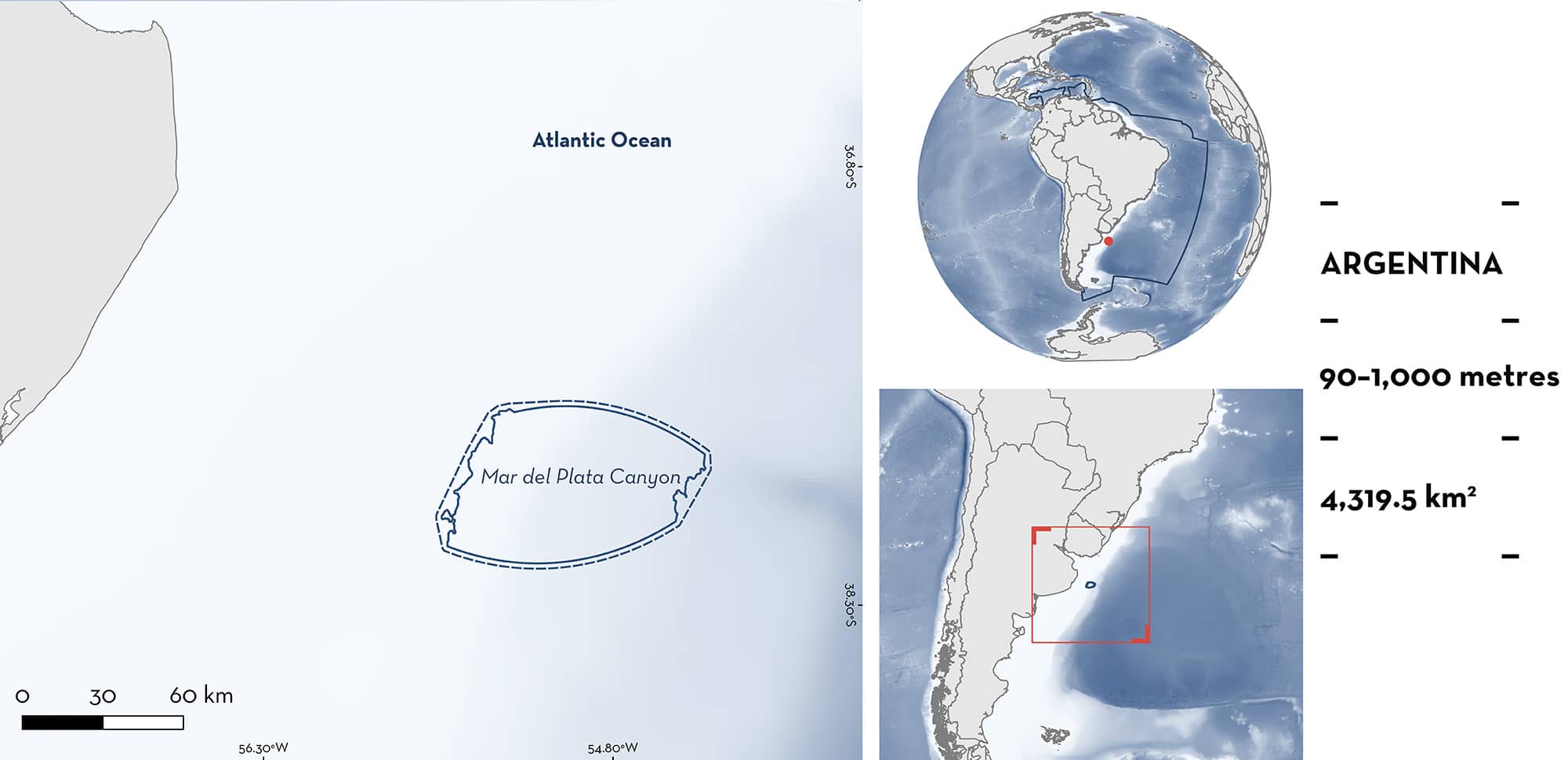
Mar del Plata Canyon is located off the coast of the Buenos Aires Province in Argentina. It includes part of the continental slope and the Mar del Plata Canyon. The area is characterised by fine sand with a mixture of terrigenous material and planktonic foraminifera substrate. The area is highly productive, influenced by the permanent Argentine Shelf-break Front. Within this area there are: reproductive areas (Southern Thorny Skate Amblyraja doellojuradoi).
Download factsheet
Mar del Plata Canyon
DESCRIPTION OF HABITAT
Mar del Plata Canyon is located at the continental margin off the coast of Buenos Aires Province, Argentina. It includes part of the continental slope and part of the Mar del Plata Canyon. This area is the largest of the Río de la Plata Canyon System. It is located in the northern sector of the margin more than 250 km off the coast and at a depth from 900–3,900 m (Bozzano et al. 2021). The area is characterised by fine sand with a mixture of terrigenous material and planktonic foraminifera substrate (Bozzano et al. 2021). It is highly productive and influenced by the permanent Argentine Shelf-break Front (Vazquez et al. 2016). This front marks the boundary where subantarctic shelf waters meet the cooler, more saline waters of the Falkland-Malvinas Current, creating a significant thermohaline front (Lutz & Carreto 1991).
This Important Shark and Ray Area is benthic and subsurface and is delineated from 90–1,000 m based on the depth range of Qualifying Species and the bathymetry of the area.
CRITERION C
SUB-CRITERION C1 – REPRODUCTIVE AREAS
Mar del Plata Canyon is an important reproductive area for one ray species.
High densities of egg capsules were found in the area for Southern Thorny Skate (Vazquez et al. 2016). Between 2009–2014, eight research cruises conducted bottom trawls on the northern Argentine continental shelf (36°S–41°S) at depths of 50–3,447 m (Vazquez et al. 2016). Sampling employed two types of bottom trawl nets and two dredges, with trawling durations of 20–30 min at speeds of 1.5–3 knots, resulting in a total of 122 fishing hauls. Catch-per-unit-effort (CPUE) for Southern Thorny Skate egg cases was calculated based on the area swept by survey trawls (Alverson & Pereyra 1969) expressed as egg capsule per km2 (capsules/km2). After taxonomic identification, the number of capsules per haul for each species was recorded (Vazquez et al. 2016).
Between 2009–2014, 70 Southern Thorny Skate egg capsules were collected in 24 hauls in the area and adjacent areas from 84–1,006 m depth. Full egg capsules (with embryos) were found in hauls at 95–1,006 m depth (Vazquez et al. 2016). Southern Thorny Skate was the third most abundant species in hauls, with relative egg capsule densities estimated between 169–3,726 capsules/km2. The highest density (>3,000 capsules/km2) was mainly found in the area at 852 m. The area included the only haul with 3,726 capsules/km2 and three of the six hauls with densities between 301–1,000 capsules/km2 (Vazquez et al. 2016). The higher density of egg capsules within this area indicates that this is an important reproductive area for Southern Thorny Skate (Vazquez et al. 2016).
Download factsheet
SUBMIT A REQUEST
ISRA SPATIAL LAYER REQUEST
To make a request to download the ISRA Layer in either a GIS compatible Shapefile (.shp) or Google Earth compatible Keyhole Markup Language Zipped file (.kmz) please complete the following form. We will review your request and send the download details to you. We will endeavor to send you the requested files as soon as we can. However, please note that this is not an automated process, and before requests are responded to, they undergo internal review and authorization. As such, requests normally take 5–10 working days to process.
Should you have questions about the data or process, please do not hesitate to contact us.


