ISRA FACTSHEETS
ISRA FACTSHEETS
SOUTH AMERICAN ATLANTIC REGION
Laje de Santos
Summary
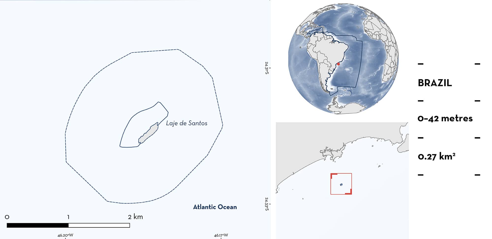
Laje de Santos is located in São Paulo State, southeastern Brazil. It is an uninhabited islet, and its habitat consists of several scattered rocky reefs interspersed with extensive sandy substrates. The area overlaps with the Laje de Santos Marine State Park. Within this area there are: threatened species, range-restricted species, and reproductive areas (Groovebelly Stingray Dasyatis hypostigma).
Download factsheet
Laje de Santos
DESCRIPTION OF HABITAT
Laje de Santos is located in São Paulo State, southeastern Brazil. It is situated 40 km offshore from the city of Santos. The area is an uninhabited islet, and its habitat consists of several scattered rocky reefs interspersed with extensive sandy substrates. The subtidal substrate is composed of granitic boulders of varying sizes and shapes, forming a steep profile. The rocky substrate is primarily covered by patches of brown and red algae, the zoanthid Palythoa caribeorum, hydrozoans, ascidians, octocorals, and sparse colonies of scleractinian corals (Luiz et al. 2008). Salinity ranges from 34.4–38.8, and temperatures from 22–28°C, with austral summer being the season when the waters are warmest and most saline. The presence of South Atlantic Central Water (SACW) in the area during spring and summer is indicated by low temperatures (<17°C) and salinity values ~35 at the bottom of the water column, which are typical thermohaline characteristics (De Santis Braga et al. 2017).
The area overlaps with the Laje de Santos Marine State Park (UNEP-WCMC & IUCN 2024).
This Important Shark and Ray Area is benthic and pelagic and is delineated from surface waters (0 m) to a depth of 42 m based on the bathymetry of the area.
CRITERION A
VULNERABILITY
One Qualifying Species considered threatened with extinction according to the IUCN Red List of Threatened Species regularly occurs in the area. This is the Endangered Groovebelly Stingray (Pollom et al. 2020).
CRITERION B
RANGE RESTRICTED
This area holds the regular presence of Groovebelly Stingray as a resident range-restricted species (L Chelotti unpubl. data 2024). Since 2023, sightings of rays have been shared through a citizen science project by recreational divers in the area. This species occurs year-round in the area, with a seasonal peak in reports in 2023–2024 during the months of May and June. Sightings of Groovebelly Stingrays are more regular and in larger numbers than in adjacent islands monitored by the same citizen science project. The Groovebelly Stingray was reported for all dives sampled within this area, while in other areas, it was only present during on 14 dives (40% of dives). The mean number of individuals observed per dive is three times higher in this area with 958 individual sightings recorded across 300 dives (mean = 3.2; L Chelotti unpubl. data 2024). This species is restricted to the South Brazil Shelf Large Marine Ecosystem (LME) and marginally Patagonian Shelf LME and East brazil LME.
CRITERION C
SUB-CRITERION C1 – REPRODUCTIVE AREAS
Laje de Santos is an important reproductive area for one ray species.
Between 2022–2024, pregnant Groovebelly Stingrays were reported by recreational divers through the ‘Viu Raia?’ citizen science project (L Chelotti unpubl. data 2024). Pregnancy was determined visually from the presence of extended abdomens. Of 931 sightings of the species, 45 were confirmed as pregnant through photo and video records. Most observations of pregnant females are from May (n = 12) and June (n = 21), suggesting a seasonal reproductive cycle. Additionally, 19 Groovebelly Stingrays with mating scars were recorded in this area between 2023–2024. Most individuals with mating scars (80%) were observed in May and June. There is an overlap in the months that animals with scars and pregnant Groovebelly Stingrays were recorded. The number of individuals reported per sampling event in May and June was approximately five times greater than in the other months in 2023 and 2024.
Within this area, there are also diver reports of Groovebelly Stingrays aggregations in May 2015 (n >10 individuals), June 2018 (n >30 individuals), and May 2023 (n >70 and n = 20 individuals). One record submitted by divers through the citizen science project also includes six individuals aggregating in May 2022 (L Chelotti unpubl. data 2024).
Download factsheet
SUBMIT A REQUEST
ISRA SPATIAL LAYER REQUEST
To make a request to download the ISRA Layer in either a GIS compatible Shapefile (.shp) or Google Earth compatible Keyhole Markup Language Zipped file (.kmz) please complete the following form. We will review your request and send the download details to you. We will endeavor to send you the requested files as soon as we can. However, please note that this is not an automated process, and before requests are responded to, they undergo internal review and authorization. As such, requests normally take 5–10 working days to process.
Should you have questions about the data or process, please do not hesitate to contact us.


