ISRA FACTSHEETS
ISRA FACTSHEETS
WESTERN INDIAN OCEAN REGION
Al Shaheen
Summary
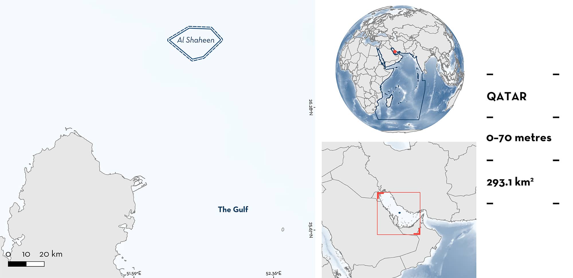
Al Shaheen lies ~145 km north of Doha, the Qatari capital, and 90 km offshore, in the Arabian/Persian Gulf. The benthic habitat in Al Shaheen is characterised by indistinct sandy substrate. Water temperatures are layered in the boreal summer months, with several distinct thermoclines and range from 18°C at depth to 36°C at the surface. Within this area there are threatened species (e.g., Blacktip Shark Carcharhinus limbatus); feeding areas (e.g., Whale Shark Rhincodon typus); and undefined aggregations (Scalloped Hammerhead Sphyrna lewini).
Download factsheet
Al Shaheen
DESCRIPTION OF HABITAT
Al Shaheen lies ~145 km north of Doha, and 90 km offshore, in Qatari waters of the Arabian/Persian Gulf (hereafter referred to as ‘The Gulf’). The area consists of pelagic waters above indistinct sandy substrates. The Gulf is a shallow, subtropical, and hyper-arid region, with a photic zone which mostly extends from 6 to 15 m (Sheppard et al. 2010). High temperatures in the boreal summer and dry winds in winter create 1–2 m equivalent of evaporation per year, and coupled with a general lack of precipitation, means that salinity of >39 ppt occurs in most Gulf waters (Sheppard et al. 2010). Water temperatures in Al Shaheen are layered in the summer months, with several distinct thermoclines between 18°C at depth and 36°C at the surface.
This Important Shark and Ray Area is pelagic and is delineated from surface waters (0 m) to a depth of 70 m based on the bathymetry of the area.
CRITERION A
VULNERABILITY
Three Qualifying Species considered threatened with extinction according to the IUCN Red List of Threatened SpeciesTM regularly occur in the area. These are the Critically Endangered Scalloped Hammerhead (Rigby et al. 2019), the Endangered Whale Shark (Pierce & Norman 2016), and the Vulnerable Blacktip Shark (Rigby et al. 2021).
CRITERION C
SUB-CRITERION C2 – FEEDING AREAS
Al Shaheen is an important feeding area for two shark species.
Whale Sharks have been directly observed by researchers feeding in large, dense aggregations annually since 2011. Whale Sharks aggregating in Al Shaheen are directly associated with the presence of spawning tuna during the summer months. Concurrent plankton sampling and barcoding of fish eggs between 2011 and 2014 indicates that this aggregation is related to tuna spawning events from Mackerel Tuna Euthynnus affinis (Robinson et al. 2016). This seasonal spawning event takes place almost daily from May until September and provides large enough amounts of food for Whale Sharks that they aggregate in large numbers (up to 100 sharks/km2), forming one of the largest aggregations of Whale Sharks in the world (Robinson et al. 2013). Sharks numbering up to 346 individuals have been recorded from one drone image of one aggregation (M Jaidah unpubl. data 2023). Satellite tracking of Whale Sharks has shown high levels of site fidelity throughout the Mackerel Tuna spawning season and identification of individuals indicates that they return on an annual basis to exploit this food source (Robinson et al. 2016). Whale Sharks have been observed throughout the area and can be found feeding from first light until early afternoon when the eggs disperse and are no longer concentrated.
Between 2011 and 2016, Blacktip Sharks were encountered during in-water Whale Shark surveys daily during the summer months. On most occasions, Blacktip Sharks were observed feeding on baitfish in the area in groups of up to 20 individuals per survey (D Robinson unpubl. data 2023). There are no other records of aggregating Blacktip Sharks outside this area of the Gulf despite surveys to investigate Whale Shark occurrence and where records of these species would have been collected.
CRITERION C
SUB-CRITERION C5 – UNDEFINED AGGREGATIONS
Al Shaheen is an important area for undefined aggregations of one shark species.
Aggregations of Scalloped Hammerheads were reported in 2011, 2012, and 2013 during Whale Shark data collection periods in schools of 50+ individuals. Oil and gas platform workers provided videos and pictures, and regular sightings appear to occur in May through to June each year (Elasmo Project unpubl. data 2023). Aggregations of this species are not reported from elsewhere in the Gulf, and additional information is required on the nature and function of these aggregations.
Download factsheet
SUBMIT A REQUEST
ISRA SPATIAL LAYER REQUEST
To make a request to download the ISRA Layer in either a GIS compatible Shapefile (.shp) or Google Earth compatible Keyhole Markup Language Zipped file (.kmz) please complete the following form. We will review your request and send the download details to you. We will endeavor to send you the requested files as soon as we can. However, please note that this is not an automated process, and before requests are responded to, they undergo internal review and authorization. As such, requests normally take 5–10 working days to process.
Should you have questions about the data or process, please do not hesitate to contact us.


