ISRA FACTSHEETS
ISRA FACTSHEETS
WESTERN INDIAN OCEAN REGION
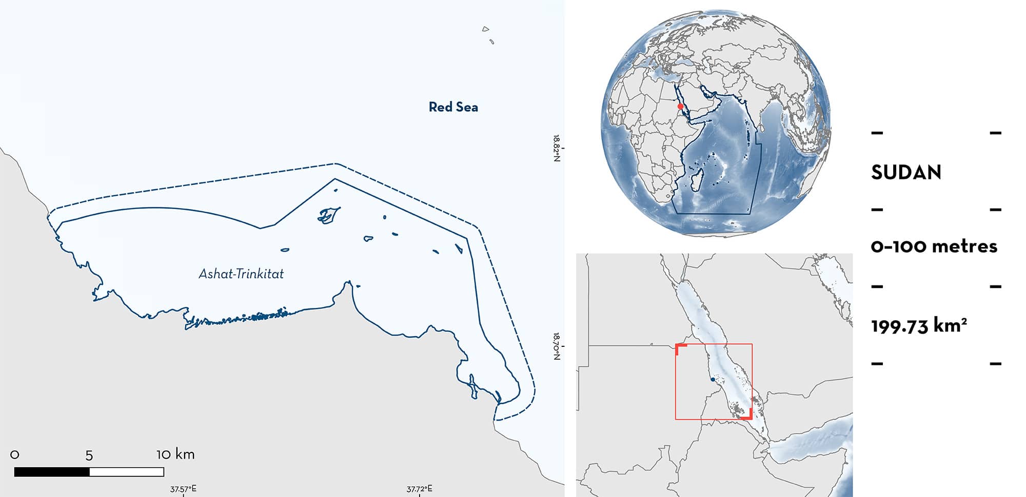
Ashat-Trinkitat
Summary
Ashat-Trinkitat is located in the Sudanese Red Sea. It is characterised by a wide delta with sandy-muddy substrates, tidal inlets, and supports one of the densest and most extensive mangrove forests in Sudan. This area is influenced by nutrients from the Bakara River that floods seasonally. Within this area there are: threatened species and reproductive areas (Green Sawfish Pristis zijsron).
Download factsheet
Ashat-Trinkitat
DESCRIPTION OF HABITAT
Ashat-Trinkitat is located in the Sudanese Red Sea. The area includes the Trinkitat Islands, Ashat, Mugadam Islands, and Trinkitat Bay. Trinkitat Islands lies south of Mugadam Islands on the southern coast of Sudan. Trinkitat Bay receives water from the Baraka River through khor (riverbed) basins for only a short period during the rainy season (June to September) (Babker et al. 2020). This provides alluvium and a suitable environment for mangrove growth. The Trinkitat shoreline is undulating with tidal inlets, sand bars, and flood depressions rich in alluvium (PERSGA/GEF 2004).
The mangrove stands at Ashat are one of the most extensive and densest in the country (I Elhassan pers. obs. 2023). Their distribution in the area is probably greatly influenced by the amount of surface run-off and alluvium reaching the sea. The site has three mangrove stands. The northern and southern stands bend around the northern mangrove edge to enclose a large inlet. A third stand is located seaward on an elongated islet, forming the inner bank of the inlet side. The northern mangrove stand is narrow and ~2.5 km long. The inner mangrove stand is the smallest, forming a 500 m belt. The southern mangrove stand is relatively broad and long, extending along 4 km of the inlet bank. Compared to other mangrove areas in the country, the forests cover a wider area, well above 500 m width in parts. The dense mangroves and muddy substrates in the Ashat area are rich in nutrients (PERSGA/GEF 2004).
This Important Shark and Ray Area is benthopelagic and delineated from inshore and surface waters (0 m) to 100 m based on the observations and maximum depth used by the Qualifying Species.
CRITERION A
VULNERABILITY
The one Qualifying Species within the area is considered threatened with extinction according to the IUCN Red List of Threatened Species™. The Green Sawfish is assessed as Critically Endangered (Harry et al. 2022).
CRITERION C
SUB-CRITERION C1 – REPRODUCTIVE AREAS
Ashat-Trinkitat is an important reproductive area for one ray species.
Green Sawfish regularly occur in the area (Elhassan 2018; I Elhassan unpubl. data 2023). It is the only sawfish species currently found in the Sudanese Red Sea (Elhassan 2018), and one of two remaining sawfish species in the Western Indian Ocean (alongside Largetooth Sawfish Pristis pristis). Since 2010, there have been 15 records of Green Sawfish in this area based mostly on confirmed fisher reports. This is the second largest clustering of contemporary Green Sawfish records in the Western Indian Ocean (the largest cluster is also located in Sudan). This species is distinctive from other shark and ray species, and recognisable based on its elongated, tooth-studded rostrum. Records have also been verified from pictures and videos available from fishers.
Adult, immature, and neonate Green Sawfish have been recorded in the area based on published size-at-maturity (>320 cm total length [TL]) and size-at-birth (~75–90 cm TL) of the species (Lear et al. 2023). Although the exact measurements of the individuals are not available, the lifecycle stage of records was often determined at time of capture. Between 2011–2019, eight juvenile Green Sawfish were caught from muddy areas in Ashat. Between 2010–2011, four Green Sawfish pups were caught from muddy areas of Trinkitat inlet in water <10 metres deep. In December 2012, a pregnant female was caught from Trinkitat Islands, and aborted six embryos in the net. Also in the same month, an individual measuring ~200 cm TL was caught as bycatch from waters ~30 m depth, and then released. In April 2016, a juvenile was caught as bycatch by a fisher targeting bony fishes (Elhassan 2018; I Elhassan unpubl. data 2023). These observations are consistent with known habitat preferences, further inferring that Ashat-Trinkitat is an important reproductive area for Green Sawfish.
The temporal and spatial scale of contemporary records in Sudan is regionally if not globally significant for Green Sawfish.
Download factsheet
SUBMIT A REQUEST
ISRA SPATIAL LAYER REQUEST
To make a request to download the ISRA Layer in either a GIS compatible Shapefile (.shp) or Google Earth compatible Keyhole Markup Language Zipped file (.kmz) please complete the following form. We will review your request and send the download details to you. We will endeavor to send you the requested files as soon as we can. However, please note that this is not an automated process, and before requests are responded to, they undergo internal review and authorization. As such, requests normally take 5–10 working days to process.
Should you have questions about the data or process, please do not hesitate to contact us.


