ISRA FACTSHEETS
ISRA FACTSHEETS
NEW ZEALAND & PACIFIC ISLANDS REGION
Baker Island
Summary
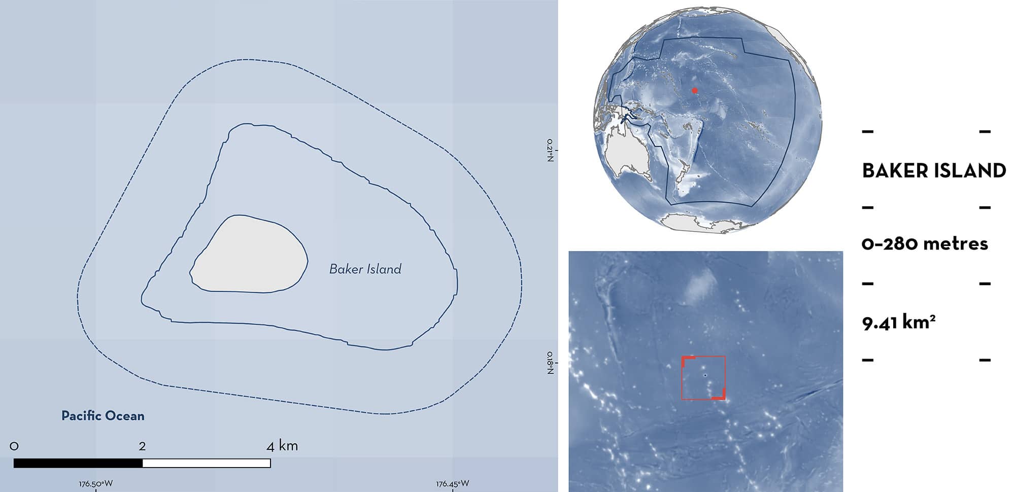
Baker Island is located in the central equatorial Pacific Ocean and part of the Phoenix Islands group. This uninhabited coral reef platform is a territory of the United States of America. The area encompasses the narrow fringing reef with a steep slope surrounding the island, and a broad shallow reef terrace on the east side, with a benthic habitat characterised by crustose coralline algae and a hard coral community dominated by the genus Acropora. The area overlaps with two marine protected areas, one Ecologically or Biologically Significant Marine Area, and one Key Biodiversity Area. Within this area there are: threatened species and undefined aggregations (Grey Reef Shark Carcharhinus amblyrhynchos).
Download factsheet
Baker Island
DESCRIPTION OF HABITAT
Baker Island is located in the central equatorial Pacific Ocean and part of the Phoenix Islands group. This low-lying, uninhabited coral reef platform is a territory of the United States of America (Brainard et al. 2019). The island is influenced by the westward-flowing South Equatorial Current at the surface and the opposing eastward-flowing subsurface Equatorial Undercurrent. This dynamic interaction, along with wind-driven equatorial upwelling and topographic upwelling from the Equatorial Undercurrent , contributes to the area’s high productivity (Brainard et al. 2019). The island’s marine environment features a narrow fringing reef with steep slopes and a broad, shallow reef terrace on the east side. The benthic habitat is characterised by crustose coralline algae and a coral community dominated by Acropora species (Brainard et al. 2019).
The area overlaps with the Baker Island National Wildlife Refuge and the Pacific Remote Islands Marine National Monument (UNEP-WCMC & IUCN 2024), the Equatorial High-Productivity Zone Ecologically and Biologically Significant Marine Area (EBSA) (CBD 2024), and the Howland and Baker marine Key Biodiversity Area (KBA 2024).
This Important Shark and Ray Area is delineated from surface waters (0m) to a depth of 280 m based on the depth range of the Qualifying Species.
CRITERION A
VULNERABILITY
One Qualifying Species considered threatened with extinction according to the IUCN Red List of Threatened Species regularly occurs in the area. This is the Endangered Grey Reef Shark (Simpfendorfer et al. 2020).
CRITERION C
SUB-CRITERION C5 – UNDEFINED AGGREGATIONS
Baker Island is an important area for undefined aggregations of one shark species.
Baker Island is a key aggregation site for Grey Reef Sharks. Data from NOAA Coral Reef Ecosystem Program expeditions show that these sharks gather around the island regularly and predictably. These observations are based on both contemporary and historical towed-diver surveys (TDS) and stationary point count surveys (SPC).
The TDS method involved two divers being towed behind a boat along a ~2.2 km track. At a depth of ~15 m, the divers recorded the number, size (total length, TL), and species of fish larger than 50 cm TL within a belt-transect extending 5 m on either side and 10 m in front of them, from the bottom to the surface (total area surveyed = 20,000 km2) (Brainard et al. 2012). In SPC surveys, two divers conducted simultaneous counts of all fishes in adjacent visually estimated 15-m-diameter cylindrical plots extending from the substrate to the limits of vertical visibility. The SPC survey is a comprehensive small-scale survey approach that covers small areas of the reef (~350–600 m2), thus, aggregations, and rare and patchily distributed species are generally not well surveyed (Brainard et al. 2012).
Between 2001–2023, 53 TDS (2001 = 2; 2002 = 1; 2004 = 6; 2006 = 6; 2008 = 8; 2010 = 9; 2012 = 10; 2015 = 5; 2017 = 5), and 144 SPC surveys (2010 = 21; 2012 = 24; 2015 = 36; 2018 = 32; 2023 = 31) were conducted in the area (CREP PIFSC 2017a, b, c, d, e, f; PIFSC 2024). Grey Reef Sharks were the most observed shark species, with sightings in 81.3% of the TDS, and 44.2% of the SPC. In total, 30 aggregations of more than three animals were recorded during the surveys (TDS and SPC), and an additional 10 aggregations were recorded ‘off survey’ during the expeditions.
The largest aggregations recorded between 2001–2008 during TSD consisted of 11 sharks (88–125 cm total length [TL]) in 2004, seven animals (125–150 cm TL) in 2002, and six animals in both 2001 and 2004. Smaller aggregations of two sharks were also recorded in 2001 and 2008. Based on the contemporary TDS data, eight aggregations of 3–5 animals were recorded in 2010, four aggregations of 4–7 animals in 2012, three aggregations of three animals in 2015, and three aggregations of 3–5 animals in 2017. SPC surveys also recorded two aggregations of three animals in 2015, three aggregations of 3–4 animals in 2017. In 2023, SPC surveys observed eight aggregations ranging from 3–18 sharks. Additionally, 10 ‘off-transect’ aggregations of 3–13 sharks were recorded during the 2001, 2002, and 2004 expeditions (CREP PIFSC 2017a, b, c, d, e, f; PIFSC 2024).
These observations reveal animals measuring between 63–175 cm TL, with most of the aggregations corresponding to juveniles (size at maturity for this species 130–145cm TL for males, and 120–142 cm TL for females [Ebert et al. 2021]), but more information is required to determine the function and nature of these aggregations.
Download factsheet
SUBMIT A REQUEST
ISRA SPATIAL LAYER REQUEST
To make a request to download the ISRA Layer in either a GIS compatible Shapefile (.shp) or Google Earth compatible Keyhole Markup Language Zipped file (.kmz) please complete the following form. We will review your request and send the download details to you. We will endeavor to send you the requested files as soon as we can. However, please note that this is not an automated process, and before requests are responded to, they undergo internal review and authorization. As such, requests normally take 5–10 working days to process.
Should you have questions about the data or process, please do not hesitate to contact us.


