ISRA FACTSHEETS
ISRA FACTSHEETS
ASIA REGION
Banda Arc
Summary
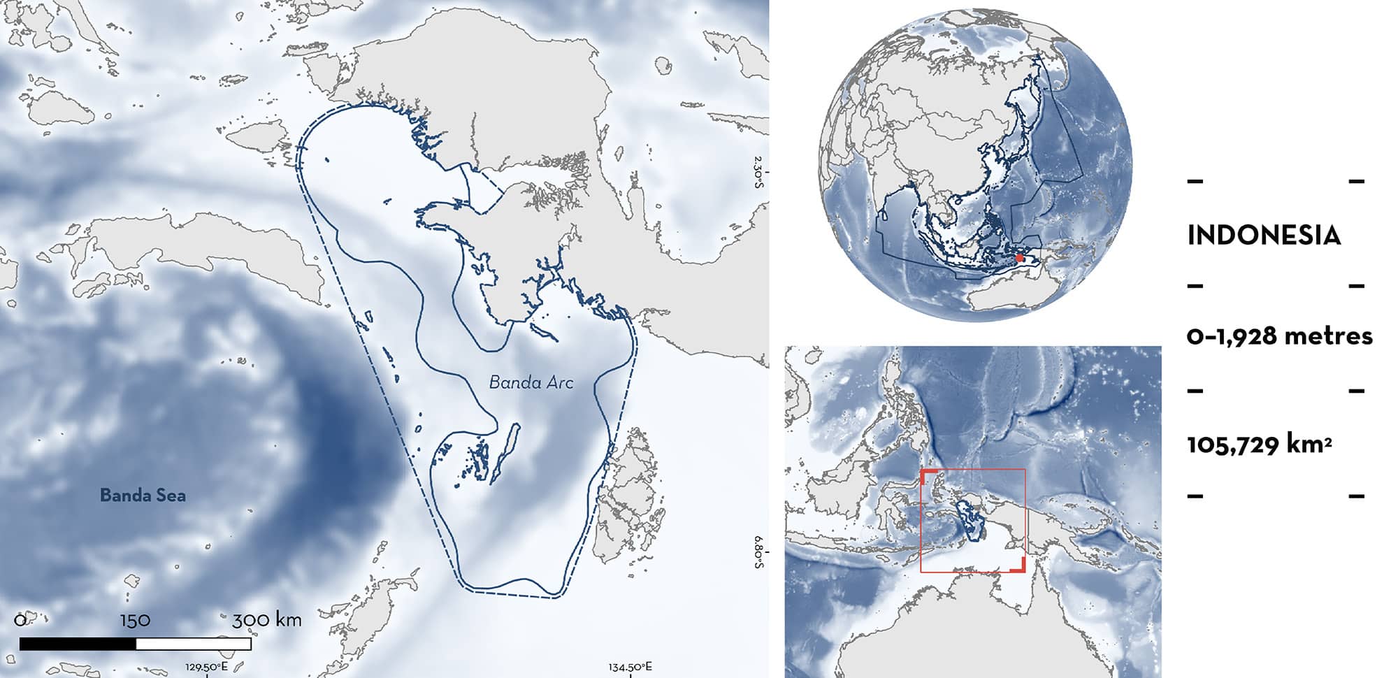
Banda Arc is located in the Banda Sea of eastern Indonesia. The area includes island groups and is influenced by monsoon trade winds. These produce large-scale upwellings on the eastern side during the southeast monsoon (June to September). The area overlaps with the Raja Ampat and Northern Bird’s Head Ecologically or Biologically Significant Marine Area and with six marine protected areas. Within this area there are: threatened species and movement areas (Whale Shark Rhincodon typus).
Download factsheet
Banda Arc
DESCRIPTION OF HABITAT
Banda Arc is located in the Banda Sea of eastern Indonesia. It is spread across three provinces: Maluku, West Papua, and Southwest Papua. The area includes several islands (e.g., southern Maluku Islands) and bays (e.g., Kaimana).
The area is highly influenced by monsoon winds (Moore et al. 2003). The southeast monsoon (June to September) produces lower sea surface temperatures and large-scale upwelling in the eastern Banda Sea, with upwelling occurring year-round in Kaimana. The northwest monsoon (December to March) produces higher temperatures and a depression of the thermocline (Moore et al. 2003; Iskandar 2010). Sea surface temperatures range from 26.5 to 29.5°C year-round in this area (Iskandar 2010).
The area overlaps with the Raja Ampat and Northern Bird’s Head Ecologically or Biologically Significant Marine Area (EBSA; CBD 2024). It also overlaps with six protected areas: Maluku Tenggara, Kaimana Locally Managed Marine Area, Pulau Sabuda dan Pulau Tataruga Wildlife Reserve, KKPD Kabupaten Kepulauan Raja Ampat Marine Recreational Park, Teluk Lelintah Wildlife Sanctuary, and KKPD Pulau Kei Kecil, Pulau-Pulau, Dan Perairan Sekitarnya.
This Important Shark and Ray Area is pelagic and is delineated from inshore and surface waters (0 m) to 1,928 m based on the global depth range of the Qualifying Species in the area.
CRITERION A
VULNERABILITY
One Qualifying Species within the area is considered threatened with extinction according to the IUCN Red List of Threatened Species. The Whale Shark is assessed as Endangered (Pierce & Norman 2016).
CRITERION C
SUB-CRITERION C4 – MOVEMENT AREAS
Northern Papua is an important movement area for one shark species.
Between 2016–2023, eight Whale Sharks, with an average size of 460 cm total length (TL), were tagged in Kaimana (n = 7) and Raja Ampat (n = 1) (Konservasi Indonesia unpubl. data 2023). All tagged individuals moved back and forth from coastal aggregation and feeding sites in Papua to other aggregation sites in the Banda Sea with no seasonality associated with the movements (Mayers et al. 2020; Konservasi Indonesia unpubl. data 2023). Two individuals moved to the Flores Sea and to areas within the Exclusive Economic Zone of East Timor and Papua New Guinea, but these movements were not regular nor predictable (Konservasi Indonesia unpubl. data 2023).
Download factsheet
SUBMIT A REQUEST
ISRA SPATIAL LAYER REQUEST
To make a request to download the ISRA Layer in either a GIS compatible Shapefile (.shp) or Google Earth compatible Keyhole Markup Language Zipped file (.kmz) please complete the following form. We will review your request and send the download details to you. We will endeavor to send you the requested files as soon as we can. However, please note that this is not an automated process, and before requests are responded to, they undergo internal review and authorization. As such, requests normally take 5–10 working days to process.
Should you have questions about the data or process, please do not hesitate to contact us.


