ISRA FACTSHEETS
ISRA FACTSHEETS
ASIA REGION
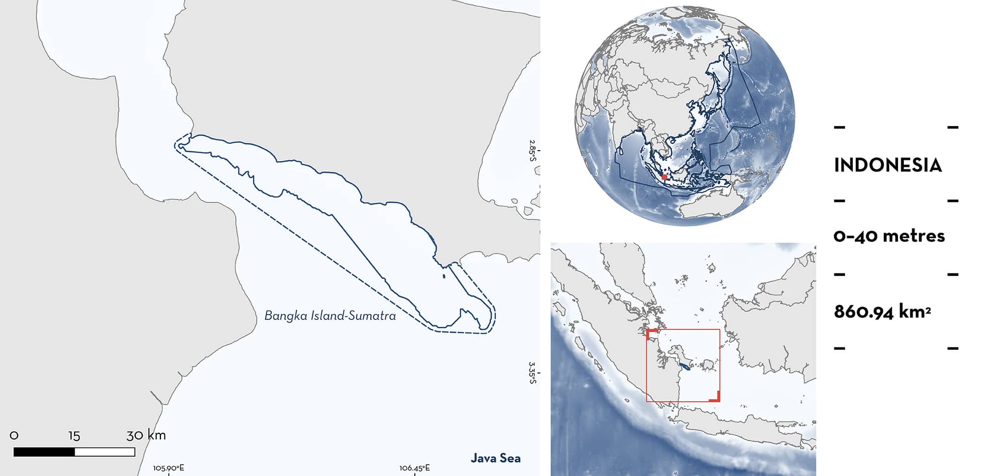
Bangka Island-Sumatra
Summary
Bangka Island-Sumatra is located within the Bangka Strait between the east coast of Sumatra and Bangka Island, Indonesia. This area is characterised by mangrove, coral reef, and seagrass habitats and is influenced by monsoonal climate. Within this area there are: threatened species (e.g., Bottlenose Wedgefish Rhynchobatus australiae) and reproductive areas (e.g., Bowmouth Guitarfish Rhina ancylostomus).
Download factsheet
Bangka Island-Sumatra
DESCRIPTION OF HABITAT
Bangka Island-Sumatra is located within the Bangka Belitung Island province of Indonesia. The area is within the Bangka Strait between Sumatra and Bangka Island. It is characterised by habitats that include coral reefs, mangroves, and seagrass beds (Akbar et al. 2020).
The area is influenced by two monsoon seasons: the northwest monsoon (December–February) and the southeast monsoon (June–August) (Rozirwan et al. 2020). The area has a dry season (June–August) and a wet season (December–February) which influences the sea surface temperature and distribution of biota (Fauziyah et al. 2022).
This Important Shark and Ray Area is benthopelagic and delineated from inshore and surface waters (0 m) to 40 m based on the depth range of the Qualifying Species in the area.
CRITERION A
VULNERABILITY
Two Qualifying Species considered threatened with extinction according to the IUCN Red List of Threatened Species regularly occur in the area. These are the Critically Endangered Bowmouth Guitarfish (Kyne et al. 2019a) and Bottlenose Wedgefish (Kyne et al. 2019b).
CRITERION C
SUB-CRITERION C1 – REPRODUCTIVE AREAS
Bangka Island-Sumatra is an important reproductive area for two ray species.
Between 2019–2021, Bottlenose Wedgefish were recorded from the incidental catch of trawlers operating in the area (Rekam unpubl. data 2024). Of 3,047 records, 429 were classed as neonates/young-of-the-year (YOY) measuring 43–81 cm total length (TL) (Rekam unpubl. data 2024). The neonates/YOY individuals were recorded in 2019 (n = 206), 2020 (n = 140), and 2021 (n = 83). These were determined to be neonates/YOY based on a size-at-birth of 46–50 TL (White & Dharmadi 2007). Catches are made year-round in this area and peak in February (BM Simeon unpubl. data 2024). There is little information globally on the reproductive biology of Bottlenose Wedgefish, highlighting the importance of Bangka Island-Sumatra for the species.
Between 2019–2021, Bowmouth Guitarfish were recorded from the incidental catch of trawlers operating in the area (Rekam unpubl. data 2024). Of 566 records, 78 were classed as neonates/YOY measuring 50–63 cm TL (Rekam unpubl. data 2024). The neonate/YOY individuals were recorded in 2019 (n = 11), 2020 (n = 29), and 2021 (n = 38). These were determined to be neonates/YOY based on a size-at-birth of 46–48 cm TL (Last et al. 2016). Catches are made year-round in this area and peak in February (BM Simeon unpubl. data 2024). There is little information globally on the reproductive biology of Bowmouth Guitarfish, highlighting the importance of Bangka Island-Sumatra for the species.
Download factsheet
SUBMIT A REQUEST
ISRA SPATIAL LAYER REQUEST
To make a request to download the ISRA Layer in either a GIS compatible Shapefile (.shp) or Google Earth compatible Keyhole Markup Language Zipped file (.kmz) please complete the following form. We will review your request and send the download details to you. We will endeavor to send you the requested files as soon as we can. However, please note that this is not an automated process, and before requests are responded to, they undergo internal review and authorization. As such, requests normally take 5–10 working days to process.
Should you have questions about the data or process, please do not hesitate to contact us.


