ISRA FACTSHEETS
ISRA FACTSHEETS
WESTERN INDIAN OCEAN REGION
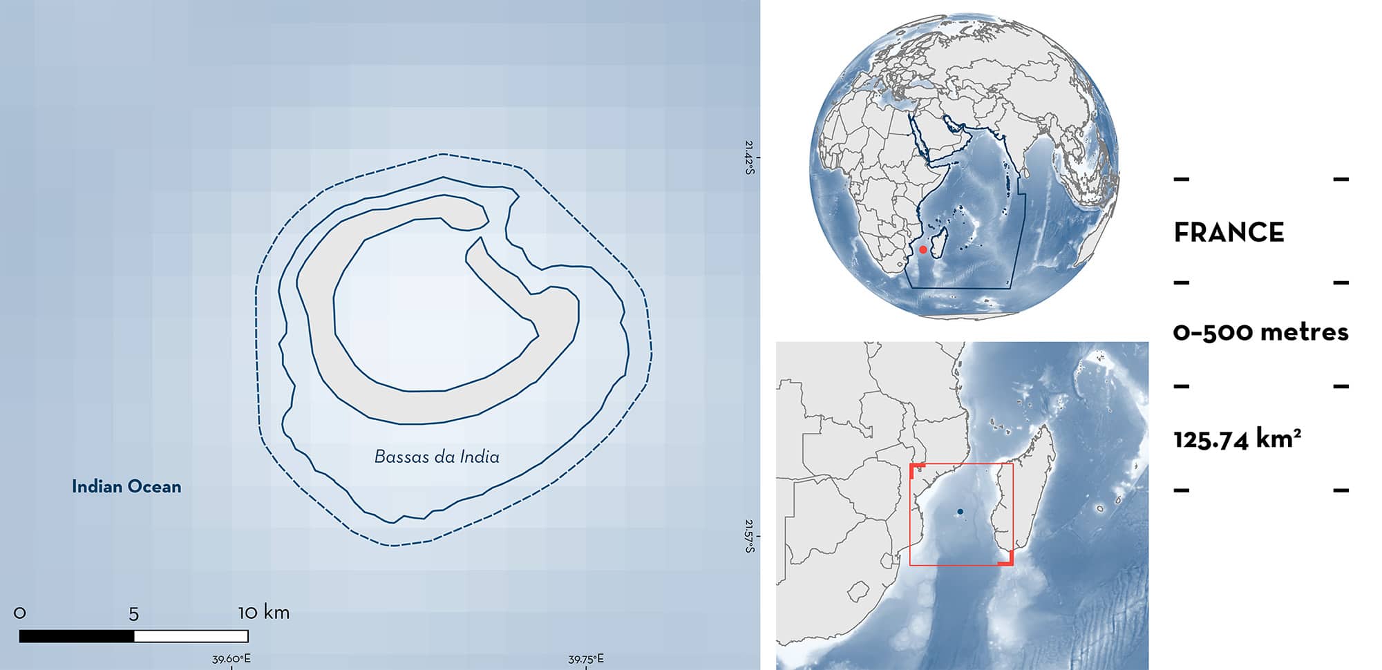
Bassas da India
Summary
Bassas da India is located in the southern Mozambique Channel, halfway between the African continent and Madagascar. It is an uninhabited atoll 110 km northwest of, and separated by deep water from, neighbouring Europa Island. Together with Europa Island, Bassas da India forms the southernmost part of the French Îles Éparses (Scattered Islands). Perched atop an extinct submarine volcano, Bassas da India consists of a hard coral reef surrounding a roughly circular shallow lagoon with a maximum depth of 15 m and includes ten barren rocky islets. The atoll is almost completely submerged at high tide, and the emerged part does not exceed 1 km at low tide. This area encompasses a range of habitats including shallow lagoons with sandy substrate, coral reefs, and pelagic waters. Within this area there are undefined aggregations (Galapagos Shark Carcharhinus galapagensis).
Download factsheet
Bassas da India
DESCRIPTION OF HABITAT
Bassas da India is a coral atoll located in the centre of the southern Mozambique Channel. The area is influenced by eddy systems, including eddy dipoles consisting of a cyclonic and an anticyclonic mesoscale eddy. The rotation of these eddies results in down- and upwelling of water, and warmer and cooler temperatures in the eddy centres, and this transfers nutrients across the thermocline (Bouvy et al. 2016). Further, these eddies reach throughout the water column to at least 1,000 m depth, and as they interact with the continental shelf, they draw nutrients off the slopes and into the water column (Roberts et al. 2014). These eddy dynamics profoundly affect pelagic biological communities including phytoplankton, zooplankton, larger invertebrates, fishes, marine mammals, and birds (Ternon et al. 2014).
Bassas da India is a subcircular atoll ~10 km in diameter with a shallow sandy lagoon. The atoll is surrounded by deep open ocean waters of the southern Mozambique Channel, reaching up to 3,000 m in depth. The climate of Bassas da India can be described as a semi-arid and tropical combination with wet austral summers and dry winters.
Bassas da India has been identified as a Key Biodiversity Area (KBA 2023). The area lies within two Ecologically or Biologically Significant Marine Areas (EBSAs): the Mozambique Channel and The Iles Éparses (CBD 2023a, 2023b).
This Important Shark and Ray Area is benthopelagic and is delineated from inshore and surface waters (0 m) to 500 m based on the depth use of the Qualifying Species in the area.
CRITERION C
SUB-CRITERION C5 – UNDEFINED AGGREGATIONS
Bassas da India is an important area for undefined aggregations of one shark species.
A visual survey in July 2010 identified 34 Galapagos Sharks, of which 32 were seen inside the Bassas da India lagoon (Clarke et al. 2012). They formed loose aggregations, with a maximum of 20 seen in a group. Almost all were visually estimated to be < 150 cm total length (TL), but no further size details were recorded. Based on additional visual observations, several juvenile specimens of 140 cm TL were seen at night outside the reef (van der Elst et al. 2021). At this size class, juvenile Galapagos Sharks tend to leave the shallow protected inshore waters and start to occupy deeper waters (Gausmann, submitted). A photographic expedition to Bassas da India recorded aggregations of Galapagos Sharks in the lagoon during the day (up to three in a frame) and at night when they estimated 30 individuals in an aggregation (up to six in a frame; SOSF 2014). Clarke et al. (2012) termed the site a ‘nursery area’, also based on an earlier study which recorded 54 Galapagos Sharks, including aggregations of up to six individuals, during a survey in October 2003 (Hammerschlag & Fallows 2005). One of these was estimated to be 120 cm TL and 15 others were < 200 cm TL (Hammerschlag & Fallows 2005). The size-at-birth of the species is 57–80 cm TL (Compagno 1984), so without more detailed length estimates, it is unclear whether any of the sharks reported in 2010 were neonates or young-of-the-year, and if this area is important for the reproduction of this species. Further information is required to determine the function of these aggregations.
Download factsheet
SUBMIT A REQUEST
ISRA SPATIAL LAYER REQUEST
To make a request to download the ISRA Layer in either a GIS compatible Shapefile (.shp) or Google Earth compatible Keyhole Markup Language Zipped file (.kmz) please complete the following form. We will review your request and send the download details to you. We will endeavor to send you the requested files as soon as we can. However, please note that this is not an automated process, and before requests are responded to, they undergo internal review and authorization. As such, requests normally take 5–10 working days to process.
Should you have questions about the data or process, please do not hesitate to contact us.


