ISRA FACTSHEETS
ISRA FACTSHEETS
WESTERN INDIAN OCEAN REGION
Bekodoy-Toliara
Summary
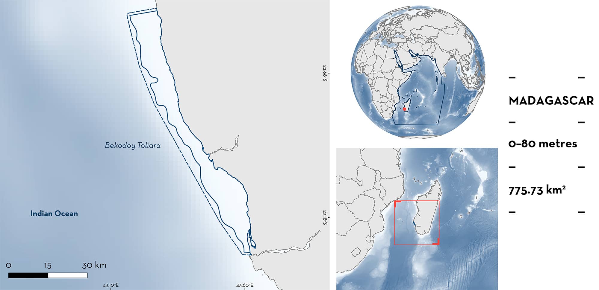
Bekodoy-Toliara is located in the southwest region of Madagascar, stretching ~90 km along the coastline of the Toliara Province. The area contains reef systems made up of fringing and barrier reefs, as well as shallow lagoons hosting patch reefs and seagrass beds. Bekodoy-Toliara is within two Ecologically or Biologically Significant Marine Areas and overlaps the Soriake Marine Protected Area and North Salary Key Biodiversity Area. Within the area there are: threatened species; range restricted species; and reproductive areas (Malagasy Blue-spotted Guitarfish Acroteriobatus andysabini).
Download factsheet
Bekodoy-Toliara
DESCRIPTION OF HABITAT
Bekodoy-Toliara is located on the southwestern coastline of Madagascar. The northern section of the area is characterised by a fringing reef system stretching south, with an 8 km wide lagoon present in the southern section. This lagoon, the Bay of Ranobe, is enclosed by a 32 km long fringing reef and contains numerous patch reefs, seagrass beds, and mangroves at its northern and southern ends. The area falls within the Western and Northern Madagascar marine ecoregion, which is shared only with the Comoros Archipelago (Spalding et al. 2007).
The area is located within the Mozambique Channel and Northern Mozambique Channel Ecologically or Biologically Significant Marine Areas (EBSAs; CBD 2023a, 2023b), the North Salary Marine Protected Area (MPA) Key Biodiversity Area (KBA 2023), and overlaps the Soariake Marine Protected Area, and three Locally Managed Marine Areas (LMMAs) located within the Bay of Ranobe: Ankaranjelita, Massif des Roses, and Vatosoa.
This Important Shark and Ray Area is benthopelagic and is delineated from inshore and surface waters (0 m) to 80 m based on the bathymetry of the area.
CRITERION A
VULNERABILITY
The one Qualifying Species within the area is considered threatened with extinction according to the IUCN Red List of Threatened SpeciesTM. The Malagasy Blue-spotted Guitarfish is assessed as Endangered (Jabado et al. Submitted).
CRITERION B
RANGE RESTRICTED
This area holds the regular presence of the Malagasy Blue-spotted Guitarfish as a resident range restricted species. This species occurs year-round in the area and has been regularly reported from artisanal fishery landing surveys between 2007–2023 (Humber et al. 2017; Ghilardi et al. 2019; Wildlife Conservation Society [WCS] unpubl. data 2023). For example, between 2018–2023 at least 56 Malagasy Blue-spotted Guitarfish were recorded from 14 surveys at a landing site in Salary, south of Bekodoy (mean = 2.4, min = 1, max = 12; WCS unpubl. data 2023). This species only occurs in the Agulhas Current Large Marine Ecosystem and is endemic to Madagascar.
CRITERION C
SUB-CRITERION C1 – REPRODUCTIVE AREAS
Bekodoy-Toliara is an important reproductive area for one ray species.
In the Bay of Ranobe, 226 Malagasy Blue-spotted Guitarfish (formerly referred to as Acroteriobatus leucospilus [Weigmann et al. 2021]) were caught between 2015 and 2018. Of these individuals, 27% were below the size-at-maturity of the species (∼56.5 cm total length [TL]; Weigmann et al. 2021), with eight specimens classified as neonates (∼30 cm TL; Ghilardi et al. 2019). Given the restricted range, and the rarity of landings for this species, records of neonates from this area are considered important.
Of note is that of 239 genetic samples taken from sharks and rays caught in traditional and artisanal fisheries and landed in Antongil Bay in northeast Madagascar between 2001 and 2002, only one sample was attributed to an unknown species of guitarfish (Doukakis et al. 2011), while in Antsiranana in northern Madagascar, 640 sharks and rays were sampled from artisanal fisheries between 2001 and 2004, none of which were guitarfishes (Robinson & Sauer 2013). These studies highlight the importance of this area for the Malagasy Blue-spotted Guitarfish in comparison to other areas of Madagascar.
Download factsheet
SUBMIT A REQUEST
ISRA SPATIAL LAYER REQUEST
To make a request to download the ISRA Layer in either a GIS compatible Shapefile (.shp) or Google Earth compatible Keyhole Markup Language Zipped file (.kmz) please complete the following form. We will review your request and send the download details to you. We will endeavor to send you the requested files as soon as we can. However, please note that this is not an automated process, and before requests are responded to, they undergo internal review and authorization. As such, requests normally take 5–10 working days to process.
Should you have questions about the data or process, please do not hesitate to contact us.


