ISRA FACTSHEETS
ISRA FACTSHEETS
ASIA REGION
Beluran
Summary
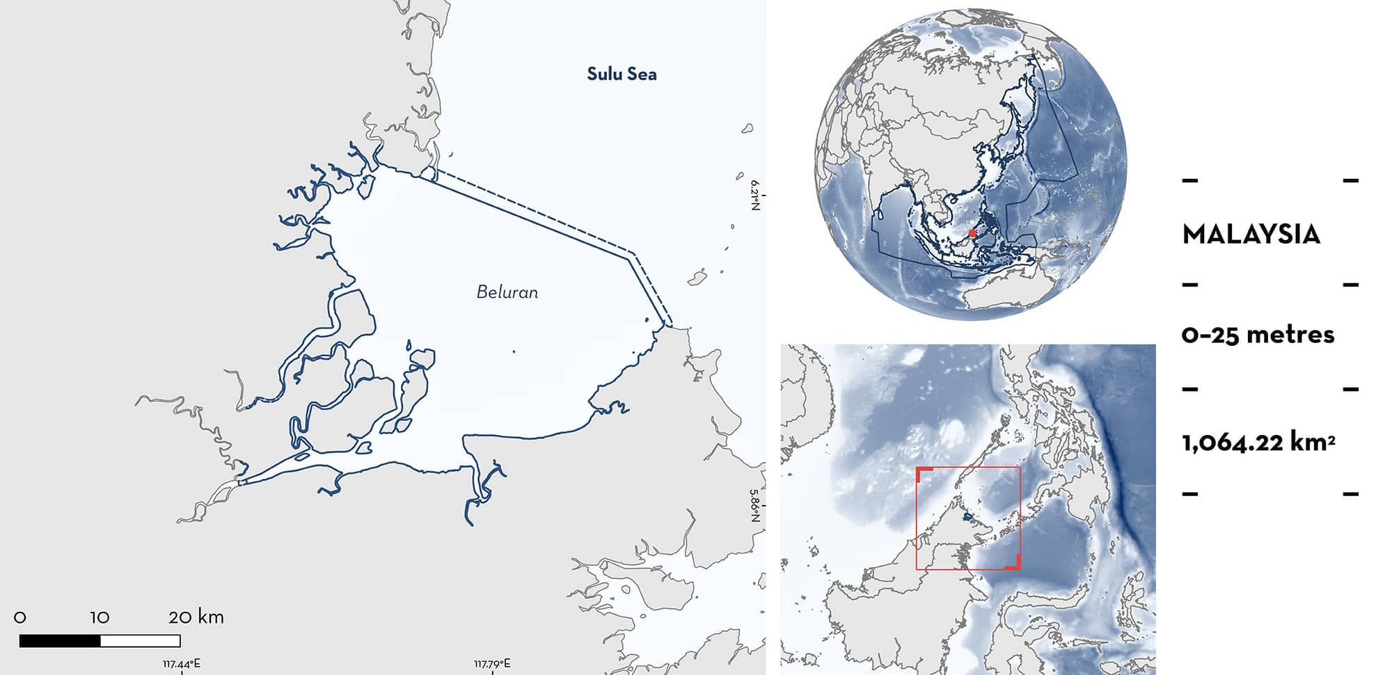
Beluran is a large coastal area near Kanawi island in eastern Sabah, Malaysia. The area is influenced by three rivers emptying into this bay. It is characterised by mangroves along the coast, shallow mudflats, and muddy substrates. Beluran overlaps with the Sulu-Sulawesi Marine Ecoregion Ecologically or Biologically Significant Marine Area. Within this area there are: threatened species and feeding areas (Indonesian Sharpnose Ray Telatrygon biasa).
Download factsheet
Beluran
DESCRIPTION OF HABITAT
Beluran is located north of Sandakan, near Kanawi Island in the eastern region of Sabah, Malaysia. Beluran is located near the mouths of the Sapi, Pimpin, and Klagan Rivers and receives significant freshwater and sediment input. The coastline is dominated by mangroves and mudflats and the deeper trawling area is characterised by muddy substrate, according to the trawl fishers who frequently operate in the region (Ho KC pers. obs. 2024).
During the northeast monsoon from November to March, the eastern region of Sabah, including Beluran, experiences higher rainfall due to the cold air flows from Siberia (Malaysian Meteorological Department 2024). Sandakan, a city located 80 km from Beluran, experiences the highest rainfall in January during the northeast monsoon and the lowest rainfall in May during the monsoonal flow (Asmat et al. 2018). At the eastern coast, surface chlorophyll-a increases in Sandakan waters from October, reaching the maximum in January during the northeast monsoon (Abdul-Hadi et al. 2013).
Beluran overlaps with the Sulu-Sulawesi Marine Ecoregion Ecologically or Biologically Significant Marine Area (EBSA; CBD 2024).
This Important Shark and Ray Area is benthopelagic and is delineated from inshore and surface waters (0 m) to 25 m based on the bathymetry of the area.
CRITERION A
VULNERABILITY
One Qualifying Species within the area is considered threatened with extinction according to the IUCN Red List of Threatened Species. The Indonesian Sharpnose Ray is assessed as Vulnerable (Sherman et al. 2021).
CRITERION C
SUB-CRITERION C2 – FEEDING AREAS
Beluran is an important feeding area for one ray species.
Since 2020 images of incidental catch (i.e., bycatch) events on trawlers have been documented using GPS-linked cameras to identify shark and ray bycatch hotspots (Marine Research Foundation unpubl. data 2024). Cameras were installed on 37 of 1,507 registered trawl vessels in Sabah, Malaysia between 2020-2022. These vessels were monitored for a combined 299 weeks and recorded 5,009 bycatch events across the whole of Sabah between 2020 and 2021. A total of 1,145 individuals were recorded from this area, representing 23% of total records from the whole of Sabah.
Monitored trawlers captured 568 Indonesian Sharpnose Rays across Sabah, constituting 11.3% of the total shark and ray bycatch. The majority of these (395 individuals) were captured within the area, representing 69.5% of the total catch of the species. Capture data suggest a seasonal peak in August, when 156 individuals (39% of total) were caught within Beluran, although further investigation is required to better define their seasonality.
Indonesian Sharpnose Rays feed almost entirely on penaeid shrimps (Lim et al. 2018). The subadults and adults feed mostly on Jinga Shrimp Metapenaeus affinis and Yellow Shrimp M. brevicornis, while juveniles feed on Jinga Shrimp and amphipods. Jinga and Yellow Shrimp juveniles generally occur in high abundance on coastal mudflats (Chong et al. 1990). In Beluran, trawlers target and regularly catch shrimp (Ho KC pers. obs. 2024), showing that prey is abundant in this area. There are mangroves and mudflats in close proximity to slightly deeper water also with a muddy substrate, where the trawlers operate, indicating that this is a good habitat for the whole lifecycle of shrimp prey for Indonesian Sharpnose Rays. Most rays are sub-adults and adults, based on size measurements (Marine Research Foundation unpubl. data 2024), indicating that this is not an area important for the early life stages of the species. It is therefore likely that Indonesian Sharpnose Rays aggregate here to feed on shrimp prey. Trawl fishers frequently capture groups of Indonesian Sharpnose Rays in Beluran. For each haul, fishing vessels typically trawl at ~2 knots for ~5 hours. The trawl length converts to ~ 18.5 km, and with a net mouth width of ~30 m, the estimated total trawling area is ~0.55 km2, however, trawlers often pull the net back and forth over the same area (Marine Research Foundation unpubl. data 2024), further supporting that these are aggregations. Out of 114 hauls with Indonesian Sharpnose Ray bycatch in Beluran, 41 caught three or more individuals, with aggregations ranging from 3 to 61 per haul (Marine Research Foundation unpubl. data 2024).
Download factsheet
SUBMIT A REQUEST
ISRA SPATIAL LAYER REQUEST
To make a request to download the ISRA Layer in either a GIS compatible Shapefile (.shp) or Google Earth compatible Keyhole Markup Language Zipped file (.kmz) please complete the following form. We will review your request and send the download details to you. We will endeavor to send you the requested files as soon as we can. However, please note that this is not an automated process, and before requests are responded to, they undergo internal review and authorization. As such, requests normally take 5–10 working days to process.
Should you have questions about the data or process, please do not hesitate to contact us.


