ISRA FACTSHEETS
ISRA FACTSHEETS
ASIA REGION
Binulbulan Island
Summary
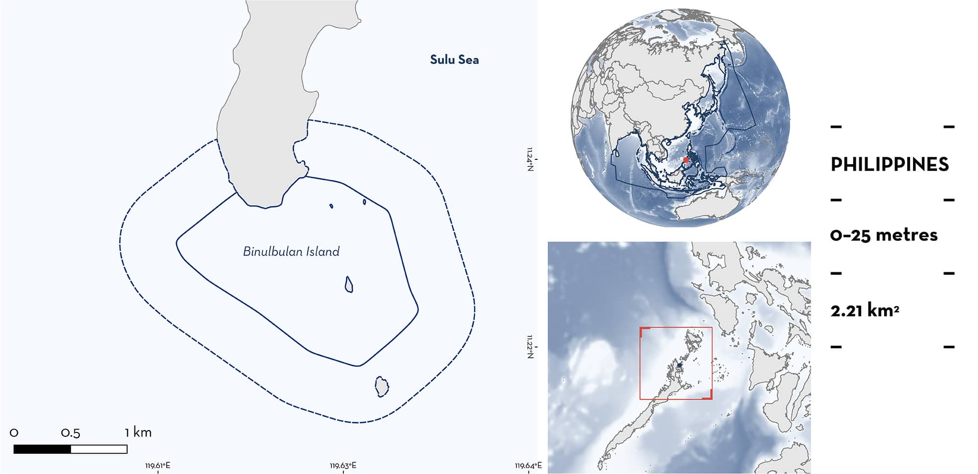
Binulbulan Island is located northeast of Palawan Island in the Sulu Sea, Philippines. This area is located above a sandy shoal. The surface wind of the Sulu Sea is strongly influenced by the East Asian Monsoon System. Vertical upwelling and cold nutrient-rich waters during the northeast winds (boreal winter) increases marine productivity in the area. This area partially overlaps with the Sulu-Sulawesi Marine Ecoregion Ecologically and Biologically Significant Marine Area. Within this area there are: threatened species and undefined aggregations (Reef Manta Ray Mobula alfredi).
Download factsheet
Binulbulan Island
DESCRIPTION OF HABITAT
Binulbulan Island is located northeast of Palawan Island, under the jurisdiction of Linapacan in the province of Palawan in western Philippines. In this area the benthos is composed by a sandy shoal.
The area lies within the Sulu Sea which has a tropical monsoon climate with only two seasons each year: the dry (boreal winter) season that prevails from November to April, and the rainy (summer) season, extending from May to October (Wang et al. 2006). Surface winds in the Sulu Sea are strongly influenced by the East Asian Monsoon System. They blow northeasterly in winter, southwesterly in summer, and are highly variable during transitional periods (Wyrtki 1961). Vertical upwelling and cold nutrient-rich waters are the result of the northeasterly winds (winter season), which increases marine productivity (i.e., phytoplankton blooms) (Wang et al. 2006).
This area partly overlaps with the Sulu-Sulawesi Marine Ecoregion Ecologically or Biologically Significant Marine Areas (EBSA; CBD 2024).
This Important Shark and Ray Area is benthopelagic and is delineated from surface waters (0 m) to 25 m based on the bathymetry of the area.
CRITERION A
VULNERABILITY
One Qualifying Species within the area is considered threatened with extinction according to the IUCN Red List of Threatened Species. The Reef Manta Ray is assessed as Vulnerable (Marshall et al. 2022).
CRITERION C
SUB-CRITERION C5 – UNDEFINED AGGREGATIONS
Binulbulan Island is an important area for undefined aggregations of one ray species.
In the Philippines, sightings of mobulid rays were collated into a national database, using in-water photographs and videos gathered from citizen science and dedicated research efforts. The database covers the period 2004–2020, but consistent monitoring was undertaken between 2017–2019 (Rambahiniarison et al. 2023). From over 7,100 islands in the Philippines, 17 sites with 2,454 sightings and 392 individual Reef Manta Rays were recorded.
Binulbulan Island is one of three sites that together hosted 92% of all identified Reef Manta Rays and accounted for 95% of sightings, highlighting this area as a key location for aggregations of this species. This area was discovered in 2018 and shows trends similar to Ticao Burias Pass which is the largest known aggregation of Reef Manta Rays in the Philippines. Within Binulbulan Island, 398 sightings and 44 individual Reef Manta Rays have been recorded, representing the second most important area for Reef Manta Rays in the Philippines. This area showed the highest resighting rate of all 17 sites surveyed, with 80% of individuals encountered more than once, suggesting evidence of long-term philopatric behaviour (Rambahiniarison et al. 2023).
Surveys were conducted between July 2022 and July 2023 using Remote Underwater Video (RUV) deployed in time-laps mode (1 photo every 5 seconds for 5 days between 6 am and 6 pm) with at least one camera deployed in one of the four contiguous stations (LAMAVE unpubl. data 2024). For this 12-month period, 2,520 sightings were reported in 218 days with an average of 12 ± 10.5 and a maximum of 63 encounters per sampling day. An average of 3 ± 2 unique individuals were recorded per sampling day with a maximum of 11 individuals found in the area at the same time.
Courtship, feeding, and cleaning behaviour has also been observed at this area (Rambahiniarison et al. 2023; LAMAVE unpubl. data 2024), however, further information is needed to understand the function and nature of this aggregation.
Download factsheet
SUBMIT A REQUEST
ISRA SPATIAL LAYER REQUEST
To make a request to download the ISRA Layer in either a GIS compatible Shapefile (.shp) or Google Earth compatible Keyhole Markup Language Zipped file (.kmz) please complete the following form. We will review your request and send the download details to you. We will endeavor to send you the requested files as soon as we can. However, please note that this is not an automated process, and before requests are responded to, they undergo internal review and authorization. As such, requests normally take 5–10 working days to process.
Should you have questions about the data or process, please do not hesitate to contact us.


