ISRA FACTSHEETS
ISRA FACTSHEETS
MEDITERRANEAN AND BLACK SEAS REGION
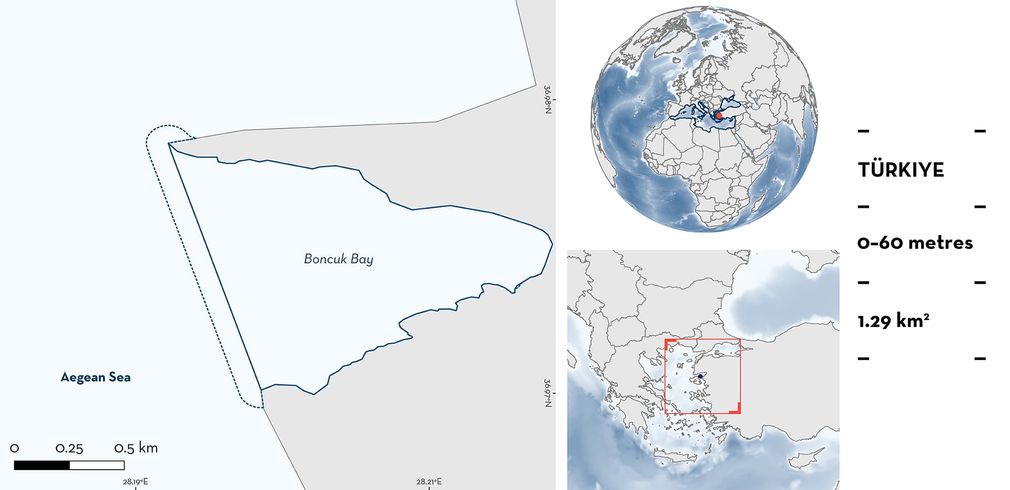
Boncuk Bay
Summary
Boncuk Bay is a sheltered bay in Gökova Gulf, Türkiye, in the Aegean Sea. This area is characterised by shallow sandy and rocky substrates, and seagrass meadows. It overlaps with a marine protected area (Gökova Bay Special Environmental Protection Area) and with the Central Aegean Sea Ecologically or Biologically Significant Marine Area. Within this area there are: threatened species and reproductive areas (Sandbar Shark Carcharhinus plumbeus).
Download factsheet
Boncuk Bay
DESCRIPTION OF HABITAT
Boncuk Bay is located in Türkiye between Bodrum and Datça peninsulas. It is a small and sheltered bay in Gökova Gulf, a long and narrow gulf of the southeastern Aegean Sea. The bay has a pebble beach at its centre and a narrow entrance facing west to the sea. Fresh water flows out of the rocks creating, when the sea is calm, a freshwater film at the surface. A rocky ledge parallel to the coast at 5–6 m depth, slopes to a drop-off reaching the centre of the bay, covered in muddy substrates at 60 m. Its relatively shallow waters have an average depth of 15 m, and the sandy substrate is interspersed with rocky areas. Water temperature varies seasonally ranging, at the surface, from ~16°C in the boreal winter to 29°C in summer (Clò et al. 2002; Öztürk 2006; Bilečenoglu 2008; Ardar et al. 2016; Filiz 2019; Ünal & Kizilkaya 2019).
Boncuk Bay falls within the Gökova Bay Special Environmental Protection Area, established in 1988. It is a designated Marine Protected Area under both national and international legislation and has been a no-take zone since 2010. The area also overlaps with the Central Aegean Sea Ecologically or Biologically Significant Marine Area (CBD 2023), and is within the Datça and Bozburun Peninsula Key Biodiversity Area (KBA 2023).
This Important Shark and Ray Area is benthopelagic and is delineated from inshore and surface waters (0 m) to 60 m based on the bathymetry of the area.
CRITERION A
VULNERABILITY
The one Qualifying Species occurring in the area is considered threatened with extinction according to the IUCN Red List of Threatened Species TM. Sandbar Shark is assessed as Endangered (Rigby et al. 2021).
CRITERION C
SUB-CRITERION C1 – REPRODUCTIVE AREAS
Boncuk Bay is an important reproductive area for one shark species.
Sandbar Sharks have been reported to aggregate in this area since the 1990s and have been studied from 2001–2021 (Clò et al. 2002; Clò & de Sabata 2004; Öztürk 2006; Bilecenoğlu 2008; Filiz & Gulsahin 2015). Aggregations peak between May and June, when groups of up to 7 individuals are sighted at temperatures >20°C (Clò et al. 2002, 2003; Bilecenoğlu 2008; Akça 2010; Filiz & Gulsahin 2015; Filiz 2019). Aggregations are mainly composed of mature individuals with most of them being females. Some of these individuals have been resighted over five consecutive years (Clò & de Sabata 2004; de Sabata et al. 2006; de Sabata & Clò 2007). Many are in advanced stages of pregnancy based on their distended abdomens, and the presence of mating scars has been reported in multiple years (in 2002–2008 and 2013–2017), which indicates that mating is occurring in the area and that these reproductive processes occur regularly (Clò & de Sabata 2004; Öztürk 2006; Bilecenoğlu 2008; Filiz & Gulsahin 2015).
Due to the filming of a Sandbar Shark birth (Clò & de Sabata 2004), and the presence of a few neonates in catches over multiple years, it has also been suggested that this may be a pupping area for the species (Filiz & Gulsahin 2015; Bengil 2020).
Download factsheet
SUBMIT A REQUEST
ISRA SPATIAL LAYER REQUEST
To make a request to download the ISRA Layer in either a GIS compatible Shapefile (.shp) or Google Earth compatible Keyhole Markup Language Zipped file (.kmz) please complete the following form. We will review your request and send the download details to you. We will endeavor to send you the requested files as soon as we can. However, please note that this is not an automated process, and before requests are responded to, they undergo internal review and authorization. As such, requests normally take 5–10 working days to process.
Should you have questions about the data or process, please do not hesitate to contact us.


