ISRA FACTSHEETS
ISRA FACTSHEETS
NEW ZEALAND & PACIFIC ISLANDS REGION
Bounty Plateau
Summary
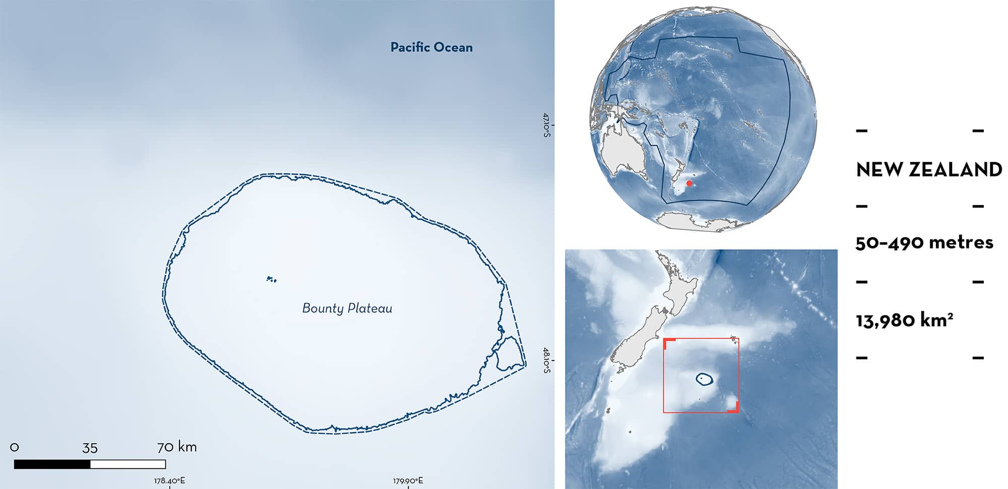
Bounty Plateau is located in southeast New Zealand. The area includes the Bounty Islands, a chain of 13 islands and five islets. It is characterised by an extended shelf near the islands and a steep slope with submarine hills and plains. The area overlaps with the Bounty Islands (nearshore) and Bounty (offshore) Key Biodiversity Areas. Within this area there are: range-restricted species (e.g., Rough Skate Zearaja nasuta).
Download factsheet
Bounty Plateau
DESCRIPTION OF HABITAT
Bounty Plateau is located in southeast New Zealand and sits in the South Pacific Ocean. It is found ~600 km south of the Chatham Islands, ~200 km north of the Antipodes Islands, and ~1,000 km east of New Zealand’s South Island. The area includes the Bounty Islands, a chain of 13 islands and five islets (Scott & Turnbull 2019). It is characterised by an extended shelf near the islands and a steep slope with submarine hills and plains. The area is highly influenced by the Subantarctic Front which includes most of the transport of the Antarctic Circumpolar Current (Chiswell et al. 2015).
The area overlaps with the Bounty Islands (nearshore) and Bounty (offshore) Key Biodiversity Areas (KBA 2024a, 2024b).
This Important Shark and Ray Area is benthic and subsurface and is delineated from 50–490 m based on the bathymetry of the area.
CRITERION B
RANGE RESTRICTED
This area holds the regular presence of the Rough Skate and Pale Ghost Shark as range-restricted species. Between 2000–2024, both species were regularly recorded in commercial longline fisheries (and by on-board observers) operating at depths of 79–489 m and generally targeting Ling Genypterus blacodes (Francis 2015; B Finucci unpubl. data 2024). Both species are endemic to the New Zealand Shelf Large Marine Ecosystem and only occur in New Zealand waters.
For Rough Skate, catches of 569 t were reported by on-board observers and 328 t were recorded by commercial fisheries between 2001–2024. Rough Skates were recorded all years in the area by commercial fisheries and were reported by observers in 13 (2001–2005, 2008–2010, 2013, 2017, 2020, 2022, 2023) of the 24 years (B Finucci unpubl data 2024). Bounty Plateau represents an area where large catches of this species are captured compared to other areas around New Zealand (Ford et al. 2018; B Finucci pers. obs 2024).
For Pale Ghostshark, catches of 160 t were reported by on-board observers and 118 t were recorded by commercial fisheries between 2001–2024. Pale Ghostsharks were reported in all years in the area (B Finucci unpubl. data 2024). Additionally, between 2008–2013, Bounty Plateau had one of the largest catches reported for the species in bottom longline fisheries across all New Zealand (Francis 2015).
Download factsheet
SUBMIT A REQUEST
ISRA SPATIAL LAYER REQUEST
To make a request to download the ISRA Layer in either a GIS compatible Shapefile (.shp) or Google Earth compatible Keyhole Markup Language Zipped file (.kmz) please complete the following form. We will review your request and send the download details to you. We will endeavor to send you the requested files as soon as we can. However, please note that this is not an automated process, and before requests are responded to, they undergo internal review and authorization. As such, requests normally take 5–10 working days to process.
Should you have questions about the data or process, please do not hesitate to contact us.


