ISRA FACTSHEETS
ISRA FACTSHEETS
SOUTH AMERICAN ATLANTIC REGION
A dispute exists between the Governments of Argentina and the United Kingdom of Great Britain and Northern Ireland concerning sovereignty over the Falkland Islands (Islas Malvinas), South Georgia and the South Sandwich Islands (Islas Georgias del Sur e Islas Sandwich del Sur) and the surrounding maritime areas.
Burdwood Bank North Slope
Summary
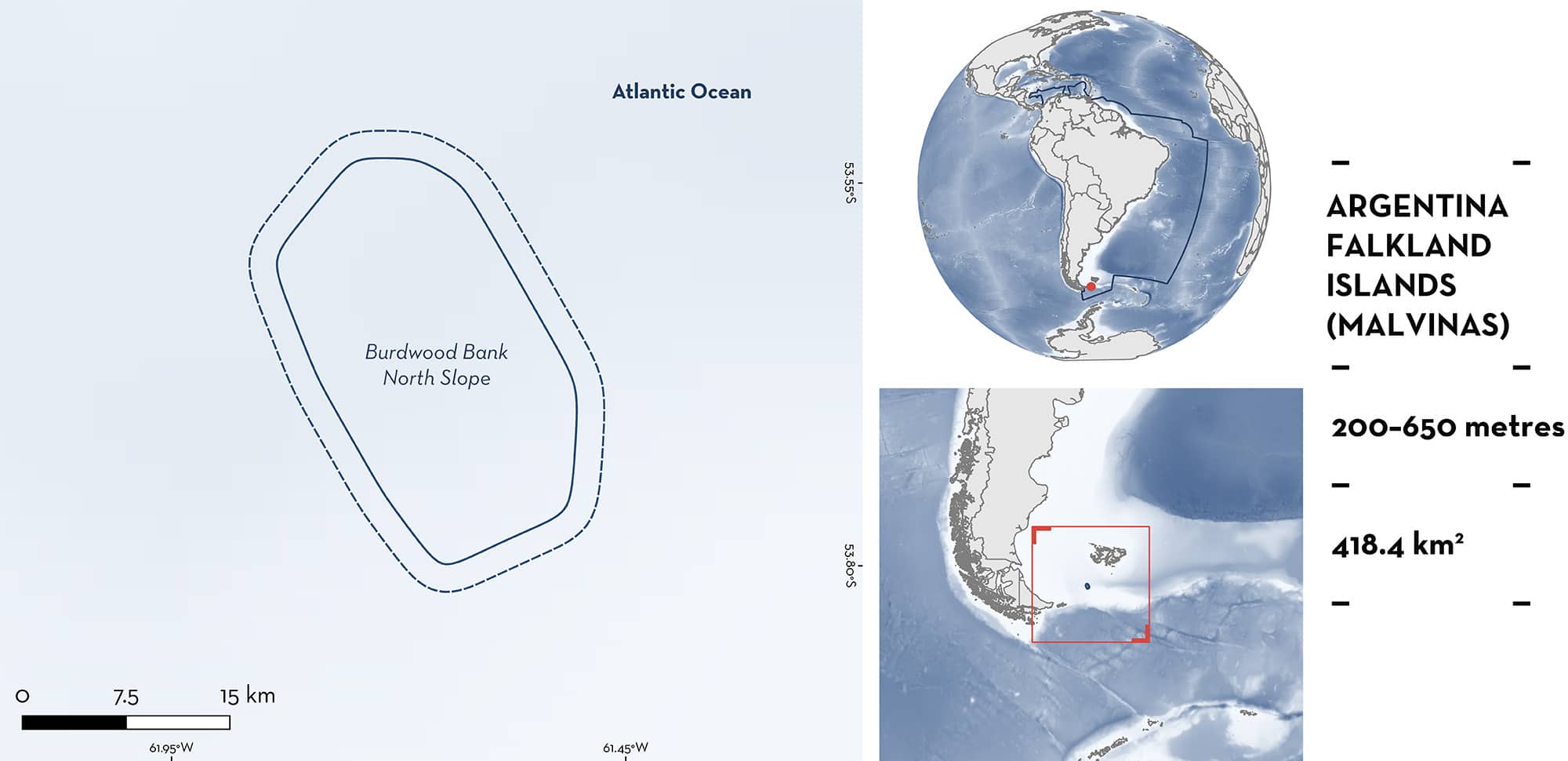
Burdwood Bank North Slope is located on the northwest slope off Burdwood Bank, in the waters of Argentina and Falkland Islands (Malvinas). The habitat is characterised by substrates covered with sponges, stony corals, and bryozoans. The area is influenced by the Antarctic Circumpolar Drift that flows around the Burdwood Bank northwest slope and leads to high primary productivity. Within this area there are: reproductive areas (Southern Thorny Skate Amblyraja doellojuradoi).
Download factsheet
Burdwood Bank North Slope
DESCRIPTION OF HABITAT
Burdwood Bank North Slope is located on the northwest slope off Burdwood Bank, Argentina and Falkland Islands (Malvinas). Burdwood Bank is bordered to the north by the Malvinas Trough, which separates it from the Malvinas Plateau and extends eastward (Guerrero et al. 1999). The habitat is characterised by substrates covered with sponges, stony coral, and bryozoans (Schejter & Bremec 2019). The area is influenced by the Antarctic Circumpolar Drift that flows around the Burdwood Bank northwest slope providing nutrients for high primary productivity (Schejter & Bremec 2019).
This Important Shark and Ray Area is benthic and subsurface and is delineated from 200–650 m based on the bathymetry in the area.
CRITERION C
SUB-CRITERION C1 – REPRODUCTIVE AREAS
Burdwood Bank North Slope is an important reproductive area for one ray species.
High densities of Southern Thorny Skate egg cases are regularly found in the area (Matusevich et al. 2023). Between 2016–2018, four research cruises conducted bottom trawl surveys on the southern portion of the southwest Atlantic at depths of 33–785 m (Matusevich et al. 2023). Sampling employed a small bottom trawl net (50 mm mesh in the wings, and 20 mm in the cod end; horizontal opening 6 m) with trawling durations of 5–20 minutes at speeds of 1.5–5 knots, resulting in a total of 110 fishing hauls. Catch-per-unit-effort (CPUE; individuals/km2) for Southern Thorny Skate egg cases was calculated based on the area swept by survey trawls (Alverson & Pereyra 1969) expressed as egg cases per km2 (egg cases/km2). After taxonomic identification, the number of egg cases per haul for each species captured was recorded (Matusevich et al. 2023).
Between 2016–2018, Southern Thorny Skate egg cases were collected in 4.6% (n = 5) of the hauls. The density of Southern Thorny Skate egg cases ranged between 296–4,322 egg cases/km2 and were only found in the area and surrounding parts of the north slope of Burdwood Bank. However, the highest egg cases density (4,322 egg cases /km2) haul was only captured in this area, between 209–642 m depth (Matusevich et al. 2023). This was the highest value observed for any species during these surveys across the southern portion of the southwest Atlantic (Matusevich et al. 2023).
Download factsheet
SUBMIT A REQUEST
ISRA SPATIAL LAYER REQUEST
To make a request to download the ISRA Layer in either a GIS compatible Shapefile (.shp) or Google Earth compatible Keyhole Markup Language Zipped file (.kmz) please complete the following form. We will review your request and send the download details to you. We will endeavor to send you the requested files as soon as we can. However, please note that this is not an automated process, and before requests are responded to, they undergo internal review and authorization. As such, requests normally take 5–10 working days to process.
Should you have questions about the data or process, please do not hesitate to contact us.


