ISRA FACTSHEETS
ISRA FACTSHEETS
CENTRAL AND SOUTH AMERICAN PACIFIC REGION
Cabo Pulmo
Summary
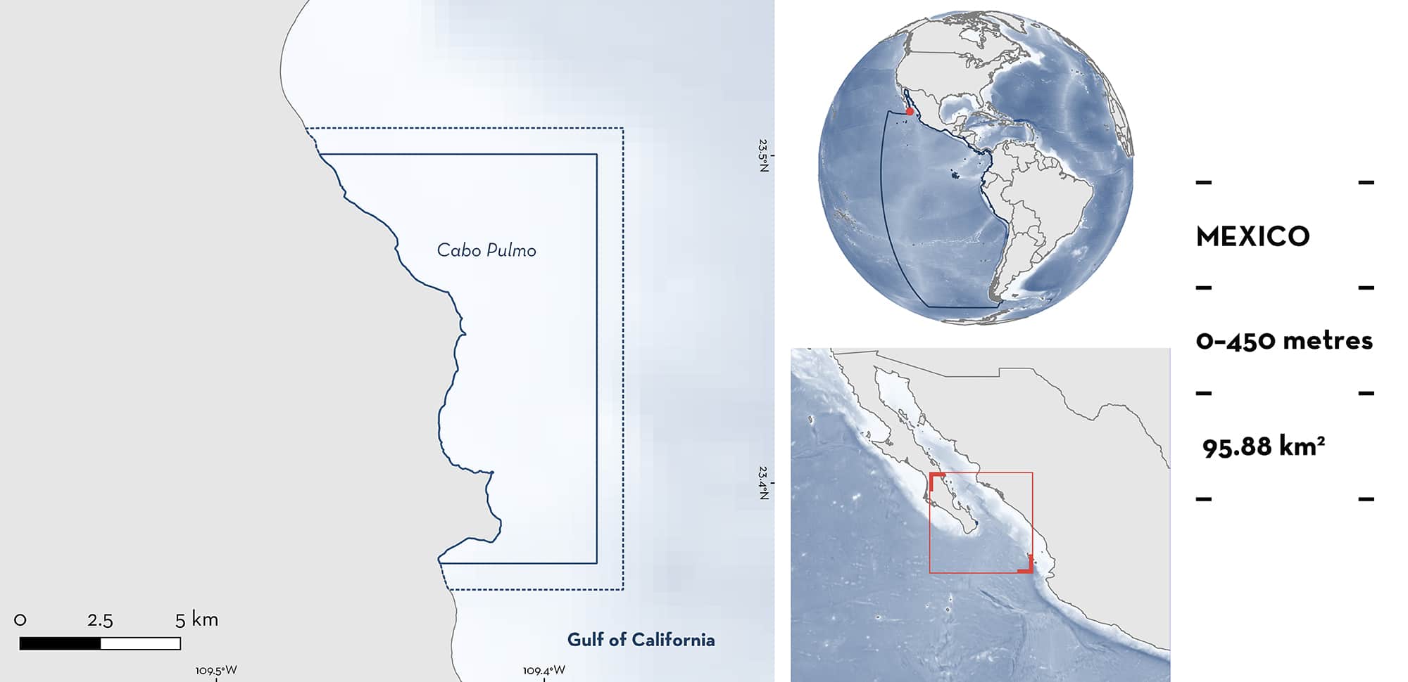
Cabo Pulmo is located in the southern Gulf of California, in the state of Baja California Sur, Mexico. It is considered the northernmost coral reef in the Eastern Pacific. The seabed in this area is mostly coarse sand, although there are some rocky portions. This area includes a Wetland of International Importance (Ramsar site) and the National Park Cabo Pulmo: one of the few fully protected areas in Mexico. Within this area there are: threatened species (e.g., Bull Shark Carcharhinus leucas); reproductive areas (Bull Shark); and undefined aggregations (Blacktip Shark C. limbatus).
Download factsheet
Cabo Pulmo
DESCRIPTION OF HABITAT
Cabo Pulmo is located near the entrance of the Gulf of California in a transitional zone between the tropical and temperate Eastern Pacific within the Baja California Sur state of Mexico. Situated within the Gulf of California Large Marine Ecosystem, this is the latitudinal section with the highest coral abundance and richness in the Gulf of California. It is the northernmost coral reef area in the Eastern Pacific (Brusca & Thomson 1975; Robinson & Thomson 1992; Soto-Mardones et al. 1999). Due to its locality, Cabo Pulmo is also under the influence of the cold waters of the California Current. In the boreal summer and autumn, the currents move in a northward direction, while during the boreal spring they move southward (CONANP 2006). As a result of these variable conditions, patterns of fish community structure are different from other reefs in the same region, in addition to seasonal changes in the assemblages of transient pelagic organisms (Trasviña-Castro et al. 2012). The seabed in this area is mostly coarse sand, although there are some rocky portions.
The protected area in Cabo Pulmo was initially designated as a National Marine Park in 1995, and then in 2000 modified to a National Park. The Cabo Pulmo National Park consists of 71.1 km2, 99% of which is located in the marine zone (CONANP 2006). This area also includes a Wetland of International Importance (Ramsar site), the Parque Nacional Cabo Pulmo (Ramsar 2022).
This Important Shark and Ray area is delineated from inshore and surface waters (0 m) to a depth of 450 m based on the bathymetry of the area.
CRITERION A
VULNERABILITY
Two Qualifying Species considered threatened with extinction according to the IUCN Red List of Threatened SpeciesTM regularly occur in this area. These are the Vulnerable Bull Shark (Rigby et al. 2021b) and Blacktip Shark (Rigby et al. 2021a).
These species are regularly present in this area, according to visual and coastal census, and drone monitoring (Asúnsolo-Rivera 2016; El Saleh 2016; Ayala-Bocos et al. 2018; Perusquia-Ardón 2020; Ayres et al. 2021b).
CRITERION C
SUB-CRITERION C1 – REPRODUCTIVE AREAS
Cabo Pulmo is an important reproductive area for one shark species. Adult female Bull Sharks are regularly observed between November–May (cold season), with fresh mating scars, suggesting that this area could be a mating area (Frida Lara-Lizardi pers. obs. 2022). Acoustic tagging (n = 28) suggests sexual segregation in this area, with females having higher residency than males, especially during December (Lara-Lizardi et al. 2022).
CRITERION C
SUB-CRITERION C5 – UNDEFINED AGGREGATIONS
Cabo Pulmo is an important aggregation area for one shark species. Blacktip Sharks have a seasonal presence from December to April in coastal habitats in the northern part of Cabo Pulmo. Higher abundances have been recorded at sea-surface temperatures < 25°C. Aggregations are composed mostly of adults with aggregation sizes between 7–1,229 individuals (El-Saleh 2016; Ayres et al. 2021a; Ayres 2022) which is greater than in other areas (Ayres et al. 2021a). The purpose of these aggregations is currently unknown. However, there are reports of females with recent mating scars, so this area may be used for mating purposes (Asúnsolo-Rivera 2016).
Download factsheet
SUBMIT A REQUEST
ISRA SPATIAL LAYER REQUEST
To make a request to download the ISRA Layer in either a GIS compatible Shapefile (.shp) or Google Earth compatible Keyhole Markup Language Zipped file (.kmz) please complete the following form. We will review your request and send the download details to you. We will endeavor to send you the requested files as soon as we can. However, please note that this is not an automated process, and before requests are responded to, they undergo internal review and authorization. As such, requests normally take 5–10 working days to process.
Should you have questions about the data or process, please do not hesitate to contact us.


