ISRA FACTSHEETS
ISRA FACTSHEETS
CENTRAL AND SOUTH AMERICAN PACIFIC REGION
Cabo San Lucas
Summary
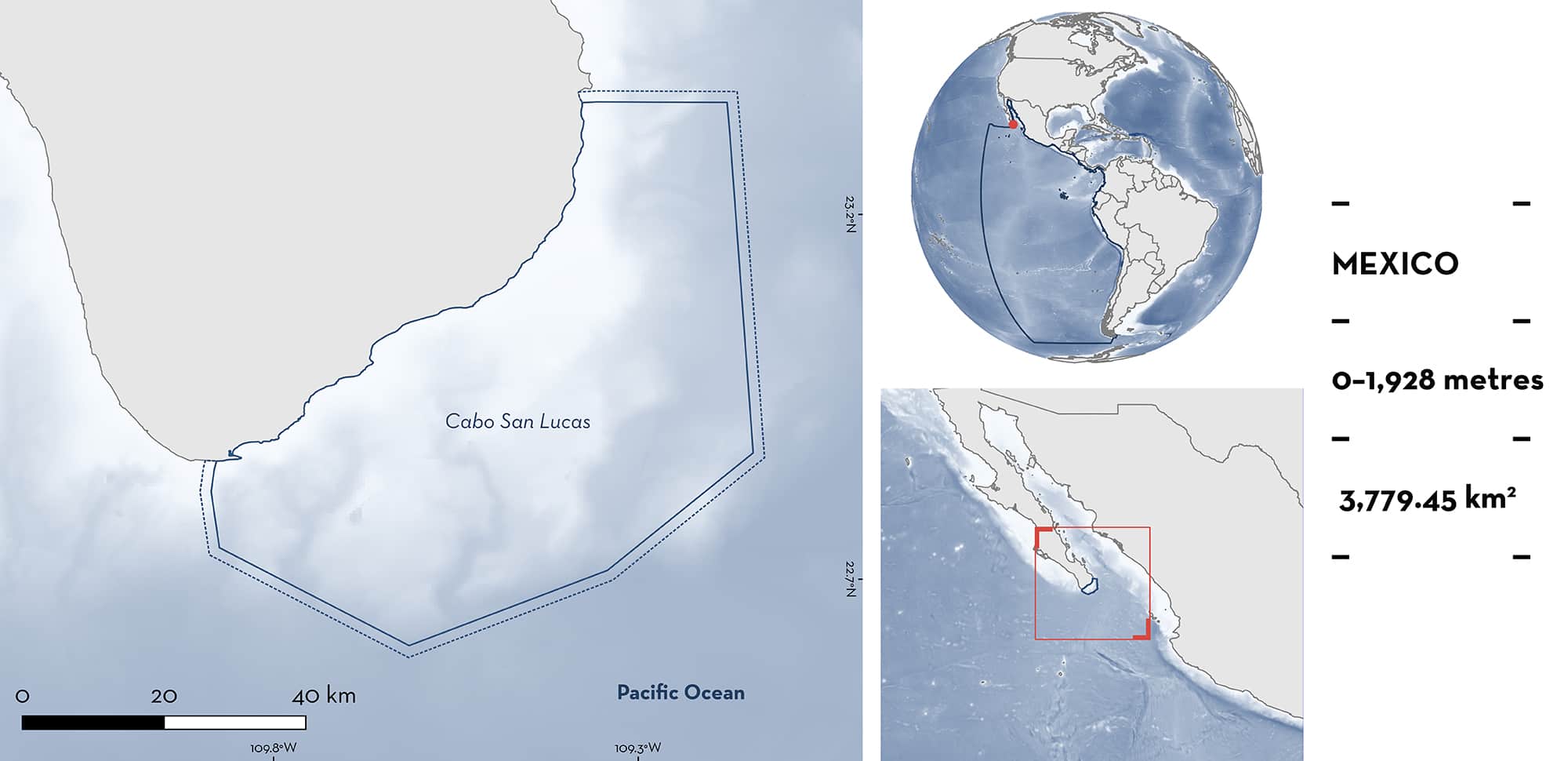
Cabo San Lucas is located at the tip of the Baja California Peninsula in Mexico. The area includes one protected area, the Protection Area of Fauna and Flora Cabo San Lucas. The coastal landscape around Cabo San Lucas is a succession of sandy beaches, rocky cliffs, and mangrove ecosystems. The continental shelf in the area is narrow with the continental slope rapidly descending to 1,000 m depth towards an area of canyons, such as the San Lucas submarine canyon and the Vinorama canyon that ends in the Banco Gordo seamount. Within this area there are: threatened species (e.g., Silky Shark Carcharhinus falciformis); areas important for movement (e.g., Spinetail Devil Ray Mobula mobular); and undefined aggregations (e.g., Whale Shark Rhincodon typus).
Download factsheet
Cabo San Lucas
DESCRIPTION OF HABITAT
Cabo San Lucas is located on the tip of the Baja California Peninsula in Baja California Sur state, Mexico. It has a narrow continental shelf that quickly reaches depths greater than 1,000 m. Situated within the Gulf of California Large Marine Ecosystem, this area contains prominent submarine canyons, including the San Lucas and Vinorama canyons, and the Banco Gordo seamount. Within this area, three water masses converge: cold water with lower salinity (~34 ppt) from the California Current; temperate water with medium salinity (~34.5 ppt) from the Eastern Tropical Pacific; and warm water with higher salinity (~34.9 ppt) from the Gulf of California. The sea surface temperature varies from 20°C in winter to 30°C in summer (Fiedler & Talley 2006; CONANP 2012; Mascareño-Suárez 2019). This area includes one protected area, the Protection Area of Fauna and Flora Cabo San Lucas (CONANP 2012).
This Important Shark and Ray Area is delineated from inshore and surface waters (0 m) to a depth of 1,928 m based on the maximum depth of the Qualifying Species.
CRITERION A
VULNERABILITY
Three Qualifying Species considered threatened with extinction according to the IUCN Red List of Threatened SpeciesTM regularly occur in the area. Threatened sharks comprise the Endangered Whale Shark (Pierce & Norman 2016) and the Vulnerable Silky Shark (Rigby et al. 2021); threatened rays comprise the Endangered Spinetail Devil Ray (Marshall et al. 2022).
Additionally, Whale Shark is listed as ‘Threatened’ and Spinetail Devil Ray as ‘Subject to special Protection’ in the Official Mexican Standard NOM-059-SEMARNAT-2010 for wildlife protection (DOF 2010).
CRITERION C
SUB-CRITERION C4 – MOVEMENT
Cabo San Lucas is an important area for the movement of two shark and one ray species.
Tracking data show that Silky Sharks move to this area near the coast during the boreal summer and autumn as part of their migrations to other areas in the Mexican Pacific, such as Revillagigedo Archipelago and the coasts of Sinaloa and Nayarit (Ketchum et al. 2020; J. Ketchum unpubl. data 2022).
Satellite tracking shows that adult and juvenile Whale Sharks move to Cabo San Lucas and Banco Gordo from Bahía La Paz during boreal spring and summer. Based on satellite telemetry and photo-identification, the movements of adult females from Banco Gordo (that were presumedly pregnant) to Revillagigedo Archipelago and back have been recorded (Eckert & Stewart 2001; Ramírez-Macias et al. 2012, 2017; SEMARNAT 2018; Ketchum et al. 2020).
Spinetail Devil Rays (n = 13) tagged with satellite transmitters between 2004–2008 showed movements from the area of La Paz to areas near Cabo San Lucas during summer (June–August) (Croll et al. 2012).
CRITERION C
SUB-CRITERION C5 – UNDEFINED AGGREGATIONS
Cabo San Lucas is an important area for undefined aggregations of two shark species.
The presence of adult female Silky Shark aggregations was reported from the waters around Banco Gordo during the boreal summer 2021. Out of the 210 observed females, 63 presented recent mating scars (Whitehead et al. 2022) which suggests that this area is used for mating. However, more evidence confirming that mating occurs within the area is needed.
Aggregations of Whale Sharks around the seamounts near Cabo San Lucas are recorded between April–June. These are composed mostly of large females (9–15 m total length [TL]), most are thought to be pregnant based on distended abdomens (Ramírez-Macías et al. 2017; SEMARNAT 2018). However, additional information to confirm their reproductive state is needed. Furthermore, juvenile Whale Sharks aggregate in Cabo San Lucas for unknown purposes, however, they are known to aggregate for feeding purposes in nearby La Paz.
Download factsheet
SUBMIT A REQUEST
ISRA SPATIAL LAYER REQUEST
To make a request to download the ISRA Layer in either a GIS compatible Shapefile (.shp) or Google Earth compatible Keyhole Markup Language Zipped file (.kmz) please complete the following form. We will review your request and send the download details to you. We will endeavor to send you the requested files as soon as we can. However, please note that this is not an automated process, and before requests are responded to, they undergo internal review and authorization. As such, requests normally take 5–10 working days to process.
Should you have questions about the data or process, please do not hesitate to contact us.


