ISRA FACTSHEETS
ISRA FACTSHEETS
SOUTH AMERICAN ATLANTIC REGION
Canelones-Maldonado
Summary
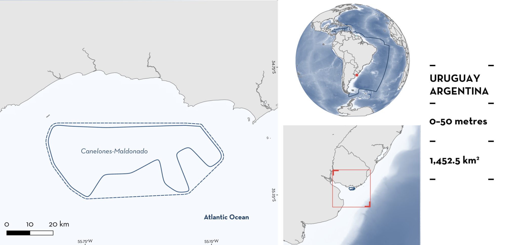
Canelones-Maldonado is located off the coast of Canelones and Maldonado departments in Uruguay. The area is situated in the Joint Regime Area of Argentina and Uruguay and sits on the continental shelf around the La Plata River. It is characterised by turbid waters and sandy substrates with mud patches. The area is influenced by vertical stratification in salinity due to the Rio de la Plata plume. Within this area there are: threatened species and range-restricted species (Angular Angelshark Squatina guggenheim).
Download factsheet
Canelones-Maldonado
DESCRIPTION OF HABITAT
Canelones-Maldonado is located off the coast of Canelones and Maldonado departments in Uruguay. The area is situated in the Joint Regime Area of Argentina and Uruguay (Flanders Marine Institute 2023). It sits on the continental shelf around La Plata River. It is characterised by turbid waters and sandy substrates with mud patches. The area is influenced by a vertical stratification in salinity, which can vary from 15–30 ppt depending on wind force and freshwater discharge (Jaureguizar et al. 2003). Mean bottom water temperature is 20°C during the warm period (December–March) and 10–12°C during the cold period (June–September). During each period, estuarine waters are almost fully thermally homogeneous both vertically and horizontally (Guerrero et al. 1997). Other environmental conditions, such as salinity and turbidity are highly influenced by neighbouring surface marine currents (Brazil Current and Patagonic Coastal Current) (Jaureguizar et al. 2016). The location of the Rio de la Plata plume (i.e., freshwater with high turbidity) across the South Atlantic Coastal System exhibits important and significant seasonal and inter-annual variation. This variation is associated not only with the interaction between the shelf water masses and the discharge pattern of the plume but is also highly influenced by wind seasonality (Jaureguizar et al. 2023).
This Important Shark and Ray Area is benthic and pelagic and is delineated from inshore and surface waters (0 m) to 50 m based on the bathymetry of the area
CRITERION A
VULNERABILITY
One Qualifying Species considered threatened with extinction according to the IUCN Red List of Threatened Species regularly occurs in the area. This is the Endangered Angular Angelshark (Oddone et al. 2019).
CRITERION B
RANGE RESTRICTED
Canelones-Maldonado holds the regular and predictable presence of the Angular Angelshark as a resident range-restricted species. This species is reported from the area in research fisheries surveys and commercial fisheries monitoring (CTMFM 2018; Elisio et al. 2021). Records of Angular Angelshark from this area are highest compared to other areas along the Uruguayan coast highlighting its importance. The Angular Angelshark is distributed across the Patagonian Shelf and the South Brazil Shelf Large Marine Ecosystems.
Between 2011–2016, recurrent high abundances of Angular Angelshark were captured in the Uruguayan fishing fleet operating in the area. Captures of more than 200 kg of individuals per fishing set (equivalent to 88 adults, with an average weight of 2.26 kg per individual; R Vögler unpubl. data 2025) were recorded in the commercial trawl fishery (CTMFM 2018). Additionally, in November–December 2019, 95 bottom trawl hauls were conducted along the northern coast of Argentina (northward from El Rincon) and Uruguay (Elisio et al. 2021). Trawls lasted 15 min at a speed of four knots. The net had a stretched mesh size of 120 mm. Relative abundance was estimated as the number of individuals per nautical mile (ind/nm2). During this survey, this area has the highest estimated abundance of Angular Angelsharks across all life stages (456–1,563 ind/nm2), encompassing five of the ten hauls with these abundances along the coast of Uruguay (Elisio et al. 2021).
Download factsheet
SUBMIT A REQUEST
ISRA SPATIAL LAYER REQUEST
To make a request to download the ISRA Layer in either a GIS compatible Shapefile (.shp) or Google Earth compatible Keyhole Markup Language Zipped file (.kmz) please complete the following form. We will review your request and send the download details to you. We will endeavor to send you the requested files as soon as we can. However, please note that this is not an automated process, and before requests are responded to, they undergo internal review and authorization. As such, requests normally take 5–10 working days to process.
Should you have questions about the data or process, please do not hesitate to contact us.


