ISRA FACTSHEETS
ISRA FACTSHEETS
SOUTH AMERICAN INLAND WATERS
Catalão Lake
Summary
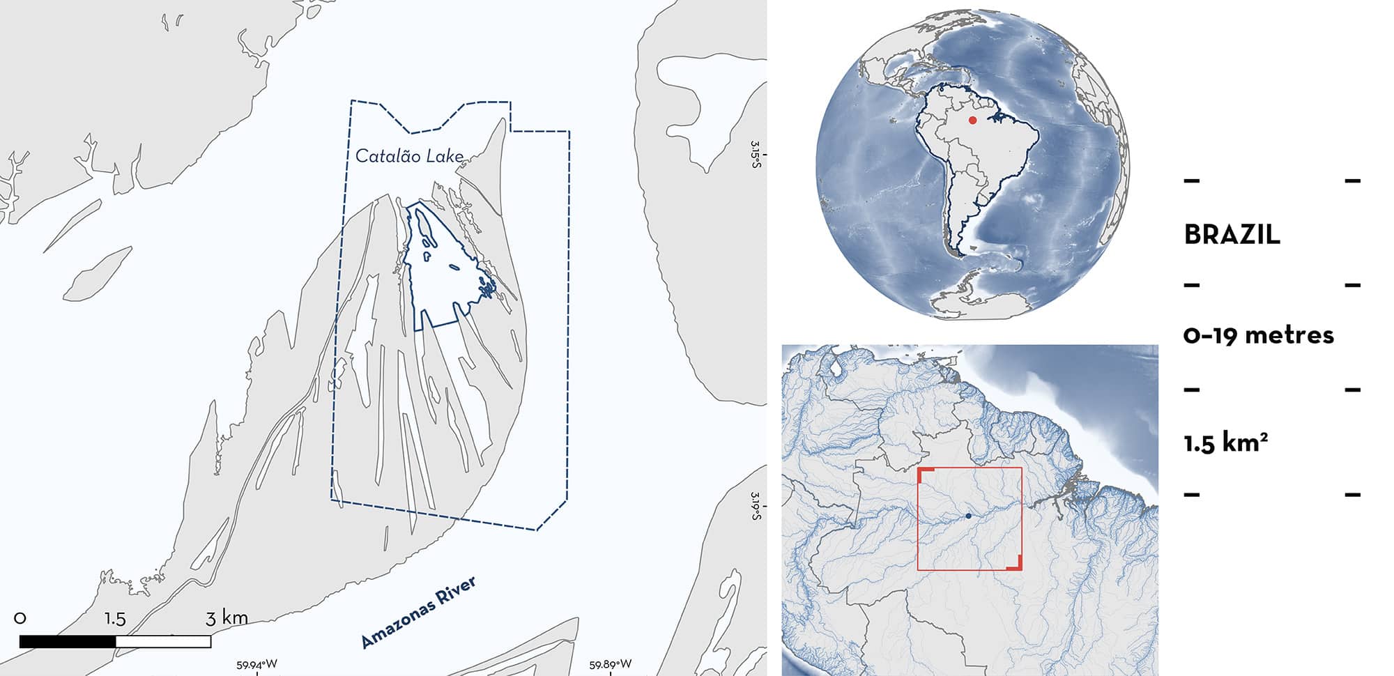
Catalão Lake is located at the confluence of the Solimões and Negro rivers, in the Amazonas state of Brazil. This floodplain lake experiences significant water level fluctuations due to seasonal flooding. This area overlaps with the Regional Center Rio Negro Ramsar Site. Within this area there are: reproductive areas (Ocellate Freshwater Stingray Potamotrygon motoro).
Download factsheet
Catalão Lake
DESCRIPTION OF HABITAT
Catalão Lake is located at the confluence of the Solimões and Negro rivers, in the municipality of Iranduba, Amazonas State, Brazil. This floodplain lake experiences significant water level fluctuations due to seasonal flooding from the Amazon River. The water in the lake is turbid and sediment-rich (Shibuya & Duncan 2022).
The maximum and minimum water level of the lower Rio Negro, where this area is located, occurs in June and October–November, respectively (Graca et al. 2025). The typical depth in the lake during the low-water season is between 17–19 m, while levels under 17 m occur in abnormally dry years (Bittencourt & Amadio 2007). In moderately or strongly dry years, Catalão Lake can maintain a narrow and shallow channel connecting to the Negro River or can become completely disconnected from the river (Röpke et al. 2018).
This area overlaps the Rio Negro Ramsar Site (Ramsar 2025).
This Important Shark and Ray Area is benthic and is delineated from surface waters (0 m) to 19 m based on the bathymetry of the area.
CRITERION C
SUB-CRITERION C1 – REPRODUCTIVE AREAS
Catalão Lake is an important reproductive area for one ray species.
Two field surveys were conducted in October 2014 and November 2015 (Shibuya & Duncan 2022). A total of 20 Ocellate Freshwater Stingrays (9 females, 11 males) were captured using bottom longlines over muddy substrate, with 10 individuals caught during each sampling year. Body sizes ranged between 25.5–50 cm disc width (DW) for females, and 25–48 cm DW for males. As size-at-maturity for this species is ~25 cm DW, all individuals were considered mature (Last et al. 2016). Bite wounds on the surface of the pectoral fins (i.e., those which could be clearly identified as bites and abrasion marks) were reported for 10 specimens (4 females, 6 males) with a total of 128 wounds for all specimens assessed (Shibuya & Duncan 2022). This high number of bite wounds on the posterior quadrants compared to the anterior quadrants of females supports previous findings that males grasp the females near the cloaca during pre-copulatory behaviour (Chapman et al. 2003; Arnés-Urgellés et al. 2018; McCallister et al. 2020). Males had a large amount of bite wounds, distributed randomly throughout the body, while females had more bite wounds on the posterior region. The higher number of wounds in males is assumed to indicate aggressive interactions among males in competition for females, caused by attempts to prevent other males from mating with the target female (Shibuya & Duncan 2022). The behaviour is likely due to the confinement of the rays in the lake during the low-water period (Shibuya & Duncan 2022). These observations are mostly related to copulatory behaviour, as Ocellate Freshwater Stingrays reproduce in the low-water period (Charvet-Almeida et al. 2005). Furthermore, one of the animals captured in 2014 was a pregnant female with embryos, which supports the importance of this area for reproductive purposes (Shibuya & Duncan 2022).
Download factsheet
SUBMIT A REQUEST
ISRA SPATIAL LAYER REQUEST
To make a request to download the ISRA Layer in either a GIS compatible Shapefile (.shp) or Google Earth compatible Keyhole Markup Language Zipped file (.kmz) please complete the following form. We will review your request and send the download details to you. We will endeavor to send you the requested files as soon as we can. However, please note that this is not an automated process, and before requests are responded to, they undergo internal review and authorization. As such, requests normally take 5–10 working days to process.
Should you have questions about the data or process, please do not hesitate to contact us.


