ISRA FACTSHEETS
ISRA FACTSHEETS
MEDITERRANEAN AND BLACK SEAS REGION
Cervia-Marina di Ravenna
Summary
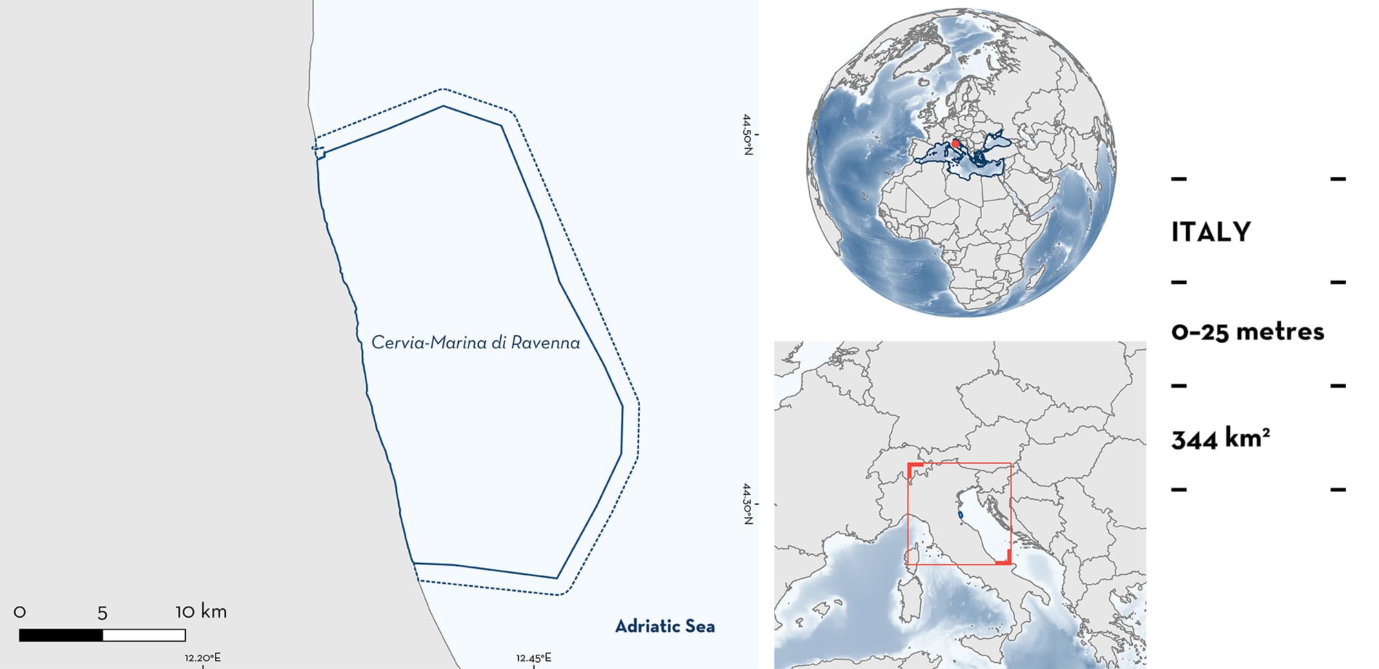
Cervia-Marina di Ravenna is located on the continental shelf of the northwest Adriatic Sea. The area is located between the cities of Cervia and Marina di Ravenna (Emilia-Romagna) in Italy. It is characterised by shallow depths, a muddy-sandy seafloor, and productive waters due to the presence of the Po River plume. The area has calm waters as it lies in the lee of the main wind-driven southward current. In this area there are: threatened species and reproductive areas (Sandbar Shark Carcharhinus plumbeus).
Download factsheet
Cervia-Marina di Ravenna
DESCRIPTION OF HABITAT
Cervia-Marina di Ravenna is located between the cities of Cervia and Marina di Ravenna (Emilia-Romagna) in Italy. The area is part of the northern Adriatic Sea, a Mediterranean sub-basin with a highly seasonal variation in biotic and abiotic factors which influence the seasonal movement, distribution, and abundance of many marine species. The strong influence of the Po River plume results in low salinity, low water temperature (but see below), and high productivity (Fonda Umani 1996; Marini et al. 2008; Lipizer et al. 2014). The region has been recognised as one of high marine productivity at several trophic levels from phytoplankton to fishes (Fonda Umani 1996). Cervia-Marina di Ravenna is characterised by shallow water (0–25 m depth) and a muddy-sandy seafloor. During the boreal summer, it is warmer (up to 28°C) and calmer than adjacent areas as it lies in the lee of the main wind-driven southward current.
The area falls within the Northern Adriatic Ecologically and Biologically Significant Marine Area (EBSA) (CBD 2023) and overlaps with a biological protection zone (zona a tutela biologica), established after the construction of natural gas platforms and semi-buried pipelines where only the use of passive fishing gear is allowed.
This Important Shark and Ray Area is benthopelagic and is delineated from inshore and surface waters (0 m) to 25 m based on the occurrence of the Qualifying Species and the bathymetry of the area.
CRITERION A
VULNERABILITY
The one Qualifying Species within the area is considered threatened with extinction according to the IUCN Red List of Threatened SpeciesTM. The Sandbar Shark is assessed as Endangered (Rigby et al. 2021).
CRITERION C
SUB-CRITERION C1 – REPRODUCTIVE AREAS
This area contains a high density of neonate Sandbar Sharks during the main pupping season, starting from mid-summer (July) until the end of summer (September). During surveys of a small-scale fishery operating in this area from 2019 until 2021, a predictable seasonal presence of neonate and a smaller number of young-of-the-year (YOY) Sandbar Sharks were observed as bycatch of gillnet fisheries. The majority of individuals were recorded with a fresh open, or partially open, umbilical scar (i.e., neonates).
Each year, data collection was undertaken daily in July and August. Daily landings from a number of fishers were surveyed each year (n = 7 fishers in 2019; n = 5 fishers in 2020; n = 6 fishers in 2021). The total number of surveyed Sandbar Sharks caught within the area was 20 (19 neonate and 1 YOY) in 2019, 14 (13 neonate and 1 YOY) in 2020 (Barbato 2022), and 20 neonates in 2021 (M. Barbato unpubl. data 2023). The size range of observed neonate and YOY were between 47 and 67 cm total length (TL), around the reported size-at-birth range of the species (56–75 cm TL; Ebert & Dando 2021).
Before the month of July, the small-scale fishery uses pots (i.e., traps) for cuttlefish. Then, the fishery switches gear to gillnets targeting demersal fish from July until September/October (depending on the season and weather conditions). According to local ecological knowledge of fishers operating in the area, Sandbar Sharks are frequently accidentally captured only in this area and these catches gradually decrease in frequency and become sporadic in the autumn (M. Barbato unpubl. data 2023). No presence of neonate and YOY has been reported with such high density in other areas of the northwest Adriatic Sea (Barbato 2022).
Download factsheet
SUBMIT A REQUEST
ISRA SPATIAL LAYER REQUEST
To make a request to download the ISRA Layer in either a GIS compatible Shapefile (.shp) or Google Earth compatible Keyhole Markup Language Zipped file (.kmz) please complete the following form. We will review your request and send the download details to you. We will endeavor to send you the requested files as soon as we can. However, please note that this is not an automated process, and before requests are responded to, they undergo internal review and authorization. As such, requests normally take 5–10 working days to process.
Should you have questions about the data or process, please do not hesitate to contact us.


