ISRA FACTSHEETS
ISRA FACTSHEETS
CENTRAL AND SOUTH AMERICAN PACIFIC REGION
Chilean Humboldt Kelp Forest
Summary
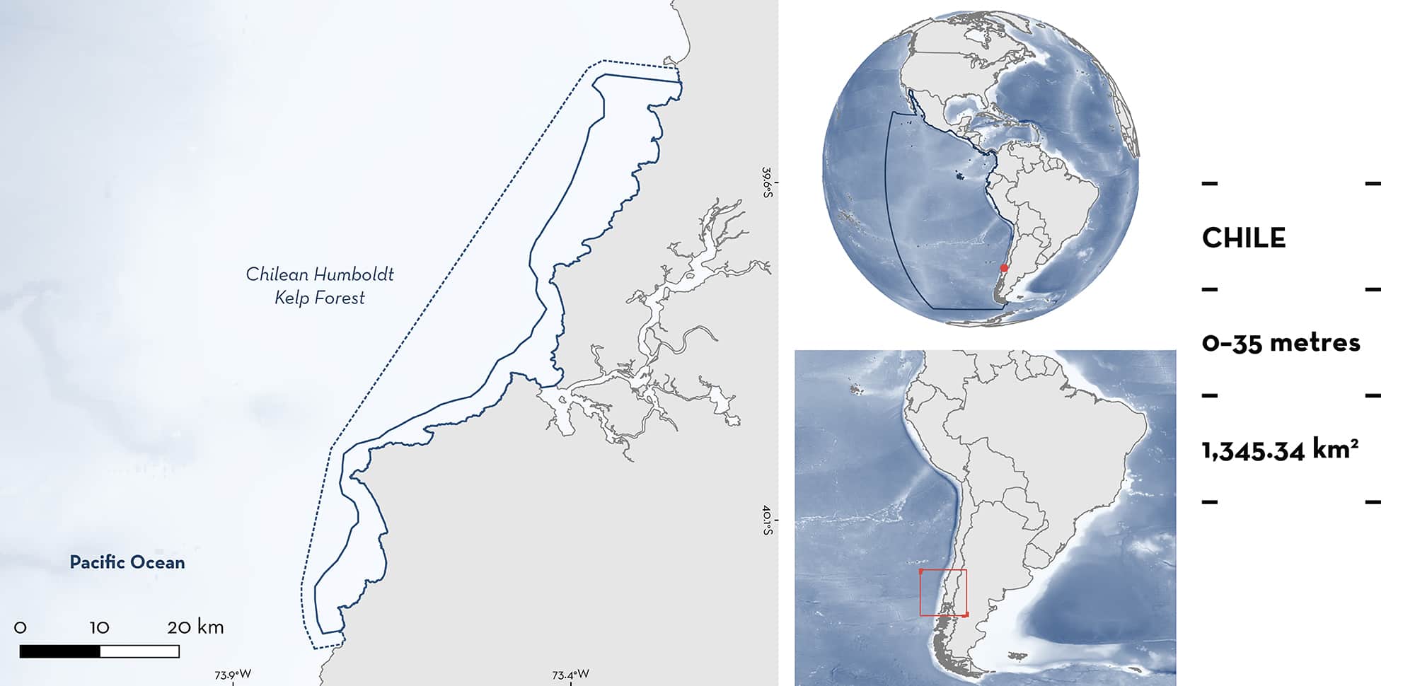
Chilean Humboldt Kelp Forest is located in the coastal region of Los Rios in south-central Chile, in the Southeast Pacific. Oceanographic conditions allow kelp forests to thrive with cold and nutrient-rich waters drawn to the surface by coastal upwelling. Kelp forests are mainly composed of one range-restricted intertidal or subtidal kelp species Lessonia trabeculata in a habitat dominated by large rocks and boulders. This creates structurally complex habitat that sustains high biodiversity. Within this area there are reproductive areas (Chilean Catshark Schroederichthys chilensis).
Download factsheet
Chilean Humboldt Kelp Forest
DESCRIPTION OF HABITAT
Chilean Humboldt Kelp Forest is located in the coastal region of Los Rios in south-central Chile, in the Southeast Pacific. Situated within the Humboldt Current Large Marine Ecosystem, this area is associated with kelp forests that exist across the Humboldt Current System (HCS) and is characterised by high productivity (Chavez et al. 2008). At the coastal edge of the HCS, where the kelp forests are found, upwelling, whether seasonal or constant, promotes high biological productivity (Montecino & Lange 2009). The HCS is affected by several spatial/temporal scales that goes from coastal trapped waves, inter-annual warming events (e.g., El Niño-Southern Oscillation), to multidecadal.
Kelp forests thrive on the rock substratum, attaining some of the highest rates of primary production of any natural ecosystem (Wernberg et al. 2019). Along the HCS, five kelp forest species are reported (Giant Kelp Macrocystis pyrifera, Calatillo Lessonia trabeculata, L. berteroana, L. spicata, Eisonia cokeri) in the intertidal and shallow subtidal zone (Thiel et al. 2007; Pérez-Araneda et al. 2020). In this area one kelp species is common (L. trabeculata) which is endemic to the HCS. The three-dimensional complexity promoted by the stipes, blades, and holdfast of the kelp species in the HCS offer diverse microhabitats (Carbajal et al. 2022) and provide protection against mechanical stress produced by waves and currents (Steneck et al. 2008).
The Important Shark and Ray Area is delineated from inshore and surface waters (0 m) to 35 m depth based on the depth of the habitat.
CRITERION C
SUB-CRITERION C1 – REPRODUCTIVE AREAS
Chilean Humboldt Kelp Forest is an important reproductive area for the oviparous Chilean Catshark since this habitat functions as an egg case nursery. Egg-bearing females use fronds and stipes of the subtidal kelp forest as anchoring structures for egg-capsule deposition. Since sharks select areas with greater densities and plant aggregations with taller, physically stable, and thicker kelps to deposit their egg capsules (Trujillo et al. 2019), the selection of appropriate physical structures should result in better protection, and thus increased temporal persistence of eggs for their development.
In the coastal region of Los Rios in south-central Chile, in Huiro and Morro Gonzalo, there are L. trabeculata forests of around 500 m2 for each site. In this area, 787 egg cases of Chilean Catshark have been reported within a year of sampling, with a maximum of 341 capsules in fall (Trujillo et al. 2019). In this same study, 38 egg capsules were observed in single kelp L. trabeculata individual with no egg cases observed outside L. trabeculata kelp forests. Egg cases were recorded in advanced developmental stages (indicative of temporal persistence).
Download factsheet
SUBMIT A REQUEST
ISRA SPATIAL LAYER REQUEST
To make a request to download the ISRA Layer in either a GIS compatible Shapefile (.shp) or Google Earth compatible Keyhole Markup Language Zipped file (.kmz) please complete the following form. We will review your request and send the download details to you. We will endeavor to send you the requested files as soon as we can. However, please note that this is not an automated process, and before requests are responded to, they undergo internal review and authorization. As such, requests normally take 5–10 working days to process.
Should you have questions about the data or process, please do not hesitate to contact us.


