ISRA FACTSHEETS
ISRA FACTSHEETS
CENTRAL AND SOUTH AMERICAN PACIFIC REGION
Clipperton
Summary
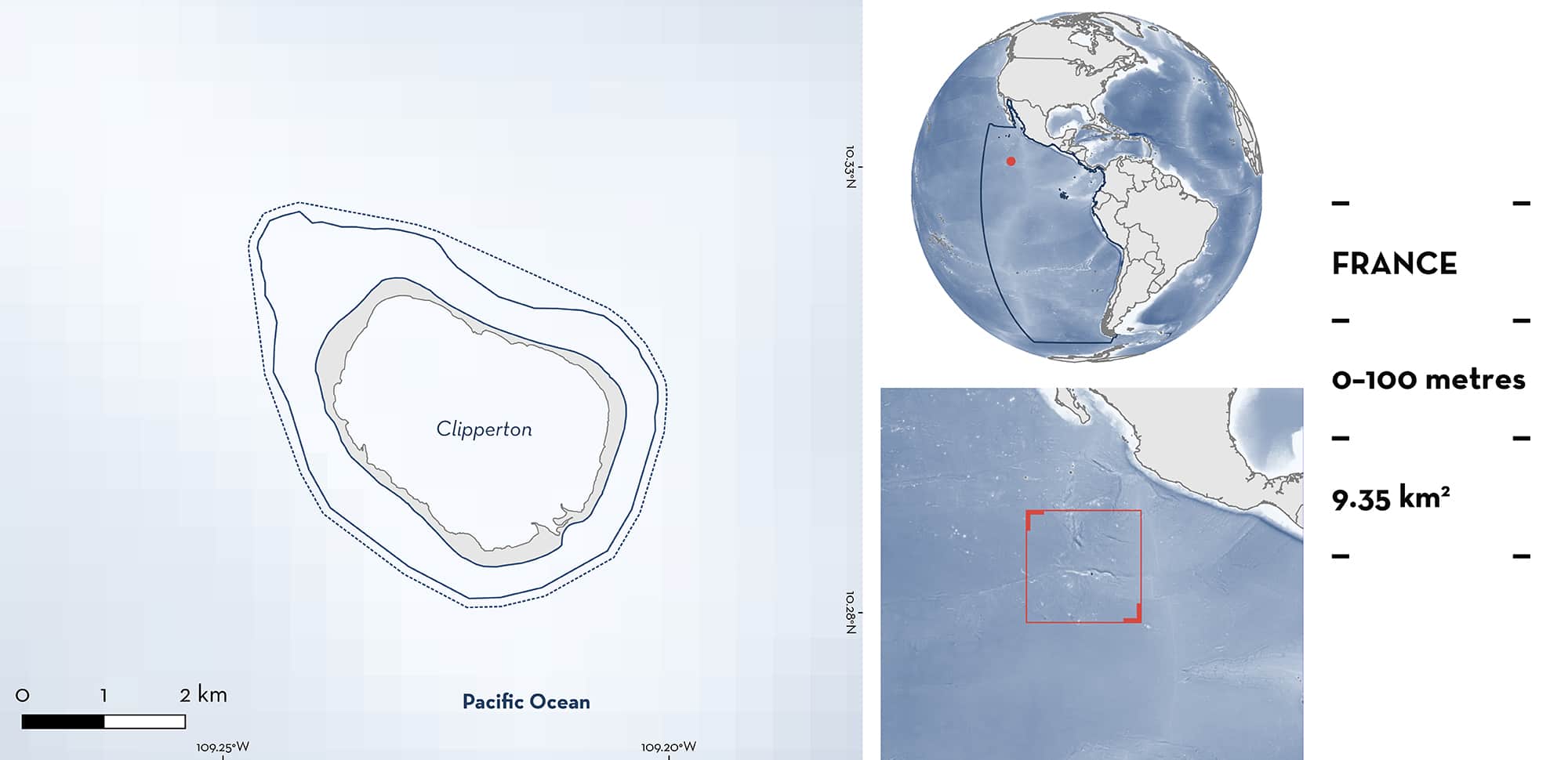
Clipperton is an atoll in the central Pacific, under the authority of the French government, approximately 1,100 km southwest of Mexico. It is the most westerly coral reef in the Eastern Tropical Pacific and is designated an Ecologically or Biologically Significant Marine Area (EBSA). The atoll comprises an enclosed stagnant freshwater lagoon and is surrounded by well-developed coral reefs that descend rapidly to deeper water (~70 m). Within the area there are: threatened species (Silvertip Shark Carcharhinus albimarginatus); and nursery areas (e.g., Gálapagos Shark Carcharhinus galapagensis).
Download factsheet
Clipperton
DESCRIPTION OF HABITAT
Clipperton (Île de Clipperton) is located at approximately 10°N and 109°W at the western edge of the Eastern Tropical Pacific and is under the authority of the French government. Situated adjacent to the Pacific Central-American Coastal Large Marine Ecosystem, the nearest islands, the Islas Revillagigedo (Mexico), are approximately 1,000 km to the north. Due to its geographic location, the island has been proposed as an important stepping-stone for the dispersion of propagules of many marine species between Pacific regions (Glynn et al. 1996). Clipperton is of volcanic origin and contains an enclosed eutrophic inner lagoon. Well-developed fringing coral reefs are found on the outer atoll sides irregularly segmented by spurs and groves, reef terraces, and seaward slopes. The shallow waters (<20 m) are dominated by Porites and branching Pocillopora corals, with large Porites, Pavona, and Leptoseris corals common in deeper waters (20–70 m) (Pogoreutz et al. 2022). The seascape of the island is influenced by intense swells and hurricanes occurring during the tropical storm season from May to October. The atoll is primarily influenced by the North Equatorial Current from January to May, and the North Equatorial Counter Current from June to December.
This Important Shark and Ray Area is delineated from from surface waters to a depth of 100 m based on the depth preferences of Qualifying Species.
CRITERION A
VULNERABILITY
One Qualifying Species within the area is considered threatened with extinction according to the IUCN Red List of Threatened SpeciesTM. The Silvertip Shark is assessed as Vulnerable (Espinoza et al. 2021).
CRITERION C
SUB-CRITERION C1 – REPRODUCTIVE AREAS
Clipperton is an important reproductive area for two shark species. Silvertip Sharks use the island as a nursery area as documented from an expedition in 2005 (Béarez & Séret 2009). Twenty-nine Silvertip Sharks were sampled using hook and line and consisted mainly of pregnant females carrying full-term or near full-term embryos and neonates with visible umbilical scars. The most recent systematic surveys of sharks undertaken in 2016 using stereo Baited Remote Underwater Video Surveys (BRUVS) recorded presence of the Gálapagos Shark on 83% of deployments and the Silvertip Shark on 33% of deployments. Importantly, the average length of Gálapagos Sharks and Silvertip Sharks were 82.3 cm fork length (FL) and 64.6 cm FL, respectively, with only one individual Gálapagos Shark considered large enough to be mature (Jost et al. 2016). Given published length-at-birth estimates of Gálapagos Sharks and Silvertip Sharks of ~80 cm total length (TL) (Wetherbee et al. 1996) and ~71 cm TL (Smart et al. 2017), respectively, it is likely these are 0+ year individuals.
Similarly, Clua (2016) reported 28 observations of sharks of both species over six survey dives in 2016, with only one Silvertip Shark and one Gálapagos Shark over 100 cm TL. The mean size of the remaining sharks was ~90 cm TL, comprising 82% Silvertip Sharks and 18% Gálapagos Sharks suggesting this area is still functional as a breeding ground for Silvertip Sharks and likely Gálapagos Shark. Tagging and subsequent redetections of two juveniles Gálapagos Sharks (120 and 131 cm TL) over a five-year period (2017–2022) confirms repeated use of this area over multiple years (Hoyos et al. 2022).
Download factsheet
SUBMIT A REQUEST
ISRA SPATIAL LAYER REQUEST
To make a request to download the ISRA Layer in either a GIS compatible Shapefile (.shp) or Google Earth compatible Keyhole Markup Language Zipped file (.kmz) please complete the following form. We will review your request and send the download details to you. We will endeavor to send you the requested files as soon as we can. However, please note that this is not an automated process, and before requests are responded to, they undergo internal review and authorization. As such, requests normally take 5–10 working days to process.
Should you have questions about the data or process, please do not hesitate to contact us.


