ISRA FACTSHEETS
ISRA FACTSHEETS
NEW ZEALAND & PACIFIC ISLANDS REGION
Colville Ridge Corridor
Summary
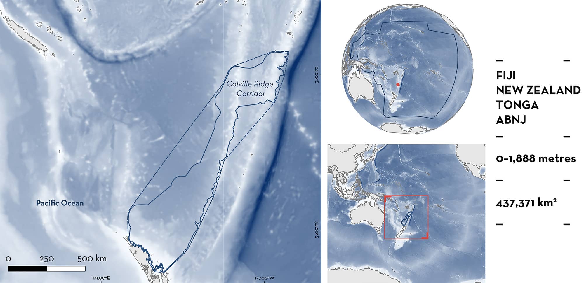
Colville Ridge Corridor is situated between Fiji, Tonga, New Zealand, and Tonga, and includes areas beyond national jurisdiction (ABNJ) in the South Pacific Ocean. The area stretches north along the Coville Ridge from New Zealand, and overlaps the Kermadec Ridge at its northern extent. It is characterised by diverse geological features including troughs and canyons, ridges and escarpments, slopes and plateaus, and abyssal mountains. The area overlaps two Ecologically or Biologically Significant Marine Areas, two Key Biodiversity Areas, and one marine protected area. Within this area there are: threatened species (e.g., Shortfin Mako Isurus oxyrinchus) and areas important for movement (e.g., Oceanic Manta Ray Mobula birostris).
Download factsheet
Colville Ridge Corridor
DESCRIPTION OF HABITAT
Colville Ridge Corridor is a transboundary area situated in the South Pacific Ocean connecting Fiji, Tonga, and New Zealand, including areas beyond national jurisdiction (ABNJ). The geological features of the area are diverse, comprising troughs and canyons, ridges and escarpments, slopes and plateaus, and abyssal mountains. The area is characterised by a large ridge which runs from New Zealand, into Fijian and Tongan waters in the north (Timm et al. 2019). The Colville Ridge lies on the oceanic Australian Plate and divides the South Fiji basin from the Havre Trough (Lewis et al. 2024). The area nears the centre of the South Pacific Ocean subtropical gyre, resulting in modest currents (Stevens et al. 2016).
The area overlaps with two Ecologically or Biologically Significant Marine Areas (EBSA): the Kadavu and the Southern Lau Region EBSA (CBD 2024a) and the Monowai Seamount EBSA (CBD 2024b); and two Key Biodiversity Areas: the Ata Island Marine (KBA 2024a) and the North Eastern North Island (offshore) (KBA 2024b).
This Important Shark and Ray Area is benthic and pelagic and is delineated from inshore and surface waters (0 m) to 1,888 m based on the global depth range of the Qualifying Species.
CRITERION A
VULNERABILITY
Two Qualifying Species considered threatened with extinction according to the IUCN Red List of Threatened Species regularly occur in the area. These are the Endangered Shortfin Mako (Rigby et al. 2019) and Oceanic Manta Ray (Marshall et al. 2022).
CRITERION C
SUB-CRITERION C4 – MOVEMENT AREAS
Colville Ridge Corridor is an important movement area for one shark and one ray species.
Shortfin Mako regularly undertake migratory movement from northeastern New Zealand to Pacific Islands. Between 2012–2017, 14 Shortfin Mako (female = 9, male = 5) were tracked using satellite telemetry (Francis et al. 2019). Thirteen of the sharks were tagged in New Zealand, and the fourteenth was tagged in eastern Australia and then tracked after it arrived in New Zealand (tagging duration ranged between 34–588 days). Of these, five Shortfin Mako (35.7%) tagged in New Zealand undertook migratory movements within the Colville Ridge Corridor, all were female (55.6% of females tagged). Three of the sharks moved from New Zealand into Fijian and/or Tongan waters, with one returning to New Zealand during the tracking period. The other two Shortfin Mako that used this area were tracked to the Kermadec Islands and back to New Zealand (Francis et al. 2019).
Between May 2017–March 2019, 50 Shortfin Mako were tagged with survival pop-up archival tags in Fiji (n = 15) and New Zealand (n = 35) (Francis et al. 2023). The tag pop-up location was recorded after a maximum of 60 days at liberty. Shortfin Mako tagged in New Zealand mostly stayed within the New Zealand exclusive economic zone (EEZ). Of the 15 Shortfin Mako tagged in Fiji, 12 (80%) lost their tag off the coast of northeastern New Zealand, within this area, and two additional individuals lost their tags further offshore within the Colville Ridge Corridor. This suggests that Shortfin Mako tagged in Fiji use this area as a movement corridor to New Zealand.
Oceanic Manta Rays regularly undertake migratory movement from New Zealand to Pacific Islands. Between March 2019–April 2024, 26 satellite tags (SPLASH-10 and Minipat) were deployed on Oceanic Manta Rays in New Zealand. Of these, 23 made movements north towards Tonga and Fiji, initiated at the end of the austral summer (E Setyawan unpubl. data 2024). In addition to the northward movements observed using satellite telemetry, two Oceanic Manta Rays have been confirmed making return migrations. A female Oceanic Manta Ray tagged in March 2019 was tracked to the Southern Lau Island group in Fiji. In February 2022, the individual was resighted back in New Zealand waters, with its identity confirmed using photo identification (L Green unpubl. data 2024). Another female Oceanic Manta Ray was tagged in February 2022 and travelled >2,500 km northeast of New Zealand before returning to New Zealand in November 2022. This resulted in a 310-day deployment covering over 9,000 km (L Green unpubl. data 2024). These observations confirm the area serves as a migratory corridor for this species.
Download factsheet
SUBMIT A REQUEST
ISRA SPATIAL LAYER REQUEST
To make a request to download the ISRA Layer in either a GIS compatible Shapefile (.shp) or Google Earth compatible Keyhole Markup Language Zipped file (.kmz) please complete the following form. We will review your request and send the download details to you. We will endeavor to send you the requested files as soon as we can. However, please note that this is not an automated process, and before requests are responded to, they undergo internal review and authorization. As such, requests normally take 5–10 working days to process.
Should you have questions about the data or process, please do not hesitate to contact us.


