ISRA FACTSHEETS
ISRA FACTSHEETS
SOUTH AMERICAN INLAND WATERS
Courantyne River
Summary
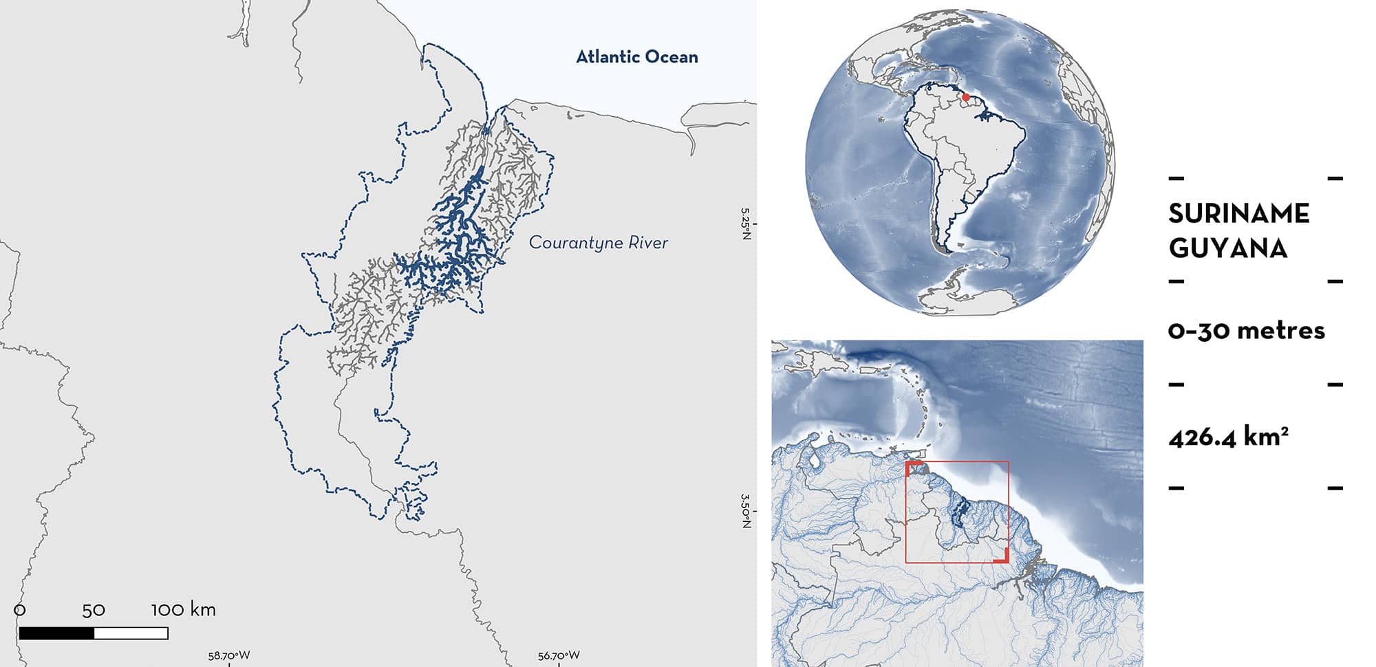
Courantyne River is located inland on the border of Suriname and Guyana. This remote area is characterised by an extensive system of streams flowing into the Courantyne River. It is influenced by a tropical rainforest climate. The habitat includes a large river and smaller tributaries with rocky and sandy substrates. Within this area there are: threatened species and range-restricted species (Suriname Freshwater Stingray Potamotrygon boesemani).
Download factsheet
Courantyne River
DESCRIPTION OF HABITAT
Courantyne River is located on the border between Suriname and Guyana. This remote inland riverine area is situated between 35–235 km upstream from the coast around the Courantyne River. It is influenced by a tropical rainforest climate with a mean annual precipitation of 1,895 mm (van den Boog et al. 2018). The Courantyne River, also known as Corentyne or Corantijn, is the longest river in Suriname. It is up to 1.5 km wide in this area, and there is also an extensive system of streams feeding into the main river. The habitat is characterised by several river bends, sand banks, and a forested shoreline (van den Boog et al. 2018). Water temperature is high and ranges from 26–32 °C in the main river and from 23–30 °C in the smaller tributaries (Mol et al. 2025). River flow is lowest from September–December and highest in May at the end of the main rainy season (Mol et al. 2025). Cow Falls, at the southern boundary of this area, is the furthest downstream large rapid complex of the Courantyne River (Mol et al. 2025). This river receives extremely low levels of sediment and minerals, leading to low turbidity (Secci disc reading up to 3 m), near neutral pH, and oxygen saturated conditions (Mol et al. 2025).
This Important Shark and Ray Area is benthic and is delineated from surface waters (0 m) to 30 m based on the bathymetry of the area.
CRITERION A
VULNERABILITY
One Qualifying Species considered threatened with extinction according to the IUCN Red List of Threatened Species regularly occurs in the area. This is the Vulnerable Suriname Freshwater Stingray (Charvet et al. submitted).
CRITERION B
RANGE RESTRICTED
Courantyne River holds the regular presence of the Suriname Freshwater Stingray as a range-restricted species. The species is restricted to part of the Courantyne River Basin (Charvet et al. submitted). It has historically been known among the Indigenous communities in this area and consumed by the Trio community in Sandlanding (van den Boog 2017; van den Boog et al. 2018), highlighting its regular occurence in the area. A survey in January–April 2016 in this area found that live export of Suriname Freshwater Stingrays was newly introduced to the villages of Apoera, Sandlanding, Washabo, and Section in Western Suriname (van den Boog et al. 2018). Fishers target this species and catch them mostly at sunset and during the night in sandy benthos waterways feeding into the Courantyne River. The survey estimated that fishers collected hundreds of individuals during the survey months. By February 2016, Suriname Freshwater Stingray captures in the area declined and fishers ventured further upstream, outside the area, to collect them (van den Boog et al. 2018). Fishers indicated that the hotspot for the species, where they collected most individuals from, ranged from Baboon Island to Cow Falls, which corresponds to the northern and southern boundaries of this area, respectively. Captures were made up to 15 km away from the main river (T van den Boog pers. obs. 2025). Since the boom-and-bust fishery, the species is still captured in this area (T van den Boog pers. obs. 2025) and export of the species is ongoing (P Charvet pers. obs. 2025).
Download factsheet
SUBMIT A REQUEST
ISRA SPATIAL LAYER REQUEST
To make a request to download the ISRA Layer in either a GIS compatible Shapefile (.shp) or Google Earth compatible Keyhole Markup Language Zipped file (.kmz) please complete the following form. We will review your request and send the download details to you. We will endeavor to send you the requested files as soon as we can. However, please note that this is not an automated process, and before requests are responded to, they undergo internal review and authorization. As such, requests normally take 5–10 working days to process.
Should you have questions about the data or process, please do not hesitate to contact us.


