ISRA FACTSHEETS
ISRA FACTSHEETS
MEDITERRANEAN AND BLACK SEAS REGION
Dalia Beach
Summary
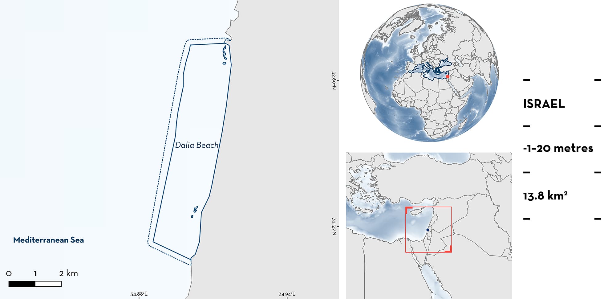
Dalia Beach is located on the Mediterranean coast of Israel. The area includes the Dor and Ma’agan Micha’el Islands nature reserve, and its coast is a part of the Carmel Coast Key Biodiversity Area. Sandy beaches bordered by Kurkar ridges characterise the site, and within it are submerged rocky sandstone areas (Kurkar reef patches), two estuaries, and other river mouths. Within this area there are: threatened species, reproductive areas, and areas with distinctive attributes (Blackchin Guitarfish Glaucostegus cemiculus).
Download factsheet
Dalia Beach
DESCRIPTION OF HABITAT
Dalia Beach is located on the Mediterranean coast of Israel. The coastline stretches ~10 km from Tel Dor to Tel Taninim and the area is characterised by sandy beaches. The Taninim Stream estuary borders the southern point of the area. This stream carries large quantities of organic matter, which flow directly into the sea basin. On the southern border of the estuary, other habitat features include a Kurkar ridge and submerged rocky Kurkar reef patches that are common to this region. Kurkar is an aeolian quartz sandstone with carbonate cement. These submerged rocky reef patches also occur at the northern border of this site (Tel Dor) and shelter the otherwise exposed coastline. In front of Ma’agan Michael beach, in the southern section of the area, there is a rocky reef with a few small islands ~200 m from the shoreline.
The area includes the Dor and Ma’agan Micha’el Islands nature reserve, and its coast is a part of the Carmel Coast Key Biodiversity Area (KBA 2023).
This Important Shark and Ray Area is benthic and is delineated from inshore and above surface waters (-1 m) to 20 m based on the bathymetry of the area.
CRITERION A
VULNERABILITY
The one Qualifying Species within the area is considered threatened with extinction according to the IUCN Red List of Threatened SpeciesTM. The Blackchin Guitarfish is assessed as Critically Endangered (Kyne & Jabado 2019).
CRITERION C
SUB-CRITERION C1 – REPRODUCTIVE AREAS
Dalia Beach is an important reproductive area for one ray species.
Seasonal visual surveys along the beach since 2016, a mark-recapture tagging program (2017–2019), and hundreds of citizen science reports year-round show the regular and predictable presence of neonate and young-of-the-year Blackchin Guitarfish at this site, with up to 700 individuals observed in a single survey (Barash et al. 2018; the MECO project unpubl. data 2023). Neonates (30–40 cm total length [TL]; size-at-birth 34 cm TL, Ebert & Dando 2021) with an open or recently closed umbilical scar or intact yolk sac are reported in late August, September, and October, indicating that parturition occurs in the area or close to it. Large females reportedly regularly captured during the boreal summer months (July–August), together with anecdotal observations of large females in August, support the notion that the area is most likely a pupping ground (Barash et al. 2018; Azrieli 2020; the MECO project unpubl. data 2023).
CRITERION D
SUB-CRITERION D1 – DISTINCTIVENESS
Neonate and young-of-the-year Blackchin Guitarfish display a unique behaviour in this area, leaving the water to rest on the wet sand throughout the day. They stay out of the water for up to 40 seconds before going back into the water by actively turning back or sliding back with the waves (Barash et al. 2018; A. Nashiv pers. comm. 2023). This behaviour of exiting the water has not been documented anywhere else in the world for any guitarfish species and is highly uncommon for sharks and rays in general. Seasonal surveys conducted over the last eight years counted dozens of individuals, and up to ~700 individuals, in extremely shallow waters or out of the water during a single survey (Barash et al. 2018; A. Nashiv pers. comm. 2023). This phenomenon occurs during summer and continues to the beginning of autumn (end of August to November), when the sea water temperature is at its highest (~31°C), and the air temperature can reach 40°C. More research is required into the ecological advantages of this behaviour and its physiological mechanism.
Download factsheet
SUBMIT A REQUEST
ISRA SPATIAL LAYER REQUEST
To make a request to download the ISRA Layer in either a GIS compatible Shapefile (.shp) or Google Earth compatible Keyhole Markup Language Zipped file (.kmz) please complete the following form. We will review your request and send the download details to you. We will endeavor to send you the requested files as soon as we can. However, please note that this is not an automated process, and before requests are responded to, they undergo internal review and authorization. As such, requests normally take 5–10 working days to process.
Should you have questions about the data or process, please do not hesitate to contact us.


