ISRA FACTSHEETS
ISRA FACTSHEETS
WESTERN INDIAN OCEAN REGION
East Africa Coastal Current
Summary
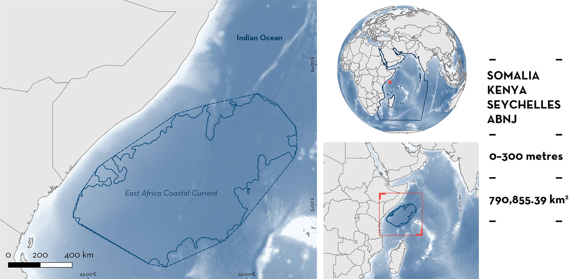
East Africa Coastal Current is located offshore from southern Somalia, Kenya, Seychelles, and areas beyond national jurisdiction (ABNJ). This area is characterised by nutrient-rich waters of the Somali Current upwelling system, considered the fifth most important upwelling system in the world. During the boreal summer monsoon, coastal upwelling in Somalia considerably reduces sea temperatures. This area is also considered the strongest seasonal-scale wind-driven upwelling in the world’s oceans. Within this area there are: reproductive areas (Blue Shark Prionace glauca).
Download factsheet
East Africa Coastal Current
DESCRIPTION OF HABITAT
East Africa Coastal Current is located offshore from southern Somalia, Kenya, Seychelles, and in areas beyond national jurisdiction. The area encompasses pelagic water habitats of the open ocean.
The Somali Current upwelling system is considered the fifth most important upwelling system globally (Mann 2000), and one of the two most intense regional-scale ocean upwelling cells that exist on the planet (Bakun 2017). The strongest seasonal-scale wind-driven upwelling in the world’s oceans occurs off the coast of Somalia during the boreal summer (Bakun 2017). In Somalia, coastal upwelling considerably reduces sea temperatures of this area during the summer monsoon (January to May) (Schott 1983; Schott & McCreary 2001). The mean seasonal sea surface temperature (2017–2022) varies between 24° to 29° C (IUCN SSC SSG 2023) with a year-around sea surface salinity of ~36 (de Oliveira Carvalho Jr 2022).
This Important Shark and Ray Area is pelagic and is delineated from surface waters (0 m) to 300 m depth based on the occurrence of the Qualifying Species in the area.
CRITERION C
SUB-CRITERION C1 – REPRODUCTIVE AREAS
This area is an important reproductive area for one shark species.
From July 2010 to June 2020, a total of 2,674 longline fishery sets with 8,267,659 hooks were monitored between 10°N to 39°S and from 23°E to 90°E, capturing a total of 1,594 Blue Sharks (Zhu et al. 2023). Results indicated a high relative abundance (inferred from capture per unit effort [CPUE; shark/1,000 hooks]) of adult females in this area during February and March. The highest proportion of pregnant females was also recorded during these months (~75% of all females sampled) (Zhu et al. 2023). This study suggests that pregnant females undertake seasonal migrations (from tropical to temperate waters) within a year to give birth to pups in productive temperate waters. A similar behaviour has been identified in the northwest Pacific Ocean (Nakano & Nagasawa 1996; Nakano & Stevens 2008; Fujinami et al. 2022), supporting these results.
Between 1967 and 2014 in the Indian Ocean, 77,396 Blue Sharks were sampled from international pelagic longline fisheries (e.g., France, Portugal, Japan) in which specimens ranged in body sizes from 50.8–444.8 cm total length (TL), covering most of the known size range of the species (Coelho et al. 2018). These surveys indicated that adult females were the dominant sex and life-history stage in this area in the first and second quarter of the year (Coelho et al. 2018).
Between 2016 and 2023, 1,817 longline fishery sets were monitored off Kenya, capturing 629 Blue Sharks of which 57% were adult females mostly in the second and third quarter of the year with the presence of pregnant females (N Wambiji unpubl. data 2023).
This combined information supports the importance of this area for Blue Shark reproduction, although the seasonality of the area is not clearly defined.
Download factsheet
SUBMIT A REQUEST
ISRA SPATIAL LAYER REQUEST
To make a request to download the ISRA Layer in either a GIS compatible Shapefile (.shp) or Google Earth compatible Keyhole Markup Language Zipped file (.kmz) please complete the following form. We will review your request and send the download details to you. We will endeavor to send you the requested files as soon as we can. However, please note that this is not an automated process, and before requests are responded to, they undergo internal review and authorization. As such, requests normally take 5–10 working days to process.
Should you have questions about the data or process, please do not hesitate to contact us.


